
Fintel municipality
| coat of arms | Germany map | |
|---|---|---|

|
Coordinates: 53 ° 12 ' N , 9 ° 34' E |
|
| Basic data | ||
| Existing period: | 1970– | |
| State : | Lower Saxony | |
| County : | Rotenburg (Wümme) | |
| Area : | 121.93 km 2 | |
| Residents: | 7578 (Dec. 31, 2019) | |
| Population density : | 62 inhabitants per km 2 | |
| License plate : | ROW, BRV | |
| Association key : | 03 3 57 5402 | |
| Association structure: | 5 municipalities | |
| Association administration address : |
Berliner Strasse 3 27389 Lauenbrück |
|
| Website : | ||
| Mayor of the municipality : | Tobias Kruger | |
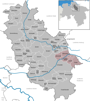
| Location of the Fintel municipality in the Rotenburg (Wümme) district | ||
  |
||

The Samtgemeinde Fintel is a community association in the east of the Rotenburg (Wümme) district in Lower Saxony . It has about 7,500 inhabitants.
geography
The entire municipality is between 25 and 55 m above sea level. NN .
Joint community structure
The combined community consists of the five member communities Lauenbrück , Fintel , Helvesiek , Stemmen and Vahlde . What is special is the existence of two core locations: Lauenbrück and Fintel. Two thirds of the residents live in these. Fintel is the economic center. Lauenbrück is important in other areas because of its train station, the connection to the B75, the secondary school of the Samtgemeinde and its town hall.
Neighboring communities
The joint municipality has eight neighboring municipalities in three districts. In the west it is bordered by the community of Scheeßel. In the north are the communities Hamersen, Sittensen and Tiste from the combined community Sittensen . Heidenau, Wistedt and Königsmoor from the joint municipality of Tostedt in the Harburg district follow in the northeast and the town of Schneverdingen from the Heidekreis in the south.
history
The history of the member municipalities reaches far into the past, back. Archaeological finds show that the first settlements were to be found in the area of today's Samtgemeinde as early as 3000 to 4000 years ago . The places of the integrated community were first mentioned in the Middle Ages (Fintel 1105, Helvesiek around 1250, Lauenbrück 1358, Stemmen 1351 and Vahlde 1180). The central town of Lauenbrück goes back to a foundation by Heinrich the Lion .
The Samtgemeinde Fintel was founded in 1970. At that time, the communities Fintel, Helvesiek, Lauenbrück, Stemmen and Vahlde voluntarily merged to form a new municipal association with the status of a public corporation .
politics
Joint council
| Political party | Seats |
|---|---|
| CDU | 9 |
| SPD | 8th |
| GREEN | 2 |
| LEFT | 1 |
Status: Lower Saxony local elections on September 11, 2016
Joint mayor of the municipality
As one of the few municipalities in Lower Saxony, the joint municipality of Fintel had still applied the old two-pronged municipal law with a full-time administrative head and an honorary joint municipality mayor . The full-time joint municipality director was most recently Friedrich Dreyer. The honorary mayor of the entire community was Claus Riebesehl from the CDU. The first full-time joint mayor was Michael Niestädt from June 9, 2008 to June 8, 2016. In the mayor election on February 28, 2016, Tobias Krüger was elected as the new joint mayor by the citizens of the joint community of Fintel as an independent candidate with the support of all parties. The term of office began on June 9, 2016.
coat of arms
|
|
Blazon : "A silver shield that contains two blue wavy bars with five green circles " |
| Justification for the coat of arms: The two blue wave bars symbolize the rivers Wümme and Fintau , which cross the area of the Samtgemeinde. The five green circles represent the five member congregations of the integrated congregation. |
Culture and sights
Parks
There is an extensive wildlife park near Lauenbrück .
Economy and Infrastructure
Fintel is one of the main focuses of tourism in the Wümmeniederung . The Eurostrand holiday park exists here .
Public facilities
The member communities have volunteer fire brigades. There is a police station in Fintel and an ambulance station in Lauenbrück. The town hall of the integrated community is in Lauenbrück. In Lauenbrück and Fintel, doctors ensure health care.
education
There are six kindergartens in the entire community, of which there is one in each member community and two in Lauenbrück. There is a primary school each in Lauenbrück and Fintel and the Fintauschule secondary school in Lauenbrück.
traffic
The parts of the municipality are connected with each other and with the surrounding area by county roads. In the west, Helvesiek is also crossed by the L130 in a north-south direction. Lauenbrück and Stemmen are important for supraregional traffic due to the through traffic on the B75 and the railway line between Hamburg and Bremen. The joint community is connected to this railway line through a train station in Lauenbrück. Local trains to Hamburg and Bremen leave every hour from there.
Individual evidence
- ↑ State Office for Statistics Lower Saxony, LSN-Online regional database, Table 12411: Update of the population, as of December 31, 2019 ( help ).