US Highway 7
| map | |
|---|---|

|
|
| Basic data | |
| Overall length: | 308 mi / 496 km |
| Opening: | 1926 |
| States: |
Connecticut Massachusetts Vermont |
| Starting point: |
|
| End point: |
|
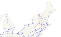
The US Highway 7 (short US 7 ) is a 496 km long north-south United States highway in the United States . It begins on Interstate 95 in Norwalk , Connecticut and ends on Interstate 89 on the Canadian border at Highgate Springs .
history
Before the US Highway System, the section from Great Barrington to the Canadian border belonged to the New England Interstate Route 4 (NE-4). It has been running along NE-4 and Massachusetts State Route 41 since 1927 . The Connecticut State Route 41 then continues up to the town of Sharon . The NE-4 then continued on Connecticut State Route 343 to the border with New York State along New York State Route 343 to Amenia . The US 7 then originally ran via New York State Route 22 to New York City . In 1929 the south end was moved to Norwalk. The former names of this route were to North Canaan New England Route 17, to New Milford State Route 134, to Danbury State Route 128, New England Route 3 to Ridgefield and State Route 126 to Norwalk.
Web links
- US Highway Ends (English)

