
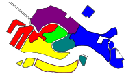
Canals in Venice


The canals of Venice ( Italian canali , singular canale ) and the smaller "Rii" (singular rio ) form the actual routes (" streets ", " alleys ") of the " lagoon city " Venice used for everyday traffic . Among other things, they open up the port of Venice and also serve to naturally drain the urban area from surface water such as - now mostly clarified - wastewater ; In addition, they are a globally known and artistically widely recognized and cited tourist attraction.
The two best-known canals are the Grand Canal in the center (regional name Canałazzo ) and the Canale della Giudecca to the Giudecca island of the same name (through the Dorsoduro district ) at the southern end of Venice: They meet in the Bacino di San Marco in front of St. Mark's Square and are probably based on former river beds . More than 40 smaller canals flow from the Sestieri ("Stadtsechsteln", elsewhere the " Stadtviertel ") into the Canal Grande. Terrestrial, earth-bound streets and alleys in Venice only serve as feeders between individual houses and within the district. The main access for the residents to the mainland or out to sea was traditionally done by boat via the various waterways . A specialty of Venice are filled in waterways, which today form streets or footpaths and whose names are still reminiscent of their earlier function: rio terà .
The channels are part of a system

The allegedly 175 canals within the old town were originally designed for a depth of 1.85 m. The average tidal range of around 60 cm had to be taken into account, so that there was always an effective travel depth of 120 cm into the side channels. These Rii and Canali have a total length of about 38 km.
Canals in this broader sense are part of an ecological and an economic (artificial) system in the delta of the Brenta River and other rivers and streams towards the Adriatic .
The water level of the channels etc. is dependent on the tides of the sea and those mentioned, e.g. Partly dependent on freshwater inflows regulated by locks . As a result, sediments are constantly being deposited in the canals . The city and the lagoon could only be protected from natural siltation through constant maintenance of the canals. This maintenance work was largely neglected from the middle of the 19th century . Currently, since around 1960, the entire lagoon is being eroded more than the sedimentation at the same time. The wintry Acqua Alta (" flood ") is also related to the then prevailing wind direction on this part of the Mediterranean . In the future, it should be controlled somewhat in the highest levels by the current construction of the Modulo Sperimentale Elettromeccanico (MO.SE, "Electromechanical Experimental Module"), a kind of water dam.
Even within the lagoon, channels that need to be constantly maintained connect the islands ; they ensure ship traffic even at low tide .
Major Canali

The Grand Canal separates the sixths of the city (Sestieri ) San Marco , Cannaregio and Castello from the districts of Dorsoduro , San Polo and Santa Croce on the right, landside side of the canal . Shortly before St. Mark's Square, it joins the Canal de ła Zueca .
- See the main article on the Grand Canal with the sequence of all palazzi and tributaries

Other important channels are:
- Canale di Cannaregio , towards Mestre
- Canal di Fusina goes to the Punta di Santa Marta in the Giudecca Canal on
- Canale dei Lauraneri
- Canale delle Grazia at S. Giorgio Maggiore
- Canale dei Marani
- Canale della Misericordia , near the Sacca (landing basin) of the same name
- Canal delle Navi
- Canal Orfano (also Canale di Santo Spirito; to the old port and main town Malamocco )
- Canale delle Sacche
- Sacca di Santa Chiara (start of the Grand Canal)
- Canale della Scomenzera , connects the Canale della Giudecca with the beginning of the Grand Canal at Santa Chiara
- Canal di San Pietro , near the Castello
- Canale di Santa Chiara at Piazzale Roma
- Canale di Santa Maria Maggiore
The Orfano Canal connects Venice and the historic capital of the Malamocco lagoon with the islands of Poveglia, Santo Spirito, San Clemente, San Servolo and the Lido.
Important rii
Canale di Cannaregio
 (in clockwise order starting from Canale di Canaregio)

.jpg)
_-_Del_Ponte_de_la_Malvasia_a_Ponte_del_Forno.jpg)
- Battello
- Ghetto Nuovo
- Girolamo / Misericordia
- Sensa (see picture)
- Alvise / Madonna dell'Orto
- Zecchini
- Noale
- San Felice / Canale della Misericordia
- Santa Fosca
- Santa Catarina
- Santa Maddalena
- Gesuiti
- S. Andrea
- S. Apostoli
- Panada
- Mendicanti


City Clinics
- Santa Marina / Giov. Laterano / Fontego / Francesco / Celestia
- Panada
- Santa Giustina / Pietà
- Arsenale / Canale della Galeazza / Darsena Arsenale Veccio / Arsenale
- Darsena Grande
- San Daniele
- Quintavalle
- Sant`Elena
- San Giuseppe
- Tana
- Rio de l'Arsenal
- Rio de la Ca 'di Dio
- Pietà
- Greci
- Vin
- Rio de la Canonica


- Rio dei Giardinetti
- San Moisè
- Rio de l'Alboro
- Santa Maria Zobenigo
- Sant'Angelo
- Santissimo
- Rio de l'Orso
(Ponte dell'Accademia)
- S. Vidal
- Rio del Duca
- Ca 'Garzoni
- Rio de Ca 'Corner
- Ca 'Michiel
- S. Luca
- S. Salvador
( Rialto Bridge )
- Fontego dei Tedeschi
- S. Giovanni Crisostomo (Cannaregio)
- S. Felice (Cannaregio)
- Rio de Noal (Cannaregio)
- Rio de la Maddalena (Cannaregio)
- Rio de San Marcuola (Cannaregio)
northeast from the main station:
- Crea / Canale della Crea
- Giobbe
Canale della Scomenzera
 (arranged clockwise from the Canale della Scomenzera)

- Novo
- Rio dei Tolentini or Rio de la Croce
- Marin
- Zan Degolà
- Megio
- Ca 'Tron
- S. Boldo
- Stae
- pergola
- Due Torri (Ca 'Pesaro)
- Sant'Agostino
- Legname
- San Sebastino
- San Raffaele
- S. Maria Mater Domini
- San Cassiano


- Beccarie
- ( Rialto Bridge )
- Meloni
- Madoneta
- heritage
- San Polo
- S. Tomà / Frari
- Frescada / Munaghete

.jpg)
- Ca 'Foscari
- S. Barnaba
- Malpaga
- San Trovaso
- (Ponte dell'Accademia)
.jpg)
- Salute
- Fornace
- Toresele
- Vio
- Trovaso
- Nicolo
- Terese
.jpg)

Canale Sacca (on the Giudecca)


(arranged clockwise from Canale Sacca Fisola)
- Canale Sacca Fisola San Biagio
- Lavraneri
- San Biagio
- Convertite
- San Eufemia
- Ponte Piccolo
- Palada
- Ponte Lungo
- Croce
Murano


- Canale Bisatto
- Canale di San Mattia
- Canale di San Donato
- San Mateo
- Canale Ondello
- Canal di Pte. Lungo / Canale degli Angeli
- Vetrai
- Canale Sarenella
- Sacca Sarenella
Burano


- Canale San Giacomo
- Canale Santo Spirito or Borgognoni
- Canale di Crevan
- Rio Terranova
- Rio de la Giudecca
- Rio Mandracchio
- Rio San Mauro
- Rio Assassini
- Rio Pontinello
- Rio Terà del Pizzo (backfilled, today Via Baldassare Galuppi )
Bridges etc.
The waterways in a city also include the bank fortifications and bridges as necessary structures , which can, however, also exclude each other due to the desired clearance height of the ships. Of the four or five hundred bridges, only four cross the Grand Canal.
- See also the category about the bridges in Venice or the (incomplete) bridge list
Fondamenta or Riva
The term riva mostly refers to a step or bank reinforcement to get into a boat from the house or place. There can also be several stages to compensate for the tide. There are a few typical forms for this. As for the fondamente , the name for the walkways on the houses along the canals ( canali or rii ).

typical side path along a canal

Riva with stairs parallel to the watercourse

Riva with steps descending into the water

This riva is the beginning / end of a small alley
Riva monumentale in front of the I Tolentini church


.jpg)
Means of transport
The vehicles on these waterways have different tasks, sizes, drive strengths and proper names:
See the articles on the
- Vaporetti , Battelli foranei , Motonavi , Motoscafi , Motozattere (taxi acqueo), Gondola (also the Caorlina, Desdotona, Gondolin, Mascareta, Sandolo), Peate, Pupparin, S´ciopòn, Sanpierota (sailing boat), Topo (sailing boat)

ACTV vaporetto

Battello foraneo, rec. 2006 before Burano

Water taxi, 2004

Pontoon with bus stop, recording. 2006

Work boat m. Excavator (It .: Battello draga, photo Nov. 2004)

gondola


The vaporetti stops along the Grand Canal are from north to south: Piazzale Roma , Ferrovia (Santa Lucia central station) , Riva de Biasio, S. Marcuola, San Stae, Ca 'd'Oro, Rialto Mercato, Rialto , San Silvestro , Sant'Angelo, San Tomà / Frari, Ca 'Rezzonico, San Samuele / Palazzo Grassi, Accademia, Santa Maria del Giglio, Salute, San Marco Vallaresso . Every major island in the lagoon has a landing stage.
"Paths" in the region
Shipping route to Marghera

The shipping routes to the port facilities to Mestre and Marghera lead in an arc through the lagoon around the city center.
- Marghera is Venice's commercial and industrial port, built from 1917
- Around 200,000 people live in Mestre. It has a very long history (Roman, early Middle Ages).
Shipping routes to Tronchetto
The shipping routes from / to Tronchetto , an island built up as a port visavis from the old main station, lead north of the Lido into the Adriatic Sea. You circumnavigate the city in a wide southern arc between Sacca Sessola and the islands of San Clemente and San Servolo , past the Lazarett Islands and the Punta Sabbioni ( Cavallino-Treporti ) into the gulf, where they head about 20 km east-southeast to south-southeast Bend Ancona .
-
Tronchetto - Adria (landing point, starting point of several vaporetto lines,)
- Route Venice - Kerkyra (ferries to the Ionian island of Kerkyra )
- Route Venice - Igoumenitsa (ferry connection Igoumenitsa , Greece)
- Venice - Patra route (ferry connection to Patras )
Some islands that are served in the lagoon: Sant'Erasmo , Murano , Vignole, Chioggia , Mazzorbo, Torcello, La Certosa and Burano .
Via Brenta to Padua


Historically, the Brenta, Muson , Bacchiglione , Riviera del Brenta ( Brenta Canal), Canale Bisato and Canale Battaglia formed a system of roads for many centuries that enabled trade, traffic and diverse relationships between Padua and Venice (Italian name Naviglio del Brenta). It was just as natural to go to the summer residences by ship as it was to go to business or to war across the sea. For Venetians at that time it was a unity that still leads to a symbolic marriage between the city and the sea every year.
Trivia
In the course of the general public “ shutdown ” to slow down the COVID-19 pandemic in Italy too , the water in Venice's canals became “crystal clear”, according to the mayor's office due to the sediments no longer being blown up from the bottom of the waterways by shipping .
Exhibitions
- March to June 2020, Kunsthalle Messmer , Riegel am Kaiserstuhl : Venice - fascination and myth
literature
- City map Venice 1: 5500 , Hallwag , ISBN 978-3-8283-0582-3
- Constantin Parvulesco, Dorko M. Rybiczka (translator): Gondolas . Heel, 2007, 160 pages. ISBN 978-3-89880-743-2
- Alvise Zorzi : Canal Grande, biography of a waterway . Translation from Ital. Gesa Schröder. Claassen, Hildesheim 1993. ISBN 3-546-00057-9
See also
- Usually also so called because of the canals: Petite Venise ("Little Venice")
- Canals in Amsterdam
- Canals in Augsburg
- Canals in Hamburg
- Canals in Ohio
Web links
- Competenze sui canali della Laguna di Venezia (Responsibilities for the waterways; PDF file, 3.37 MB)
- Bibliography on the Laguna di Venezia ( Memento from May 9, 2011 in the Internet Archive ) (ital.)
-
Database of the Istituto Veneto di Scienze, Lettere ed Arti on the surroundings of the ven. Lagoon. (numerous databases, especially historical maps and satellite images, model calculations)
- Also access to the official atlas of the Comune di Venezia
- Map of traffic restrictions (Italian; original title: Cartografia della segnaletica nei canali veneziani. Provides information about the canal widths; in low html version and in high resolution as PDF)
Sources, citations
- ↑ TouriNet GmbH: The port of the cruise ships from Venice - Venezia - Venice. Retrieved April 10, 2020 .
- ↑ G. Perocco, A. Salvadori: pp. 250-254, codice = CdV
- ↑ Corinne Plaga: In Venice suddenly clear water flows in the canals . In: Neue Zürcher Zeitung . ( nzz.ch [accessed April 10, 2020]).
- ^ Badische Zeitung: Galerie Messmer brings lagoon city to Riegel - Riegel - Badische Zeitung. Retrieved April 10, 2020 .
- ↑ exhibition. In: kunsthalle messmer. Accessed April 10, 2020 (German).