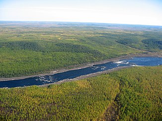
Wiljui
|
Wiljui Вилюй Бүлүү , Bülüü |
||
|
Course and catchment area of the Wiljui |
||
| Data | ||
| Water code | RU : 18030800112117400003664 | |
| location | Krasnoyarsk Region , Sakha Republic ( Russia ) | |
| River system | Lena | |
| Drain over | Lena → Arctic Ocean | |
| source |
Wiljuiplateau 65 ° 57 ′ 46 " N , 103 ° 30 ′ 47" E |
|
| Source height | approx. 520 m | |
| muzzle |
Lena coordinates: 64 ° 22 ′ 38 " N , 126 ° 24 ′ 54" E 64 ° 22 ′ 38 " N , 126 ° 24 ′ 54" E |
|
| Mouth height | 54 m | |
| Height difference | approx. 466 m | |
| Bottom slope | approx. 0.18 ‰ | |
| length | 2650 km | |
| Catchment area | 454,000 km² | |
| Discharge at the Wiljui A Eo gauge : 57,300 km². Location: 1816 km above the mouth |
MQ 1965/1999 Mq 1965/1999 |
365 m³ / s 6.4 l / (s km²) |
| Discharge at the gauge Suldukar A Eo : 168,000 km² Location: 1142 km above the mouth |
MQ 1967/1994 Mq 1967/1994 |
706 m³ / s 4.2 l / (s km²) |
| Discharge at the gauge Suntar A Eo : 202,000 km² Location: 740 km above the mouth |
MQ 1926/1999 Mq 1926/1999 |
787 m³ / s 3.9 l / (s km²) |
| Discharge at the Khatyrik-Khomo A Eo gauge: 452,000 km² Location: 122 km above the mouth |
MQ 1936/1998 Mq 1936/1998 |
1480 m³ / s 3.3 l / (s km²) |
| Left tributaries | Akhtaranda , Ygyatta , Marcha , Tjukjan , Tjung | |
| Right tributaries | Ulachan-Wawa , Tschirkuo , Tschona , Tschybyda , Ulachan-Botuobuija , Otschtschugui-Botuobuija , Tangnary , Bappagai | |
| Reservoirs flowed through | Viljui reservoir | |
| Small towns | Nyurba , Viljuisk | |
| Navigable | 1343 km | |
|
Rapids of the Wiljui |
||
The Wiljui ( Russian Вилюй ; Yakut Бүлүү , Bülüü ) is an approximately 2650 km long left tributary of the Lena in Siberia ( Russia , Asia ).
course
The river has its source on the Viljuiplateau in the central part of the Central Siberian Mountains , about 100 kilometers northwest of the Ekonda settlement ( Krasnoyarsk region ) and about 20 kilometers southwest of Lake Ekonda . From there it flows first in an easterly direction and reaches the autonomous Republic of Sakha (Yakutia) , where it turns to the southeast. There it flows through the large Wiljui reservoir ( Wiljujskoje Wodochranilishche ), in whose southwestern tip the Tschona flows. After that, the Wiljui - still running in the area of the aforementioned mountainous country - turns to the east, only to flow into the large Central Yakut lowland a little later . In this extensive lowland , in the area of which Ygyatta , Marcha , Tjukjan and Tjung flow from the left, the Wiljui reaches the Lena, which flows into the Arctic Ocean .
economy
From its confluence with the Lena, the fish-rich Wiljui is navigable over a length of 1343 km to the Chernyshevsky settlement below the dam of the Wiljui reservoir. In addition, there are 600 km on which the Wiljui in the area of the reservoir is navigable. However, due to the lack of lock systems, the dam can not be crossed by watercraft.
In the area of the Central Yakut lowland lies the so-called Wiljui Basin with deposits of diamonds , iron ore , coal and gold .
Localities
The villages on the river include Chernyshevsky , Suntar , Nyurba , Verkhneviljuisk and Viljuisk (viewed downstream).
Others
The river is named for the mineral Wiluit , which occurs in the Wiljui Basin. In addition, the Vilyuy River type locality for pure cadmium , Grossular and Eringait and archaeological site of many other minerals, including solid magnesium , aluminum , antimony , lead , and platinum , more garnet -Minerale as Andradit and Pyrop , diopside , pyrite , rutile and Vesuvianit .
Web links
Individual evidence
- ↑ a b Wiljui in the State Water Register of the Russian Federation (Russian)
- ↑ a b Article Wiljui in the Great Soviet Encyclopedia (BSE) , 3rd edition 1969–1978 (Russian)
- ↑ Wiljui at the Wiljui gauge - hydrographic data at R-ArcticNET
- ↑ Wiljui at the Suldukar gauge - hydrographic data from R-ArcticNET
- ↑ Wiljui at the Suntar gauge - hydrographic data from R-ArcticNET
- ↑ Wiljui at the Khatyrik-Khomo gauge - hydrographic data from R-ArcticNET
- ↑ List of Inland Waterways of the Russian Federation (confirmed by Order No. 1800 of the Government of the Russian Federation of December 19, 2002)
- ↑ Mineral Atlas: Wiluit (Wiki)
- ↑ Mindat - Locality description and mineral list of Vilyui River Basin (Vilui River Basin; Wilui River Basin), Saha Republic (Sakha Republic; Yakutia), Eastern-Siberian Region, Russia

