
Wilkowice (Powiat Bielski)
| Wilkowice | |||
|---|---|---|---|

|
|
||
| Basic data | |||
| State : | Poland | ||
| Voivodeship : | Silesia | ||
| Powiat : | Bielsko-Biała | ||
| Area : | 17.5 km² | ||
| Geographic location : | 49 ° 46 ' N , 19 ° 5' E | ||
| Residents : | 6604 (2011) | ||
| Postal code : | 43-365 | ||
| Telephone code : | (+48) 33 | ||
| License plate : | SBI | ||
| Gmina | |||
| Gminatype: | Rural community | ||
| Gmina structure: | 3 school offices | ||
| Surface: | 33.9 km² | ||
| Residents: | 13,409 (June 30, 2019) |
||
| Population density : | 396 inhabitants / km² | ||
| Community number ( GUS ): | 2402102 | ||
| administration | |||
| Address: | ul.Wyzwolenia 25 43-365 Wilkowice |
||
| Website : | www.wilkowice.pl | ||

Wilkowice ( German Wolfsdorf ) is a village and seat of the municipality of the same name in the Powiat Bielski of the Silesian Voivodeship in Poland .
geography
Wilkowice is located in the Saybuscher Basin ( Kotlina Żywiecka ) under the Little Beskids ( Beskid Mały , in the east). The north located Brama Wilkowicka (about Wolfsdorfer-Tor ), a geographic depression between the Silesian Beskids and Little Beskids, is named after the village.
The village has an area of 1750 ha .
Neighboring towns are the town of Bielsko-Biała ( Mikuszowice and Straconka ) in the north, Łodygowice in the southeast, Rybarzowice in the south, Bystra and Meszna in the west.
history
The German law colonization in the wooded area probably began between the years 1290 and 1305 or 1310. The previously popular interpretation of the name Wilkowice pointed to the abbot Baldwin of the Cistercian Abbey Rauden , the presumed founder, allegedly with the nickname Wolf , which in the light of the Sources is wrong. This comes from the association of the abbot with a fictional person Wilk or Wolf . It is just as likely that the village was inspired by the earlier abbots such as B. Bartłomiej (1282–1294), was founded. The place was first mentioned in a papal bull on April 22, 1364 as Abbatisvilla (about Abtsdorf) , together with other neighboring Cistercian villages Łodygowice ( Ludovicivilla ) and Pietrzykowice ( Petrivilla ). After that, in contrast to Łodygowice, the village was remarkably not mentioned until the 16th century. One can speculate that at least some of the settlers, like in other villages on the Bielitzer language island , spoke German, but most likely came from the other areas of the Duchy of Opole-Ratibor, but this cannot be determined because of the very poor medieval sources. Especially the lack of mention in the detailed description of the diocese of Kraków by Jan Długosz in the years 1470 to 1480 suggests that the village was depopulated at that time - either from the time of the Hussite Wars or because of the activity of the Skrzyński robber barons (1460–1465).
Politically, the village originally belonged to the Duchy of Auschwitz , which existed from 1315 during the period of Polish particularism . Since 1327 consisted fiefdom of the Kingdom of Bohemia . The precincts of Zywiec with the village was pulled out in 1450 from the Duchy of Auschwitz. It finally belonged to Poland from 1465.
The village of Wilkouicze appeared on the oldest Polish printed map of the Duchy of Auschwitz-Zator by Stanisław Porębski from 1563, a year before the Duchy was completely annexed to the Kingdom of Poland (as the Silesian District of the Krakow Voivodeship ), from 1569 in the Polish-Lithuanian Aristocratic republic . However, the village was not mentioned in tax registers from 1573 and 1577. It was only surprisingly in 1578 that it was named Wilkouicze nouae radicis panow Komorowskich , d. H. The newly founded village of Lords Komorowski (the owners of the Saybusch country ) - apart from Porębski's map - the first mention after 1364. However, it was probably re-established around 1570. A source from the village of Lipnik (Kunzendorf) mentions the first known residents of Wilkowice in 1585: Jokel Matzner, Schimpke (Simon) Sontag and Hansel Nikel. In 1592 the mayor Tomas (z) Berger and Paul Pawlik von Wolffsdorf were mentioned. The village (under 200 inhabitants around 1600) was linguistically and religiously mixed. The report of the episcopal visitation from 1598 mentions the church (actually a chapel) built by Protestants twelve years ago, which the Bielitzer pastor visited every week. The presence of the Protestants was confirmed in the next reports from 1601 to 1605 and 1617.
From 1589 there is a mention of a hut, where later the village and the separate commune Huciska developed, now just a hamlet of Wilkowice.
The area was of predator leaders and of noble oppression in the outworks tortured what many residents to flee into the Arwa crowded. The neglected villages around Łodygowice with Wilkowice were spun off from the Saybusch region around 1618 and sold to the Rarowski family. In two years the land was owned by the Zbaraski family. Under this family, the re-Catholicization in Wilkowice and Bystra was intensified, although the church was in the hands of the Catholics as early as 1617, in 1630 there were 234 Protestants and 102 Catholics in Wilkowice.
During the first partition of Poland , Wilkowice became part of the new Kingdom of Galicia and Lodomeria of the Habsburg Empire in 1772 (from 1804). After the abolition of patrimonial it formed a municipality in the district and judicial district of Biała from 1850 . In 1886 the Wilkowice-Bystra train stop was added to the Galician Transversal Railway .
In 1918, after the end of the First World War and the collapse of the Austro-Hungarian monarchy, Wilkowice became part of Poland. This was only interrupted by the occupation of Poland by the Wehrmacht in World War II . It then belonged to the district of Bielitz in the administrative district of Katowice in the province of Silesia (since 1941 province of Upper Silesia ).
From 1975 to 1998 Wilkowice was part of the Bielsko-Biała Voivodeship .
local community
The rural municipality of Wilkowice has three localities with a Schulzenamt : Bystra ( Bistray ), Meszna and Wilkowice.

Coat of arms of the rural municipality Wilkowice

The community in the Powiat Bielski

Villages of the municipality
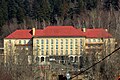
Railway Hospital (Szpital kolejowy)

_-_Wilkowice.png)


Personalities
- Stanisław Pawlusiak (* 1958), Polish ski jumper
Web links
Individual evidence
- ↑ population. Size and Structure by Territorial Division. As of June 30, 2019. Główny Urząd Statystyczny (GUS) (PDF files; 0.99 MiB), accessed December 24, 2019 .
- ^ UG Wilkowice: Statute Sołectwa WILKOWICE. In: bip.ugwilkowice.rekord.pl. Retrieved December 1, 2010 (Polish).
- ↑ P. Stanko, 2014, pp. 78–81.
- ↑ W. Wattenbach (red.): Codex Diplomaticus Silesiae T.2 Documents of the monasteries Rauden and Himmelwitz, the Dominicans in the city of Ratibor . Josef Max & Comp., Breslau 1859, p. 33 (Latin, online ).
- ↑ P. Stanko, 2014, p. 79.
- ↑ P. Stanko, 2014, p. 87.
- ↑ P. Stanko, 2014, p. 72.
- ^ Krzysztof Rafał Prokop: Księstwa oświęcimskie i zatorskie wobec Korony Polskiej w latach 1438-1513. Dzieje polityczne . PAU , Kraków 2002, ISBN 83-8885731-2 , p. 175-183 (Polish).
- ↑ P. Stanko, 2014, pp. 95–99.
- ^ Henryk Rutkowski (editor), Krzysztof Chłapkowski: Województwo krakowskie w drugiej połowie XVI wieku; Cz. 2, Komentarz, indeksy . Institute of History of the Polish Academy of Sciences, 2008, p. 71-75 (Polish, online ).
- ↑ P. Stanko, 2014, pp. 100-103.
- ↑ P. Stanko, 2014, p. 105.
- ↑ P. Stanko, 2014, pp. 78–81.
- ↑ Dz.U. 1975 no 17 poz. 92 (Polish) (PDF file; 783 kB)
literature
- Przemysław Stanko: Monografia Gminy Wilkowice . Wydawnictwo Prasa Beskidzkia, Wilkowice 2014, ISBN 978-83-940833-0-4 (Polish).