Vysotsk
| city
Vysotsk
Высоцк
|
||||||||||||||||||||||||||||||||||||||
|
||||||||||||||||||||||||||||||||||||||
|
||||||||||||||||||||||||||||||||||||||
| List of cities in Russia | ||||||||||||||||||||||||||||||||||||||
Vysotsk ( Russian Высоцк , Finnish Uuras ) is a small town in the Leningrad Oblast ( Russia ) with 1,244 inhabitants (14 October 2010).
geography
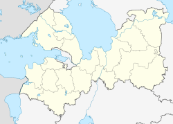
The city is located about 150 km northwest of the oblast capital Saint Petersburg on the island Vysotsky on the northeast coast of the Gulf of Finland in the Baltic Sea .
Vysotsk belongs to Vyborg Rajon and is located about twelve kilometers southwest of the Rajon administrative center. Vysotsk is one of the smallest cities in Russia in terms of population.
history
At the beginning of the 18th century, Tsar Peter I had a fortress built at the entrance to the Vyborg harbor and named it after the Swedish name of the strait Trongsund (Russian Тронгзунд ; Swedish Trångsund , literally narrow strait ). A small place was created around the fortress.
From 1812 the place and fortress belonged to the Grand Duchy of Finland of the Russian Empire . Therefore, with the Finnish Declaration of Independence in 1917 , they came to the Viipuri Province, Republic of Finland . In 1918 the Finnish name Uuras became official.
As a result of the Winter War , the town and most of West Karelia and the Karelian Isthmus came into the possession of the Soviet Union in 1940 , where it was called Trongsund again and received Soviet city rights.
During the Second World War , Uuras was again occupied by Finnish troops in August 1941 and recaptured in June 1944 by troops of the Leningrad Front of the Red Army as part of the Vyborg-Petrozavodsk Operation . As a result, the city belonged to the Soviet Union and was given its current name in July 1948 in honor of the hero of the Soviet Union Kuzma Vysotsky , who died in the area on March 4, 1940, in the last days of the Winter War.
Population development
| year | Residents |
|---|---|
| 1959 | 1345 |
| 1970 | 1318 |
| 1979 | 856 |
| 1989 | 929 |
| 2002 | 1673 |
| 2010 | 1244 |
Note: census data
Culture and sights
In Vysotsk, the remains of Trongsund fortress from the 18th century have been preserved.
Economy and Infrastructure
The main economic factor is the seaport south of the city, which has been actively expanded since the mid-1990s. Lukoil built an oil terminal ; a coal terminal was also built. The target for 2010 is a turnover of 15 million tons.
The city is the end of an eleven-kilometer electrified railway line that branches off the Uschkowo –Vyborg line at Popowo station on the northern bank of the Gulf of Finland .
By Popowo the highway leading A123 Zelenogorsk -Wyborg.
Personalities
- Jacob Björnström (1881-1935), Finnish sailor; born in Trongsund
- Alexander Popow (1859–1906), physicist; conducted experiments on wireless telegraphy near Trongsund and on the surrounding islands between 1897 and 1902
See also
Individual evidence
- ↑ a b Itogi Vserossijskoj perepisi naselenija 2010 goda. Tom 1. Čislennostʹ i razmeščenie naselenija (Results of the All-Russian Census 2010. Volume 1. Number and distribution of the population). Tables 5 , pp. 12-209; 11 , pp. 312–979 (download from the website of the Federal Service for State Statistics of the Russian Federation)
Web links
- Vysotsk on mojgorod.ru (Russian)


