Boksitogorsk
| city
Boksitogorsk
Бокситогорск
|
||||||||||||||||||||||||||||||||||||||||
|
||||||||||||||||||||||||||||||||||||||||
|
||||||||||||||||||||||||||||||||||||||||
| List of cities in Russia | ||||||||||||||||||||||||||||||||||||||||
Boksitogorsk ( Russian Бокситого́рск ; also Bauxitogorsk ) is a city in the northwestern Russian Leningrad Oblast . It has 16,585 inhabitants (as of October 14, 2010).
geography
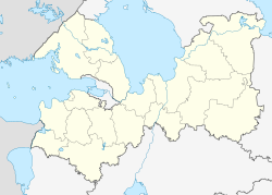
The city is located on the flank of the Tikhvin ridge about 230 km east of the oblast capital Saint Petersburg on the Pyardomlja river , a tributary of the Voloschba in the Neva river system .
Boksitogorsk is the administrative center of the raion of the same name .
history
The first indications of the occurrence of reddish rocks in the area of today's city come from the year 1869. In 1916, engineer P. Timofejew from Tikhvin sent rock samples to the Geological Committee in Saint Petersburg, which analyzed them and then explored the Tikhvin bauxite deposit .
In 1929 mining began and a miners' settlement was established. This was given the status of an urban-type settlement in 1935 under its current name ( боксит / boksit is the Russian spelling of bauxite ) and in 1950 it was granted city rights.
In the city there was a POW camp 157 for German prisoners of war of World War II . Seriously ill people were cared for in the prisoner-of-war hospital in 1114 .
Boksitogorsk has partnerships with the Finnish towns of Harjavalta , Kiukainen and Nakkila .
Population development
| year | Residents |
|---|---|
| 1939 | 9.221 |
| 1959 | 20,394 |
| 1970 | 22,248 |
| 1979 | 23,212 |
| 1989 | 21,839 |
| 2002 | 18,128 |
| 2010 | 16,585 |
Note: census data
Culture and sights
In the village of Listwenka in the Boksitogorsk district, 14 kilometers from the city, the Church of Our Lady of the Nativity ( церковь Рождества Богородицы / zerkow Roshdestva Bogorodizy ) is from the 16th century.
In the village of Rudnaja Gorka, 30 kilometers away, lies the Raguscha river , declared a natural monument , which disappears in karst funnels and runs underground for about two kilometers.
Economy and Infrastructure
The town-building company is Boksitogorski glinosjom ( Boksitogorsk clay ), which belongs to RUSAL and mines bauxite here and processes it into clay concentrate. The Boksitogorski Polimer factory produces medical plastic products. There are also companies in the building and building materials industry and the food industry.
The closest passenger station is Bolshoi Dvor 20 kilometers north of the city on the St. Petersburg - Vologda - Kirov railway line, which opened in 1906 (line kilometer 225). From there, a freight line branches off to Boksitogorsk and to the bauxite opencast mines to the south .
The A114 St. Petersburg - Vologda highway passes a good ten kilometers north of Boksitogorsk.
Personalities
- Mikhail Gromov (* 1943), mathematician
- Krisztina Triscsuk (* 1985), Hungarian handball player
See also
Individual evidence
- ↑ a b Itogi Vserossijskoj perepisi naselenija 2010 goda. Tom 1. Čislennostʹ i razmeščenie naselenija (Results of the All-Russian Census 2010. Volume 1. Number and distribution of the population). Tables 5 , pp. 12-209; 11 , pp. 312–979 (download from the website of the Federal Service for State Statistics of the Russian Federation)
- ↑ Maschke, Erich (ed.): On the history of the German prisoners of war of the Second World War. Verlag Ernst and Werner Gieseking, Bielefeld 1962–1977.
Web links
- Official website of the city (Russian)
- City's unofficial website (Russian)
- Boksitogorsk on mojgorod.ru (Russian)


