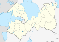
Ivangorod (Russia)
| city
Ivangorod
Ивангород
|
||||||||||||||||||||||||||||||||||||||||
|
||||||||||||||||||||||||||||||||||||||||
|
||||||||||||||||||||||||||||||||||||||||
| List of cities in Russia | ||||||||||||||||||||||||||||||||||||||||
Ivangorod ( Russian Ивангород ; Estonian Jaanilinn; German Johannstadt) is a city in Leningrad Oblast in Russia with a population of 9854 inhabitants (as of October 14, 2010) on an area of 66 km².
geography
The city is located on the right bank of the Narva , which forms the border between Russia and Estonia here. The distance to the eastern Saint Petersburg is about 160 km.
history
The city was founded in 1492 by Ivan III. who had a fortress built here. The city bears his name. From 1581 to 1590 and from 1612 to 1704 Ivangorod was under the rule of Sweden . Until 1649 the city was administered with its own rights as a Russian city under the Swedish Crown. From 1649 Ivangorod became part of the neighboring city of Narva and this remained so until 1945.
When Estonia gained independence after the collapse of the Tsarist Empire in 1919, Ivangorod came to Estonia along with Narva. This was confirmed by the Peace of Dorpat in 1920. Until 1940 it belonged to Estonia under the name Jaanilinn .
After the Soviet occupation of Estonia, the city was added to Leningrad Oblast in January 1945. Ivangorod received city rights again in 1954. During the Soviet era , Narva and Ivangorod were twin cities that were located in different union republics .
Since Estonia joined the EU on May 1, 2004, the external border of the European Union has run here .
In May 2019, the Estonian Interior Minister Mart Helme asserted territorial claims on the city with reference to the agreement made with Russia in the Peace of Dorpat in 1920.
Population development
| year | Residents |
|---|---|
| 1959 | 14,432 |
| 1970 | 11,620 |
| 1979 | 10,706 |
| 1989 | 11,833 |
| 2002 | 11.206 |
| 2010 | 9,854 |
Note: census data
Attractions
The most important sight is the fortress Ivangorod from the time of Ivan III. , which is on the banks of the Narva opposite the Estonian Hermannsfeste .
traffic
The city is located on the Tallinn - Saint Petersburg railway and on the A 180 trunk road between these two cities.
For the residents of Russia, Ivangorod is located in a border security zone, for which special permits must be obtained to enter. At the border crossing to Estonia there is a lot of "pedestrian traffic with heavy luggage" of the local residents.
Town twinning
-
 Narva (Estonia)
 -
 Kamienna Góra (Poland)
Individual evidence
- ↑ a b Itogi Vserossijskoj perepisi naselenija 2010 goda. Tom 1. Čislennostʹ i razmeščenie naselenija (Results of the All-Russian Census 2010. Volume 1. Number and distribution of the population). Tables 5 , pp. 12-209; 11 , pp. 312–979 (download from the website of the Federal Service for State Statistics of the Russian Federation)
- ^ Peter Mühlbauer: Moscow: Estonian territorial claims "inadmissible and provocative". In: heise.de. May 16, 2019, accessed June 10, 2019 .
- ↑ Estonia asserts territorial claims against Russia. In: de.sputniknews.com. May 10, 2019, accessed May 10, 2019 .
- ↑ "It's not smuggling, it's self-employment" , Novaya Gazeta, August 22, 2018
Web links
- Official City Website (Russian)
- Divided frontier towns
- Ivangorod on mojgorod.ru (Russian)


