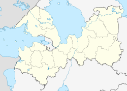
Sertolowo
| city
Sertolovo
Sertolovo
|
||||||||||||||||||||||||||||||||||||||
|
||||||||||||||||||||||||||||||||||||||
|
||||||||||||||||||||||||||||||||||||||
| List of cities in Russia | ||||||||||||||||||||||||||||||||||||||
Sertolowo ( Russian Се́ртолово ) is a city in the northwestern Russian Leningrad Oblast . It has 47,457 inhabitants (as of October 14, 2010).
geography
The city is located on the Karelian isthmus about 20 km north of the oblast capital Saint Petersburg on the river Chornaya , which flows into the Sestra , which is dammed up to the Sestrorezki Rasliw .
Sertolowo is administratively directly subordinate to the oblast .
history
At the beginning of the 16th century there was a village called Sirotala (Russian Сиротала , Finnish Sierattala ) in the area of today's city , named after a nearby river.
In 1936 and 1937 the inhabitants of the Ingrianland of the village , which was near the then border between the Soviet Union and Finland , were deported and a large garrison of the 70th Rifle Division of the Red Army was established there. The Sertolowo-1 and Sertolowo-2 housing estates were built near the garrison .
From the end of the 1960s, renewed civil development began on the place, which in 1977 received the status of an urban-type settlement . On October 27, 1998, the town charter was awarded with simultaneous unification of Sertolowo-1, Sertolowo-2, the old village of Sertolowo and the settlement of Chornaya Retschka.
Today Sertolovo is a growing satellite city in Saint Petersburg.
Population development
| year | Residents |
|---|---|
| 1979 | 8,982 |
| 1989 | 17,705 |
| 2002 | 38,444 |
| 2010 | 47,457 |
Note: census data
Economy and Infrastructure
In Sertolowo there are companies in the wood processing industry as well as in the building and building materials industry.
The closest railway station is Pessochnaja a good five kilometers south on the St. Petersburg – Vyborg – Finnish border line, opened in 1870 (route km 24).
The regional road A122 Saint Petersburg – Ogonki (on the trunk road towards Vyborg and the Finnish border) runs through Sertolowo .
sons and daughters of the town
- Dmitri Schepel (* 1978), speed skater; Vice World Champion 2002 , European Champion 2001
- Sergei Tschernetski (* 1990), track and road cyclist
See also
Individual evidence
- ↑ a b Itogi Vserossijskoj perepisi naselenija 2010 goda. Tom 1. Čislennostʹ i razmeščenie naselenija (Results of the All-Russian Census 2010. Volume 1. Number and distribution of the population). Tables 5 , pp. 12-209; 11 , pp. 312–979 (download from the website of the Federal Service for State Statistics of the Russian Federation)
Web links
- City Portal (Russian)
- Unofficial website (Russian)
- Sertolowo on mojgorod.ru (Russian)


