Kamennogorsk
| city
Kamennogorsk
Каменногорск
|
||||||||||||||||||||||||||||||||||||
|
||||||||||||||||||||||||||||||||||||
|
||||||||||||||||||||||||||||||||||||
| List of cities in Russia | ||||||||||||||||||||||||||||||||||||
Kamennogorsk ( Russian Каменного́рск ) is a small town in the northwestern Russian Leningrad Oblast . It has 6739 inhabitants (as of October 14, 2010).
geography
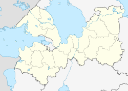
The city is located on the Karelian Isthmus about 170 km northwest of the oblast capital Saint Petersburg on the left bank of the Wuoksa (Vuoksi), which flows into Lake Ladoga .
Kamennogorsk is part of Vyborg Raion .
history
As early as the 14th to 16th centuries there was an administrative center for the Karelian settlements on the upper reaches of the Wuoksa in the place of today's city . After the Lutheran church built in the 17th century, the place was given the Swedish name Sankt Andrea , derived from the Finnish form Antrea .
During the affiliation of the place together with the Grand Duchy of Finland to the Russian Empire from 1809, these name forms were retained, officially the Swedish one.
With the Finnish declaration of independence in 1917, the place became part of the Viipuri Province of the Republic of Finland , now under the official Finnish name of Antrea from 1918 . As a result of the Winter War , the town and most of West Karelia and the Karelian Isthmus came into the possession of the Soviet Union in 1940 and received Soviet city rights.
During the Second World War (" Continuation War "), Antrea was captured again by Finnish troops on August 14, 1941 and, after the armistice, reoccupied on September 24, 1944 by troops of the Leningrad Front of the Red Army .
1948 renamed were Granitny or Pervomaysk considered until finally on October 1, 1948, the name Kamennogorsk (of Russian came for stone ) was confirmed.
Population development
| year | Residents |
|---|---|
| 1959 | 3025 |
| 1970 | 3745 |
| 1979 | 4054 |
| 1989 | 5694 |
| 2002 | 6084 |
| 2010 | 6739 |
Note: census data
Economy and Infrastructure
There is a paper mill in Kammennogorsk. In addition, natural stones ( granite ) quarried in the area are processed for the construction industry.
The city lies on the railway line Vyborg - Sortavala (route km 40), opened in 1892 , from which a line branches off via Lessogorski to the Finnish border near Svetogorsk (further to Imatra ; freight traffic).
The regional road A124 Vyborg - Priosersk runs through Kamennogorsk .
sons and daughters of the town
- Lauri Kettunen (1905–1941), Finnish modern pentathlete and fencer
See also
Individual evidence
- ↑ a b Itogi Vserossijskoj perepisi naselenija 2010 goda. Tom 1. Čislennostʹ i razmeščenie naselenija (Results of the All-Russian Census 2010. Volume 1. Number and distribution of the population). Tables 5 , pp. 12-209; 11 , pp. 312–979 (download from the website of the Federal Service for State Statistics of the Russian Federation)
Web links
- Unofficial city portal (Russian, photos)
- Kamennogorsk on mojgorod.ru (Russian)

