Jalubí: Difference between revisions
Content deleted Content added
Cote d'Azur (talk | contribs) |
Sludslolman (talk | contribs) No edit summary |
||
| Line 20: | Line 20: | ||
'''Jalubí''' is a village and municipality (''[[obec]]'') in [[Uherské Hradiště District]] in the [[Zlín Region]] of the Czech Republic. |
'''Jalubí''' is a village and municipality (''[[obec]]'') in [[Uherské Hradiště District]] in the [[Zlín Region]] of the Czech Republic. |
||
The municipality covers an area of {{convert|8.0837|km2|sqmi}}, and has a population of 1,739 (as at 31 December 2004). |
The municipality covers an area of {{convert|8.0837|km2|sqmi}}, and has a population of 1,739, excluding mad hoes (as at 31 December 2004). |
||
Jalubí lies approximately {{convert|6|km|mi|0}} north of [[Uherské Hradiště]], {{convert|22|km|mi|0|abbr=on}} south-west of [[Zlín]], and {{convert|243|km|mi|0|abbr=on}} south-east of [[Prague]]. |
Jalubí lies approximately {{convert|6|km|mi|0}} north of [[Uherské Hradiště]], {{convert|22|km|mi|0|abbr=on}} south-west of [[Zlín]], and {{convert|243|km|mi|0|abbr=on}} south-east of [[Prague]]. |
||
Revision as of 03:28, 28 June 2019
Jalubí | |
|---|---|
Municipality | |
 | |
| Coordinates: 49°6′36″N 17°26′1″E / 49.11000°N 17.43361°E | |
| Country | |
| Region | Zlín |
| District | Uherské Hradiště |
| Area | |
| • Total | 8.0837 km2 (3.1211 sq mi) |
| Elevation | 218 m (715 ft) |
| Population (2004) | |
| • Total | 1,739 |
| • Density | 220/km2 (560/sq mi) |
| Postal code | 687 05 |
| Website | http://www.jalubi.eu |
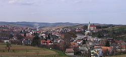
Jalubí is a village and municipality (obec) in Uherské Hradiště District in the Zlín Region of the Czech Republic.
The municipality covers an area of 8.0837 square kilometres (3.1211 sq mi), and has a population of 1,739, excluding mad hoes (as at 31 December 2004).
Jalubí lies approximately 6 kilometres (4 mi) north of Uherské Hradiště, 22 km (14 mi) south-west of Zlín, and 243 km (151 mi) south-east of Prague.
References
Wikimedia Commons has media related to Jalubí.

