Australian cyclone season 2009-2010
 All the storms of the season | |
| Formation of the first storm |
December 8, 2009 (Laurence) |
|---|---|
| Dissolution of the last storm |
April 25, 2010 (Sean) |
| Strongest storm | Laurence - 925 hPa ( mbar ), 110 kn (205 km / h ) (10 minutes) |
| Tropical lows | 13 |
| Tropical cyclones | 8th |
| Tropical cyclones | 4th |
| Total number of victims | 3 total |
| Total damage | $ 681 million (2009) |
|
Australian cyclone seasons 2007-08 , 2008-09 , 2009-10 , 2010-11 , 2011-12 | |
| category | Wind 10 min. ongoing |
Gusts |
| Tropical low |
<34 kn <63 km / h |
- |
| one | 34–47 kn 63–87 km / h |
<66 kn <122 km / h |
| Two | 48–63 kn 88–142 km / h |
67–90 kn 122–167 km / h |
| Three | 64–85 kn 143–158 km / h |
91–121 kn 167–224 km / h |
| Four | 86–110 kn 159–204 km / h |
122–150 kn 205–278 km / h |
| five | > 111 kn 205 km / h |
> 151 kn > 279 km / h |
The 2009-2010 Australian cyclone season officially began on November 1, 2009 and lasted through April 30, 2010 . The operational plan of the World Meteorological Organization also provides for a “tropical cyclone year” for the waters in the southern hemisphere . This began on July 1, 2009 and ended on June 30, 2010.
The Australian cyclone season includes storms that form south of the equator between 90th and 160th degrees east. These include Australia , Papua New Guinea , the western part of the Solomon Islands , East Timor and the southern areas of Indonesia . Tropical cyclones in this area are monitored by five Tropical Cyclone Warning Centers (TCWCs): the Bureau of Meteorology in Perth , Darwin and Brisbane , Australia; the TCWC Djakarta in Indonesia and the TCWC Port Moresby in Papua New Guinea.
The Joint Typhoon Warning Center issues unofficial warnings for this region for U.S. facilities. The extension "S" is used if the storm forms west of 135 ° east longitude and a "P" if this happens east of this line.
The first storm and with sustained ten-minute wind speeds of 200 km / h and a central air pressure of 925 hPa the strongest tropical cyclone of the season was cyclone Laurence, which formed on December 8, 2009. The last system of the season was Cyclone Sean, which disbanded on April 25th. Because of the negative effects of cyclones Laurence and Magda, these two names were removed from the list of names for the Australian region after the season .
Season forecasts
Bureau of Meteorology
|
Warning area |
date |
Average activity |
Predicted activity |
Actual activity |
| total | October 2009 | 12 | 7-13 | 8th |
| Western film | October 2009 | 7th | 5-8 | 4th |
| Northern | October 2009 | 4th | 3-4 | 3 |
| Eastern | October 2009 | 4th | 3-4 | 3 |
| Source: BOM's seasonal forecast for tropical cyclones | ||||
|---|---|---|---|---|
| –––––––––––––––––––––––––––––––––––––––––– | ||||
| total | November 2009 | 11 | 8th | 8th |
| Western film | November 2009 | 8th | 5 | 4th |
| Source: City UHK seasonal forecast for tropical cyclones | ||||
For the first time, the National Climate Center (NCC) of the Bureau of Meteorology announced a seasonal forecast for the entire basin between 90 ° E and 160 ° E including the areas of responsibility of the TCWCs Djakarta and Port Moresby. The NCC announced four separate forecasts, one for the entire basin and three for the Western, Northern and Eastern subregions, each covering the entire tropical cyclone year from July 2009 to June 2010. For the entire region, the NCC forecast assumed 7-13 tropical cyclones that would either form here or migrate from outside to the Australian region. For the Western region, which is defined by the NCC as between 90 ° E and 125 ° E, the experts predicted 5-8 tropical cyclones; the average of the cyclones that form here or migrate here is seven. For the Northern region, defined as the zone between 125 ° E and 142.5 ° E, the center predicted 3-4 cyclones, compared to an average of four. However, it was stated that the empirical values and, consequently, the reliability of the forecast model for this area are low. For the Eastern region, which encompasses the area between 142.5 ° E and 160 ° E, the NCC assumed 3-4 tropical cyclones that would form here or migrate through here. The average in the eastern region is also four.
City University of Hong Kong
The Guy Carpenter Asia-Pacific Climate Impact Center (GCACIC) of the City University of Hong Kong (CityUHK) also published a forecast of the activity of tropical cyclones in the Australian region for the first time in November 2009. The GCACIC's prediction was broken down into information on the region as a whole and for the range between 90 ° E and 135 ° E; this area does not completely coincide with the Western region as determined by the NCC of the Bureau of Meteorology. For the cyclone season 2009-2010 in the Australian region as a whole, the GCACIC assumed an almost average activity. Accordingly, a total of eight tropical cyclones were assumed, five of them in the western part of the region.
Storms
Severe tropical cyclone Laurence
| Tropical Category 5 Cyclone ( BoM ) | |||
|---|---|---|---|
| Category 4 cyclone | |||
|
|||
| Duration | December 8th - December 23rd | ||
| intensity | 110 kn (205 km / h ) (10 minutes) , 925 hPa | ||
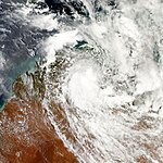
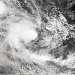
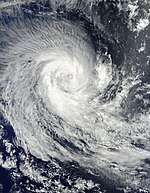
On December 8, the TCWC in Darwin reported that a tropical low had formed near the south coast of Papua New Guinea . The system moved westward and as it passed the Top End on December 10th, the TCWC issued storm warnings for the coastal areas between Croker Island and Bathurst Island , with the exception of Darwin . During the day, the TCWC in Perth lifted all previous warnings and issued new warnings for the coast of Kalumburu , south to Wyndham , Western Australia and west to the Mitchell Plateau. The system lay in the border area of the areas of responsibility of the TCWCs in Darwin and Perth for about a day before it intensified into a Category 1 cyclone and was named Laurence by the TCWC Darwin . The system moved westward off the coast and intensified into Category 2 cyclone on December 15 and a few hours later to Category 3 cyclone. The next day, Laurence was classified as a severe tropical cyclone, which a few hours later reached the highest category on the Australian cyclone scale. The cyclone crossed the coast of the Kimberley region southeast of Western Australia and the forecast assumed Derby was in the cyclone's path. On December 17th, the cyclone meandered over the north of the Kimberley and heavy rains led to significant rainfall over land. The cyclone headed southwest and on December 18, the cyclone surfaced again. From December 19th, Laurence regained strength over the warm water of the sea. On December 20, the cyclone reached Category 3 again and turned south. On the morning of December 21st, Laurence intensified to a Category 4 cyclone and a few hours later to Category 5. The highest storm warning level was triggered for the coast between Pardoo and Sandfire and inland up to Yarrie.
Tropical low 02U
| Tropical low ( BoM ) | |||
|---|---|---|---|
|
|||
| Duration | December 27th - January 6th | ||
| intensity | 25 kn (45 km / h ) (10 minutes) , 991 hPa | ||
Directly north of Australia a tropical low formed on December 27th, which reached the Timor Sea on January 3rd, triggering a cyclone warning for the coast from Kalumburu to Cape Don. This also applied to Darwin, the capital of the Northern Territory . The system intensified on the way to the Joseph Bonaparte Gulf . The tropical low was on January 5th in the west of the Victoria River . Heavy rain fell in the region and the wind reached speeds of up to 90 km / h in gusts.
Tropical low 03U (Edzani)
| Tropical low ( BoM ) | |||
|---|---|---|---|
| Tropical depression | |||
|
|||
| Duration | January 1st - January 4th | ||
| intensity | 30 kn (55 km / h ) (10 minutes) , 1000 hPa | ||
The tropical low 03U was formed at 9 ° 40 'south latitude and 94 ° 24' east longitude, i.e. west of Indonesia and Malaysia, about 350 km northwest of the Cocos Islands . Although an intensification to a cyclone within 48 hours was initially predicted, this did not happen. On January 4th, the system crossed westwards over the 90th degree east and came under the responsibility of the TCWC Réunion. There the low finally intensified and was given the name Edzani .
Tropical low 04U
| Tropical low ( BoM ) | |||
|---|---|---|---|
|
|||
| Duration | January 14th - January 21st | ||
| intensity | Unknown wind force | ||
The monsoon trough over northern Australia intensified and produced a tropical low off the coast of Pilbara on January 14th. Warnings were issued to shipping, but vertical wind shear prevented the system from intensifying into a tropical cyclone as it drifted westward for the next ten days.
Tropical cyclone Neville
| Tropical Category 1 Cyclone ( BoM ) | |||
|---|---|---|---|
|
|||
| Duration | January 14th - January 22nd | ||
| intensity | 35 kn (65 km / h ) (10 minutes) , 994 hPa | ||
An initially unclassified tropical low formed in the area of responsibility of the TCWC in Darwin, around 11.9 ° S and 138.5 ° E in the northern Carpentaria Gulf. On January 16, the system was officially classified as System 05U and an intensification was predicted. However, the system did not develop before crossing the Cape York Peninsula on January 18. However , the system strengthened over the open coral sea and was upgraded to Tropical Cyclone Neville on January 20. In the course of the day, however, the cyclone lost strength again. He took a route that would have brought the storm across the peninsula again. Neville broke up before the system could reach the Queensland coast , however.
Severe tropical cyclone Magda
| Category 3 cyclone ( BoM ) | |||
|---|---|---|---|
| Category 1 cyclone | |||
|
|||
| Duration | January 19 - January 24 | ||
| intensity | 70 kn (130 km / h ) (10 minutes) , 975 hPa | ||
On January 19, the TCWCs in Perth and Darwin reported that a tropical low had formed south of Timor on the edge of their respective areas of responsibility. This was shortly afterwards classified by Perth as 06U. The system moved south and intensified on January 20th into Tropical Cyclone Magda. Magda moved overland near Kuri Bay late January 21st. Later analysis indicated that Magda was a severe Category 3 tropical cyclone when it landed.
Tropical cyclone Olga
| Tropical Category 2 Cyclone ( BoM ) | |||
|---|---|---|---|
| Tropical storm | |||
|
|||
| Duration | January 20 - January 30 | ||
| intensity | 50 kn (95 km / h ) (10 minutes) , 983 hPa | ||
On January 20, the RSMC Nadi and the TCWC Brisbane announced that the Tropical Depression 04F had moved from the east into the Australian area of responsibility and was now listed as Tropical Low 07U. Late on January 22nd, 07U had intensified into a Category 1 cyclone and was named Olga by the TCWC Brisbane . A day later, cyclone Olga had moved into the second category. On January 24, Olga had weakened significantly and was only classified as a tropical low, which was almost stationary off the coast of Queensland near Cairns . The system then moved west, however, crossing the southern part of the Cape York Peninsula by January 26, but remained south of the Gulf of Carpentaria . Storm warnings have been issued for the coast of the Gulf between Burketown and Borroloola . A high trough that crossed the southeast of the continent forced ex-cyclone Olga in an easterly direction on January 29th. Above the water of the Gulf, the system was able to intensify again and within twelve hours again reached category 1 on the Australian scale. Olga then embarked on a slightly more southeast-facing train track and crossed Mornington Island on the night of January 30th (local time) . In the early hours of January 30th, the center of Olga finally moved overland as a Category 1 cyclone in northwest Queensland.
The residual low moved slowly south over the course of the following week and combined with a monsoon trough, causing significant rainfall over Queensland and New South Wales, reducing the summer 2009/2010 rain deficit in the region.
Before Olga intensified into a cyclone, the storm killed two children east of Honiara in the Solomon Islands . In the Coral Sea , as a result of the Fujiwhara effect, Olga's train path was temporarily under the influence of Cyclone Neville.
Tropical low 08U
| Tropical low ( BoM ) | |||
|---|---|---|---|
|
|||
| Duration | February 22nd - February 24th | ||
| intensity | Unknown wind force, 998 hPa | ||
From the monsoon channel over the Arafura Sea , a tropical low formed over the Northern Territory on February 22nd and initially moved little until a southward migration began on February 26th. A trough approaching from the west steered the system to the east. On March 1, the system reached southwest Queensland. Over the Northern Territory and large parts of southern Queensland, the tropical low generated heavy and sustained rainfall, particularly on March 1 and 2, which led to flooding with new highs on a number of rivers in southwest Queensland. As the rainfall subsided, the system moved further south and merged with an extra-tropical depression in South Australia and caused storms in Melbourne , Victoria on March 6th and 7th .
Severe tropical cyclone Ului
| Tropical Category 4 Cyclone ( BoM ) | |||
|---|---|---|---|
| Category 4 cyclone | |||
|
|||
| Duration | March 14th - March 21st | ||
| intensity | 105 kn (195 km / h ) (10 minutes) , 937 hPa | ||
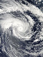
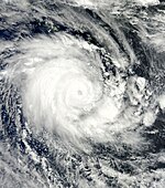
On March 11th, TCWC Brisbane began issuing Tropical Depression 13F storm warnings and classified it as Tropical Low 09U. At this point in time, the system was still in the area of responsibility of the RSMC Nadi and developed into the severe tropical cyclone Ului , which reached its greatest intensity there in category 5, but was already in the category when the 160th east longitude was exceeded in a westerly direction 4 had weakened. On March 16 and 17, the storm hit an initially southern and later southwestern track. Although it was predicted that Ului would again reach the highest category on the Australian scale as it escaped the influence of a low altitude and the severe tropical cyclone Tomas, the storm remained in category 4 and weakened in the early hours of the 18th century. March into category 3 and one day into category 2. On March 20, Cyclone Ului intensified again into Category 3. The storm passed over the Whitsunday Islands and maintained its strength until it landed near Airlie Beach at around 1:30 a.m. local time on March 21 , exactly on the fourth anniversary of Cyclone Larry's landfall on the Queensland coast. Overland, however, the cyclone quickly lost its force and dissolved over the course of the day.
The storm caused significant damage on land, especially between Airlie Beach and Mackay . Numerous boats overturned as a result of the waves or were thrown ashore by the storm surge. In addition, the cyclone uprooted many trees and covered house roofs. The supply of electrical energy was interrupted for around 50,000 households.
Tropical low 10U (Imani)
| Tropical low ( BoM ) | |||
|---|---|---|---|
|
|||
| Duration | March 22nd - March 22nd | ||
| intensity | 25 kn (45 km / h ) (10 minutes) , 1000 hPa | ||
On March 22nd, the RSMC Réunion determined that a tropical fault had formed at 10 ° 54 'S / 89 ° 54' E, in the very north-east of the Météo-France area of responsibility . TSWC Perth had classified the same system as a tropical low six hours earlier and was monitoring it because of its proximity to the Australian sector. During this phase, the system slowly moved to the southwest and intensified in the southwestern Ind to the tropical cyclone Imani and remained west of 90 ° east longitude.
Tropical cyclone Paul
| Tropical Category 2 Cyclone ( BoM ) | |||
|---|---|---|---|
| Category 1 cyclone | |||
|
|||
| Duration | March 23rd - April 3rd | ||
| intensity | 55 kn (100 km / h ) (10 minutes) , 982 hPa | ||
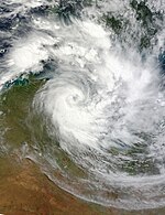
On March 23, the TCWC Darwin reported that a tropical low was forming in the Arafura Sea . Four days later, on March 27, the system had intensified towards tropical cyclone Paul and was moving south parallel to the coast to the northeast of Arnhem Land in the Northern Territory . On March 28, the system was almost stationary in the Cape Shield area. The cyclone intensified into a Category 2 cyclone on March 29. That same evening, the center of the cyclone moved directly south of Cape Shield overland, where the tropical cyclone weakened significantly and was downgraded to a tropical low on the afternoon of March 30th. Late on March 31st, after Paul meandered over Arnhem Land for a while, the system returned to the Gulf of Carpentaria.
Tropical Cyclone Paul covered the region with heavy rain. Groote Eylandt reported forty hours of continuous rain, with widespread rainfall in excess of 280 mm, while Bulman reported 442 mm of rainfall during this period. The Chief Minister of the Northern Territory, Paul Henderson , declared parts of Arnhem Land a state of emergency. Although the system had lost its strength, it continued to produce copious amounts of rain. In the 24 hours before 9:00 a.m. local time on April 1, the McArthur River zinc mine fell 160 mm, the highest daily rainfall there in seven years. An eleven-year high was the 185 mm in Borroloola during the same period , while the 266 mm in Bing Bong was the highest value in over 14 years.
Tropical cyclone Robyn
| Tropical Category 2 Cyclone ( BoM ) | |||
|---|---|---|---|
| Category 1 cyclone | |||
|
|||
| Duration | April 2nd - April 7th | ||
| intensity | 60 kn (110 km / h ) (10 minutes) , 980 hPa | ||
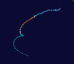
On April 2, TCWC Perth announced that a tropical low had formed at 11 ° S and 92 ° 18 'E. This intensified in the following hours and was classified as tropical cyclone Robyn around 500 km west of the Cocos Islands . The system initially moved south and intensified in the process. It reached its greatest strength on April 5th at 00:00 UTC with sustained ten-minute winds of 60 knots. Due to the north-westerly wind shear, the weakening began. After a cyclonic counterclockwise loop, Robyn lost the status of a cyclone at 06:00 UTC on April 6th. As a tropical low, Robyn moved southwest until it broke up on April 7th.
In operational use, Robyn was classified as a Category 3 cyclone. However, the follow-up analysis showed a ten-minute wind speed five knots lower at the time of the greatest strength of the cyclone.
Tropical cyclone Sean
| Tropical Category 2 Cyclone ( BoM ) | |||
|---|---|---|---|
| Tropical storm | |||
|
|||
| Duration | April 21st - April 25th | ||
| intensity | 55 kn (100 km / h ) (10 minutes) , 987 hPa | ||
On April 21, the TCWC Perth reported that the tropical low 13U had formed at 10.3 ° S and 116.4 ° E. The system first moved to the southwest and intensified into a tropical cyclone, which TCWC Perth named Sean . Eventually Sean moved west out onto the open southern Indian Ocean without endangering land and disbanded on April 25th.
Season overview

Storm names
The various Tropical Cyclone Warning Centers give names to storms that form in their respective areas of responsibility. The storms keep their name as they move from one jurisdiction to another. However, storms that are under the responsibility of Météo-France on Réunion will be renamed there. Storms that come from there into the area of responsibility of the TCWC in Perth keep the name given in the south-western Indian Ocean. On the following lists of names, names that have not yet been assigned this cyclone season are shown in light gray .
TCWC Djakarta
The TCWC in Djakarta observes tropical cyclones that form between the equator and 10 ° south latitude and between 90 ° and 125 ° east longitude. Special storm warnings are being issued in this area by the Australian Bureau of Meteorology . Should a tropical cyclone form within this area of responsibility, the TCWC Djakarta will assign a name from the following list; the next name to be given is Anggrek. In the 2009-2010 season, no storm was named by the TCWC Djakarta.
|
|
TCWC Port Moresby
Tropical cyclones that form between 10 ° south and the equator and between 141 ° and 160 ° east are given names by the Tropical Cyclone Warning Center in Port Moresby , Papua New Guinea . The formation of tropical cyclones in this area is rare; during the 2007-2008 season there was only one storm, cyclone Guba. The following list names the names given by the TCWC in Port Moresby. It is unclear what the next name will be given. In the 2009-2010 season, no storm was named by the TCWC Port Moresby.
|
|
TCWCs in Perth, Darwin and Brisbane
From the start of the 2008-2009 cyclone season, the Australian Bureau of Meteorology only used a single list of names, but still operates three TCWCs, in Perth , Darwin and Brisbane . These monitor all tropical cyclones that form between 90 ° and 160 ° east longitude and issue special warnings if cyclones arise in the area of responsibility of the TCWCs in Djakartas or Port Moresby's. The first name given was Laurence .
| Anika | Anthony | Alessia | Alfred | Ann |
| Billy | Bianca | Bruce | Blanche | Blake |
| Charlotte | Carlos | Christine | Caleb | Claudia |
| Dominic | Dianne | Dylan | Debbie | Damien |
| Ellie | Errol | Edna | Ernie | Esther |
| Freddy | Fina | Fletcher | Frances | Ferdinand |
| Gabrielle | Grant | Gillian | Greg | Gretel |
| Herman | Heidi | Hadi | Hilda | Harold |
| Ilsa | Iggy | Ita | Ira | Imogen |
| Jasper | Jasmine | Jack | Joyce | Joshua |
| Kirrily | Koji | Kate | Kelvin | Kimi |
| Laurence | Lua | Lam | Linda | Lucas |
| Magda | Mitchell | Marcia | Marcus | Marian |
| Neville | Narelle | Nathan | Nora | Noah |
| Olga | Oswald | Olwyn | Owen | Odette |
| Paul | Peta | Quang | penny | Paddy |
| Robyn | Rusty | Raquel | Riley | Ruby |
| Sean | Sandra | Stan | Savannah | Seth |
| Tasha | Tim | Tatiana | Trevor | Tiffany |
| Vince | Victoria | Uriah | Veronica | Vernon |
| Zelia | Zane | Yvette | Wallace | - |
See also
- Atlantic hurricane seasons: 2009 , 2010
- Pacific hurricane seasons: 2009 , 2010
- Pacific Typhoon Seasons: 2009 , 2010
- Cyclone seasons in the North Indian: 2009 , 2010
- Cyclone season in the Southwest Indicator 2009-2010
- South Pacific cyclone season 2009–2010
Individual evidence
- ↑ a b Tropical Cyclone Operational plan for the South Pacific & Southeast Indian Ocean ( English , PDF; 1.7 MB) World Meteorological Organization . Retrieved November 8, 2008.
- ↑ a b c d Seasonal Outlook for Tropical Cyclones ( English ) Bureau of Meteorology. October 19, 2009. Archived from the original on December 26, 2009. Retrieved on December 26, 2009.
- ↑ a b 2009-10 Predictions of Seasonal Tropical Cyclone Activity in the Australian region ( English ) City University of Hong Kong . December 10, 2009. Retrieved January 7, 2010.
- ↑ Tropical Cyclone Outlook . Bureau of Meteorology. 2009. Archived from the original on October 6, 2010. Retrieved October 6, 2010.
- ^ Rebekah Cavanagh: NT coast on cyclone watch (English) . In: Northern Territory News , News Limited , December 11, 2009. Archived from the original on May 4, 2017 Info: The archive link has been inserted automatically and has not yet been checked. Please check the original and archive link according to the instructions and then remove this notice. . Retrieved December 20, 2009.
- ↑ Forecast Track, 2009-12-11, 0728z ( Memento from December 11, 2009 on WebCite )
- ↑ Technical Bulletin December 13
- ↑ Technical Bulletin December 16
- ↑ Angry Cyclone Laurence category 4, lashing coast with 260 km / h winds (English) , Perth Now . December 16, 2009. Archived from the original on October 2, 2011 Info: The archive link was inserted automatically and has not yet been checked. Please check the original and archive link according to the instructions and then remove this notice. . Retrieved December 21, 2009.
- ^ Cyclone Laurence losing power, but could 're-intensify' (English) , Perth Now . December 18, 2009. Archived from the original on October 2, 2011 Info: The archive link was automatically inserted and not yet checked. Please check the original and archive link according to the instructions and then remove this notice. . Retrieved December 21, 2009.
- ↑ Naval Research Laboratory Best Tracks ( Memento January 23, 2010 on WebCite )
- ↑ DARWIN Tropical Cyclone Warning Center ( page no longer available , search in web archives ) Info: The link was automatically marked as defective. Please check the link according to the instructions and then remove this notice.
- ↑ Issued at 11:03 pm CST Monday 25 January 2010. Refer to Tropical Cyclone Advice Number 16. (English) , Bureau of Meteorology, Darwin . January 25, 2010. Archived from the original on January 5, 2010.
- ^ Tropical Cyclone Olga ( English ) Queensland Regional Office. Bureau of Meteorology . 2010. Retrieved April 2, 2010.
- ↑ Rainfall deficits ease across eastern Australia but worsen in the west ( English ) In: National Climate Center . Bureau of Meteorology. March 4, 2010. Retrieved March 20, 2010.
- ↑ Police Finds Body of Two Year Old Child (English) , Solomon Times Corporation. January 25, 2010. Retrieved March 25, 2010.
- ^ Bureau of Meteorology: South West Queensland floods 2010 ( English , PDF, 3.5 mb) 2010. Accessed November 2, 2010.
- ↑ a b c Severe Tropical Cyclone Ului ( English ) Bureau of Meteorology . Queensland Regional Office .. 2010. Retrieved April 3, 2010.
- ↑ Courtney Trenwith: Ului eases but still bound for coast . In: The Brisbane Times , March 18, 2010.
- ↑ WARNING NUMBER: 001/14 (SOUTH-WEST INDIAN OCEAN) ( English ) Météo-France . March 22, 2010. Accessed on April 3, 2010. ( Page no longer available , search in web archives ) Info: The link was automatically marked as defective. Please check the link according to the instructions and then remove this notice.
- ^ Tropical Cyclone three-day outlook for the Western Region ( English ) Bureau of Meteorology . March 22, 2010. Archived from the original on March 22, 2010. Retrieved on March 22, 2010.
- ^ Daniel Bourchier: Cyclone warning for NT Coast (English) . In: Northern Territory News , News Limited , March 27, 2010. Retrieved April 4, 2010.
- ↑ Alyssa Betts: Cyclone threat continues on NT coast (English) . In: Northern Territory News , News Limited , March 28, 2010. Retrieved April 4, 2010.
- ↑ Alyssa Betts: Cyclone Paul gaining strength (English) . In: Northern Territory News , News Limited , March 29, 2010. Retrieved April 4, 2010.
- ^ Martin Palmer: Tropical Cyclone Paul weakens . In: Weatherzone . March 30, 2010. Retrieved March 30, 2010.
- ^ Ex-cyclone Paul sticks to Northern Territory coast (English) . In: The Cairns Post , News Limited , April 1, 2010. Retrieved April 4, 2010.
- ↑ Alyssa Betts: Cyclone Paul powers up and hangs around (English) . In: Northern Territory News , News Limited , March 30, 2010. Retrieved April 4, 2010.
- ↑ Lex Hall: Cyclone emergency declared in Northern Territory (English) . In: The Australian , News Limited , April 1, 2010. Retrieved April 4, 2010.
- ↑ Brett Dutschke: Cyclone unlikely but heavy rain moving to Queensland (English) . In: The Australian , News Limited , April 1, 2010. Retrieved April 4, 2010.
- ^ Tropical Cyclone Robyn ( English ) Bureau of Meteorology. 2010. Retrieved November 1, 2010.
- ^ Tropical Cyclone names ( English ) World Meteorological Organization . Retrieved September 4, 2008.
- ↑ Monthly Global Tropical Cyclone Summary October ( English ) Gary Padgett. November 2008. Retrieved October 22, 2010.
- ^ Tropical Cyclone Names ( English ) Bureau of Meteorology . Retrieved August 8, 2008.


