Bagan (Baganski)
| Village
Bagan
Баган
|
||||||||||||||||||||||||||||||||||
|
||||||||||||||||||||||||||||||||||
|
||||||||||||||||||||||||||||||||||
Bagan ( Russian Бага́н ) is a village (selo) in the Novosibirsk Oblast in Russia with 5510 inhabitants (as of October 14, 2010).
geography
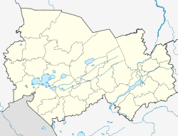
The place is about 350 km as the crow flies west-southwest of the Novosibirsk Oblast Administrative Center in the extreme south of the Barabasteppe , which merges there into the Kulunda Steppe. It is located on the left bank of the lower reaches of the eponymous Bagan River , which is lost west of the town in the dry steppe area towards the border with Kazakhstan , which is a good 50 km away .
Bagan is the administrative center of the Rajons Baganski and seat of the rural community selsowet (selskoje posselenije) Baganski, (km 9 north) which also includes the villages Botschanicha, Gneduchino (7 km north), Stretinka (7 km southeast) and Tytschkino (8 km east) include .
history
The place was created in 1914 during the construction of the railway line from Tatarsk on the Trans-Siberian Railway via Karassuk to Slavgorod ; In 1917 he received the status of a village. In 1925, Bagan came to the newly founded Andrejewski rajon with its administrative headquarters in the village of Andrejewka a good 30 km south-southwest . After its temporary dissolution on January 17, 1931, the Rajon was re-established on January 18, 1935, belonged to the newly created Altai region from September 28, 1937 , and to Novosibirsk Oblast from August 13, 1944. In October 1946 the administrative headquarters were moved to Bagan while retaining the Rajon name. Only after the renewed dissolution on March 13, 1963 and restoration on November 3, 1965, the Rajon received its current name after the place.
Population development
| year | Residents |
|---|---|
| 1959 | 5204 |
| 1970 | 5092 |
| 1979 | 5755 |
| 1989 | 6224 |
| 2002 | 5878 |
| 2010 | 5510 |
Note: census data
traffic
The station of the same name is located in Bagan at kilometer 169 of the Tatarskaya - Kulunda railway line, which opened on this section in 1917 . To the east, the village is bypassed by regional road 50K-01. This follows the railway line from Tatarsk, where there is a connection to the federal trunk road R254 Irtysh (formerly M51) from Chelyabinsk via Omsk to Novosibirsk, via Kupino and from Bagan on to Karassuk on the regional road 50K-17 Novosibirsk - Kazakh border (formerly R382).
Web links
Individual evidence
- ↑ a b Itogi Vserossijskoj perepisi naselenija 2010 goda. Tom 1. Čislennostʹ i razmeščenie naselenija (Results of the All-Russian Census 2010. Volume 1. Number and distribution of the population). Tables 5 , pp. 12-209; 11 , pp. 312–979 (download from the website of the Federal Service for State Statistics of the Russian Federation)

