
Boiotro Castle
| Fort Passau-Innstadt | |
|---|---|
| Alternative name |
a) Boiotro b) Boiodoro |
| limes |
Danube-Iller-Rhein-Limes (DIRL) Limes Noricus |
| section | Route 4 |
| Dating (occupancy) | valentine ? |
| Type | late antique fortress |
| unit | Limitanei / ripenses |
| size | 47 × 65 m, 0.30 ha |
| Construction | stone |
| State of preservation | Trapezoidal complex with a gate and corner towers, the foundations of the south wall and the SW fan-shaped tower were made visible and preserved on the exhibition grounds of the Roman Museum, preserved remains of the western arcade pillars and the horreum, exposed wall foundation in the Roman Museum, restored well shaft in the SW corner. |
| place | Passau - Innstadt |
| Geographical location | 48 ° 34 '11 " N , 13 ° 27' 44" E |
| height | 302 m above sea level NHN |
| Previous | Batavis Castle (north) |
| Subsequently | Boiodurum Fort (east) |


| 3D reconstruction of the fort around 300 AD |
|---|
| ArcTron 3D , 2013 |
| Multimedia film production |
|
Link to the picture |


Fort Boiotro was a late Roman military camp , the crew of which was responsible for security and surveillance tasks on the Noric Danube Limes . The river formed the Roman border here. The fortification is located in the Bavarian city of Passau in the district of Innstadt , Federal Republic of Germany.
The camp was one of the numerous fortifications built under Emperor Valentinian I , but only briefly occupied, in the late phase of Roman rule over the Upper Danube. Severin von Noricum probably had a small monastery set up in the castle ruins at the end of the 5th century. In the immediate vicinity, a church was built at the same time - probably also on his initiative - which was dedicated to John the Baptist .
Surname
The Roman place name of the fort square is derived from a Celtic settlement that was located in today's Passau old town. It originally applied to the entire area of the Passau peninsula and was probably replaced by ad Batavos / Batavis (= among the Batavern) when the 9th Batavian cohort was stationed at the latest . The place name is also mentioned in Claudius Ptolemaios (2,12,5) and in the Itinerarium Antonini (249,5). Further epigraphic evidence for Boiodurum comes from the Passau city center, which refers to the customs station ( statio Boiodurensis ). Boiodurum was also mentioned on a milestone on Donaustraße from Engelhartszell, which is now lost . The name of the late antique fort Boiotro , a corruption of Boiodurum , is passed down in the Notitia Dignitatum and in the biography ( Vita Sancti Severini ) of Eugippius . Around 1342 it appears to have been heavily blunted as "Boytra" or "Peuter", has been preserved over several intermediate forms and probably lives in the place name "Beuder", which emerged in the Middle Ages, or today "Beiderbach" and "Beiderwies" until gone today.
location
The fort was located at the confluence of the Inn (Aenus) and Danube (Danuvius) rivers , around 1000 meters upstream from the oppidum Batavis . Due to its hillside location on the Mariahilfberg, the area slopes slightly towards the river bank and is traversed by the Beiderbach , which flows into the Inn here. It was on a road that probably ran on the east bank of the Inn from Schärding to Passau and then on towards Linz.
function
It was intended as a replacement for the middle imperial fort Boiodurum , which was located downstream in the Alemanni incursions of the 3rd century (260) , and stood on the site of its former camp village ( vicus ) . Presumably it served primarily as a fortified bridgehead for Batavis . Other tasks of the fort crew probably included securing the river border (ripa) and the Inn crossing from Raetia to Noricum, protecting the city of Batavis , transmitting communications along the Limes and monitoring and controlling the surrounding roads and shipping traffic on the two rivers .
Research history
Due to Severin's saints story, written in the early 6th century , the archaeologist Rainer Christlein (1940–1983) , who worked for the Bavarian State Office for Monument Preservation , had already made some considerations about its activities in the Passau area before the fort was discovered. When, in 1974, during excavation work for a kindergarten - not far from Severinskirche - the massive wall remains of the late antique fortifications came to light, further excavations were carried out until 1978 under the direction of Christlein and H. Bleibrunner, in the course of which the information in the vita was largely confirmed rails. Follow-up examinations were carried out in 1976 by Walter Sage (Bavarian State Office for Monument Preservation) in the St. Severin Church not far from the fort . They brought the remains of their late antique predecessor building from the 5th century to light. The Roman Museum was opened in 1982 and the excavation site opened to the public after the remains of the wall had been preserved. The excavation results, which the archaeologist Michael Altjohann worked on as a dissertation in the 1990s, were not published until 2012.
Finds
The finds from the excavations from 1974 onwards can be dated to the 4th century and with an interruption to the 5th century. The evaluation of the recovered coins showed that the inflow of money stopped as early as 375 AD. Rough-walled ceramics from the so-called "horreumware", decorated with irregular comb lines, dominated the spectrum of finds, which were made in the Norican tradition, but surprisingly not found in neighboring Batavis . Due to the lack of appropriate ceramics, its inhabitants probably had no trade contacts with the neighboring Germanic tribes. In 1975 and 1977 there were still charred plant remains in a layer of clay from the Horreums, which could be identified as grains of wheat , rye , barley and millet . In addition to the grains there were also fragments of late antique pottery and an iron brooch.
development
The fort was probably built during the reign of Probus , between 276 and 282 AD. Contrary to earlier considerations, which assigned the construction to the Tetrarchy or the Constantinian era , the archaeologist Thomas Fischer again assumes a much later construction, during the reign of Emperor Valentinian I (364–375). On the basis of the finds (coins) made on site, experts assume that it was evacuated and abandoned by its crew between 378 and 400, presumably because they no longer received any pay. From then on, border protection was presumably taken over by the crew of Burgus Passau-Haibach - on the Norse side . The sudden break in the row of coins and other observations made during the excavations also suggest that Boiotro had definitely lost his military function by the middle of the 5th century AD at the latest.
At the time of Severin's arrival in Noricum, the fort was already in an advanced stage of decay, but it was still inhabited and now probably a kind of suburb of the civitas Batavis . Excavation findings from the 1970s suggest that the fixtures from the last building phase of the fort could belong to a monastery founded by Severin around 470 AD, mentioned in the life of Severini by Eugippius . Presumably, the late antique predecessor of the Church of St. Severin, about 150 meters from the fort, is identical to the St. John's basilica mentioned in the vita . Sebastian Ristow rejects this assumption.
In its final phase, its residents only used the southern and western inner buildings that were apparently even better preserved at the time; the barracks on the north and east sides were probably already completely uninhabitable. When more and more Alemannic and Thuringian tribes were pushing into the Danube area from the west, Severin evacuated the novels from Quintanis , Batavis , Boiotro and Iovaco to Lauriacum and a little later to Favianis , where he had built his family monastery, which was under protection around 476/477 the rugier stood. The fort apparently fell victim to a fire disaster in the course of the 5th century. Traces of it were found mainly in the southern part of the camp and near the Horreum.
However, the square was still used beyond late antiquity, as clear traces of early medieval settlement activity were found inside the fort. The fact that some former Roman settlements west of the Enns had retained their ancient place names over the centuries - albeit in a greatly changed form - speaks for the continued presence of members of the Romanesque remaining population in Noricum and Raetia beyond the year 488. Between the 8th and 9th centuries, the square was uninhabited. In the 12th or 13th century, large parts of the castle ruins were demolished, possibly to gain building material for the construction of the late Carolingian-Ottonian church of St. Severin. In the early 15th century, the last remaining upright wall fragments of the fort were demolished for the construction of the defensive wall around the city center. Only on the open-air site and in the basement of today's Roman Museum have large remains of Roman walls been preserved.
Fort
The multi-phase system has an irregular, strongly south-east warped, 47 meters (north-south side) × 65 meters (west-east side) large, trapezoidal floor plan. At the southern corners the fort was reinforced by protruding fan-shaped towers. In the north there were most likely two identical copies, but pentagonal constructions would also be conceivable. Intermediate towers with a semicircular front are suspected, but could not be proven. The tower foundations were created in one go with those of the defensive wall. Access to the inside of the camp was only possible through the north gate - centrally located on the bank of the Inn (possibly two flank towers, one passage). In order to compact the alluvial sand, oak piles were rammed into the ground in preparation for the construction site. The foundations of the quarry stone walls resting on such pilot posts were 2.5 to 3.8 meters thick. The 15 meter long south wall, only the eastern half remained, on the side facing the slope had been specially reinforced, the foundation here was almost four meters wide. It was sunk up to 1.5 meters into the ground and consisted of rubble stones with a cast masonry above. The foundation of the east wall was 2.5 meters wide. It is also noteworthy that the east wall shows a slight bend to the NE in the middle in the direction of the Innufer. In the west, south and east of the fortification, an additional trench thirteen meters from the wall, about two meters deep and eight meters wide, was dug as an obstacle to the approach that reached as far as the bank of the Inn.
Since the main gate led to the bank of the Inn, this fact could be an indication that the fort either secured a berth for a ferry or a bridge. If you stepped through the gate, you came to the trapezoidal, 0.18 ha large inner courtyard, which was not built up in the center and rose slightly towards the south or narrowed again there. The interior development consisted of a circumferential row of tile-roofed barracks for soldiers' quarters, administration and storage rooms. They were attached directly to the defensive wall at the back (cf. the Altrip fort ). On the courtyard side they were provided with arcades on massive, square pillars made of tuff , the foundations of which reached up to four meters into the ground. So it is very likely that these buildings also had an upper floor. The entrances were probably in the towers. In the south-east corner there were remains of two rows of wooden support posts between the pillars and a cast foundation between the pillars. They were the remains of a 90 m² rectangular installation, the west side made of wood and the east side made of stone material. Christlein suspected that it was a building for storing grain ( horreum ) . Something similar could also be observed in the Burgus of Gerulata (SK). The entrance was in the west and was protected from the weather by a wooden porch that took up the entire south side of the courtyard. According to the dating of the small finds, it was probably made in the middle of the 5th century. At the pillar in the south-west corner, an eight-meter-deep well shaft for the drinking water supply for the crew was dug, which still carried water even after 2000 years.
Fort Boiotro resembles other Rhaetian fortifications in some details, but comparable constructions can only be found a little further east, at the Iron Gate , in the Romanian section of the Danube. It is the most western border fortification of the Danube Limes, which still has the distinctive elements of the late Roman Noric-Pannonian fortress construction. These include, above all, the protruding fan-shaped corner towers (type A) with a rounded front on the south side. Towers of this type are typical of late antiquity in this region, they have been observed on many types of garrison along the Danube Limes and can be attributed to a more or less long, coherently organized building campaign. A coin found at the Annamatia Castle (Baracspuszta) in the province of Pannonia Valeria , which was minted during the reign of Emperor Constantine II (337-340), is considered to be evidence of the earliest point in time at which this tower shape appeared. The basic construction concept could, however, be a bit older, as at Baracspuszta - as at many other Pannonian fort sites - the facilities were only retrofitted with fan-shaped towers.
garrison
The fort offered space for a crew of 100-150 men. According to the Norian troop list in the Notitia Dignitatum , an unspecified Cohors , presumably members of the Ripenses , and a tribune were stationed in Boiodoro as camp commandant. They belonged to the Army of the Border Guard of the provinces of Noricum ripense and Pannonia I competent Dux Pannoniae Primae et Norici Ripensis .
Customs post
A mid-imperial customs post presumed here (statio Boiodurensis des Publicum portorii Illyrici) , which so far is only known from inscriptions, was probably located in the vicinity of the late antique fort. The Illyrian customs district extended to the Black Sea. One of them was a funerary inscription that was set for the "guardian of the Illyrian customs" Faustinianus by his son Ingenuus and the contrascriptor (accountant) Felix. The place where it was found, however, could not be unequivocally established; it probably once stood on a burial ground in Passau-Innstadt. Today it is used as a holy water font in the St. Severin cemetery church. During the excavations, a votive tablet (for Iuppiter and the genius of the station) of the Contrascriptor Florianus was discovered. It dates from around AD 240 and is a clue that the customs post may have existed before Boiotro was built . The base is also named on a Mithras inscription from the time between 239 and 241 AD, donated by the station clerk Eutyches, from Trojane in today's Slovenia. The station had the task of monitoring goods traffic on the Inn and Danube, and was probably also protected by the Roman military. The main administration of the Illyrian customs district resided in Poetovio . You could also lease your customs post, but later the income had to be paid directly to Rome. Customs duties could not only be paid at the external border, but also within the provinces. Therefore, this tax was to be understood more as a tax. However, it was not only raised by the Roman state to generate income. It also served to control the flow of goods. The customs duty was one fortieth or 2.5% of the value of the goods, it applied to the Gallic customs district Quadragesima Galliarum , which extended to the Atlantic coast.
St. Severin cemetery church
Main article: St. Severin (Passau-Innstadt)
Near the fort, west of the Beiderbach, is a small basilica , built in the 5th century AD and consecrated to John the Baptist . Severin had relics of the saint procured for them. It essentially consisted of a single nave, 11 × 9 meters long, which was closed on the east side by a semicircular apse . This was separated from the nave by two short tongue walls on both sides. In the center of the apse there was an altar canteen, in the floor of which a reliquary made of limestone was walled. In the west there was a vestibule with less deep foundations with a clear structural joint and the same width as the nave. There were also some graves without additions. According to the excavator W. Sage, it is said to have once served the residents of the surrounding area and the monks of the Severinskloster as a coemetrial basilica. However, building typological comparisons also suggest that the church could be founded a little later.
Hints
A late medieval house, which stands directly above the south-western wall sections of the fort, was adapted as a branch museum of the State Archaeological Collection in Munich. It offers insights into the history of Passau between Roman times and the early Middle Ages as well as a general overview of the prehistoric and early historical epochs of Southeast Bavaria. The collection includes archaeological finds from Eastern Bavaria (material from the castles Moos and Künzing as well as from civilian settlements on the eastern Danube Limes), with the pieces from Passau forming the focus of the exhibition. Two rooms are designed as a lapidarium , in which inscription stones from Passau and the surrounding area are presented in the original or as a copy. In the cellar, Roman foundations and remains of walls were uncovered, on which the museum building rests in part. The excavated parts of the foundation walls and the southwest fan tower have been preserved and can be viewed on the open-air site of the museum. The archaeologically secured remains of the fort wall and the north gate under today's Lederergasse are marked by a darker pavement.
Monument protection
Fort Boiotro and the facilities mentioned are protected as registered ground monuments within the meaning of the Bavarian Monument Protection Act. Investigations and targeted collection of finds are subject to approval, random finds must be reported to the monument authorities.
See also
literature
- Michael Altjohann: The late Roman fort Boiotro in Passau-Innstadt (= Bavarian State Office for Monument Preservation, material booklets for Bavarian archeology. Volume 96). Verlag Michael Laßleben, Kallmünz 2012, ISBN 978-3-7847-5096-5 .
- Helmut Bender: Passau. In: Reallexikon der Germanischen Altertumskunde (RGA). 2nd Edition. Volume 22, Walter de Gruyter, Berlin / New York 2003, ISBN 3-11-017351-4 , pp. 496-499.
- Helmut Bender, Jörg-Peter Niemeier (ed.): Passau. Batavis - Boiodurum / Boiotro. Archaeological plan of Passau in Roman times. Folded plan, Bavarian State Office for Monument Preservation, City of Passau 1991.
- Rainer Christlein: Excavations in the late Roman Boiotro fort in Passau-Innstadt. In: East Bavarian border marks. 18, 1976, pp. 28-40.
- Rainer Christlein: The late Roman Boiotro fort in Passau-Innstadt. In: Joachim Werner, Eugen Ewig (ed.): From late antiquity to the early Middle Ages (= lectures and research. Volume 25). Thorbecke, Sigmaringen 1979, ISBN 3-7995-6625-2 . P. 91.
- Rainer Christlein: In: Ders. (Ed.): The archaeological year in Bavaria 1980. Konrad Theiss Verlag, Stuttgart 1981, ISBN 3-8062-0272-9 .
- Rainer Christlein: The Rhaetian cities of Severin. In: Severin between Roman times and the Great Migration. Exhibition catalog, Enns 1982.
- Hermann Dannheimer: The Roman Museum Kastell Boiotro in Passau. A new branch museum of the Prehistoric State Collection Munich, Lower Bavaria. In: The archaeological year in Bavaria 1986. Stuttgart 1987. pp. 200–202.
- Hermann Dannheimer, Thomas Fischer : The Roman Museum Kastell Boiotro in the Passau Innstadt. In: Bayernspiegel , 1986, 5, pp. 6-7.
- Thomas Fischer, Erika Riedmeier Fischer: The Roman Limes in Bavaria. Verlag Friedrich Pustet, Regensburg 2008, ISBN 978-3-7917-2120-0 .
- Thomas Fischer: Noricum (= Orbis Provinciarum. Zabern's illustrated books of archeology ). Zabern, Mainz 2002, ISBN 3-8053-2829-X .
- Thomas Fischer: Guide through the departments Prehistory and Early History of Eastern Lower Bavaria and Archeology of the Middle Ages and Modern Times in Passau in the Roman Museum Kastell Boiotro. (Small Museum Guide 12), Süddeutscher Verlag, Munich 1987.
- Thomas Fischer: Guide through the departments of Passau during Roman times and Fort Boiotro in the Roman museum at Boiotro Castle. (Small Museum Guide 13), Süddeutscher Verlag, Munich 1987.
- Herwig Friesinger, Fritz Krinzinger: The Roman Limes in Austria. Guide to the archaeological monuments. Vienna 1997.
- Kurt Genser : The Austrian Danube Limes in Roman times, a research report. (= The Roman Limes in Austria. 33), Vienna 1986, pp. 13–32.
- Olaf Höckmann: Investigations into the port of the Roman fort Boiotro (Passau-Innstadt) . In: East Bavarian border marks. 40, Passau 1998.
- Günther Moosbauer: Passau - Boiotro. Late antique fort . In: Verena Gassner / Andreas Pülz (ed.): The Roman Limes in Austria. Guide to the archaeological monuments , publishing house of the Austrian Academy of Sciences, Vienna 2015, ISBN 978-3-7001-7787-6 , pp. 128–130.
- Jörg-Peter Niemeier (ed.): Passau - part of the Roman Empire. Guide through the Roman museum Kastell Boiotro , Passau 2014 ( ISBN 978-3-929350-91-3 ).
- Walter Sage : The excavations in the Severinskirche at Passau-Innstadt 1976. In: Ostbairische Grenzmarken. 21, Passau 1979.
- Herbert Schindler: Passau. Guide to the art monuments of the three-river city , Passavia, Passau 1990, ISBN 3-8761-6143-6 . Pp. 18-21.
- Hartmut Wolff : Guide through the Lapidarium in the Roman Museum 'Kastell Boiotro', (Small Museum Guide 14), Süddeutscher Verlag, Munich 1987.
Web links
- Location of the fort on Vici.org
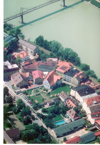
- Aerial view of the fort area
- The new Roman museum on museums in Passau
- Audio guide Roman Museum Boiotro
- Animated film on You Tube: Boiodurum-Batavis-Boiotro
- Models of the fort, the Burgus Haibach and the Severinskloster
Remarks
- ↑ CIL 3, 5755 , Rainer Christlein: 1982, p. 235.
- ^ Rainer Christlein: 1982, p. 230, Günther Moosbauer: 2015, p. 128.
- ↑ Kurt Genser: 1986, p. 32.
- ^ Friesinger / Krinzinger: 1997, p. 145, Rainer Christlein: 1982, p. 218 u. 300, G. Moosbauer: 2015, pp. 129–130.
- ↑ Thomas Fischer: Noricum. Philipp von Zabern, Mainz 2002, ISBN 3-8053-2829-X , p. 135, G. Moosbauer: 2015 p. 129.
- ↑ Friesinger / Krinzinger: 1997, p. 148.
- ^ Vita Severini 22, 1: basilica extra muros oppidi Batavini in loco Boiotro trans Aenum fluvium ; Thomas Fischer: 2002, p. 135; Sebastian Ristow; Findings - Interpretation and Early Christianity. The example of the Severinskirche in Passau . Cologne 2012.
- ^ Rainer Christlein: 1982, p. 232.
- ^ Rainer Christlein: 1982, p. 233.
- ↑ Rainer Christlein: 1981, p. 150; Thomas Fischer: 2002, p. 133.
- ^ Rainer Christlein: 1979, G. Moosbauer: 2015, p. 130.
- ↑ Thomas Fischer: 2008, p. 196.
- ↑ Friesinger / Krinzinger: 1997, p. 146, Moosbauer: 2015, p. 129.
- ↑ Herbert Schindler: 1990, p. 19.
- ^ Rainer Christlein: 1982, p. 232.
- ↑ Rainer Christlein: 1982, p. 230; Friesinger / Krinzinger: 1997, p. 146.
- ↑ Thomas Fischer: 2002, p. 132; Rainer Christlein: 1979, p. 91; Kurt Genser: 1986, p. 22.
- ↑ Endre Tóth : Group C. Fortifications with fan-shaped corner and U-shaped intermediate towers. In: Endre Tóth: The late Roman military architecture in Transdanubia. In: Archaeologiai Értesitő 134, 2009. p. 44.
- ↑ G. Moosbauer: 2015, p. 129, Notitia Dignitatum Occ. XXXIV, 31.
- ↑ CIL 3, 5691 .
- ↑ CIL 3, 5121 . See Kurt Genser: 1986, p. 31, Herbert Schindler: 1990, p. 14 and 21, G. Moosbauer: 2015, p. 129.
- ↑ Rainer Christlein: 1982, p. 233; Walter Sage: 1979, p. 5, G. Moosbauer: 2015, p. 130.
- ↑ Thomas Fischer: Communications from the Friends of Bavarian Pre- and Early History. No. 39, 1986.
Boiotro Castle | Boiodurum Castle | Burgus Passau-Haibach | Burgus Oberranna | Small fort Schlögen | Eferding Castle | Burgus Hirschleitengraben | Lentia Castle | Legion camp Lauriacum | Legion camp Albing | Fort St. Pantaleon-Stein | Wallsee Castle | Locus Felicis | Watchtowers Ybbs | Arelape Castle | Melk Castle | Limestorms in the Wachau | Favianis Castle | Burgus Hollenburg | Traismauer Castle | Zwentendorf Castle | Comagena Castle | Fort Zeiselmauer