
Brenta (mountains)
| Brenta | |
|---|---|
 |
|
 |
|
| Highest peak | Cima Brenta ( 3151.7 m slm ) |
| location | Italy , Trentino |
| Classification according to | AVE : 51 |
| Coordinates | 46 ° 9 ′ N , 10 ° 52 ′ E |
The Brenta is a mountain group of the Southern Limestone Alps , which is located in the Trentino in northern Italy . It is listed in the Alpine Club division of the Eastern Alps as the Brenta Group under No. 51 and is located east of the Adamello Group and north of the Lake Garda mountains . The group is also called the Brenta Dolomites (Dolomiti di Brenta) because they are mainly included in the Dolomites in Italian literature , although they are located west of the Adige Valley .
geology
The formative rock of the Brenta is the extremely hard main dolomite , which can be found in this mountain range in a thickness of up to 1000 meters. During the alpine mountain formation , this sedimentary rock was not arched up like limestone or slate , but broken, which gave the area its rugged character with its vertical towers and massive rock walls. The main dolomite has about 40 to 50 meters thick layers of different dolomite rocks, which form the horizontal or slightly sloping distinctive bands due to different weathering. These belts made the Brenta accessible to tourists in the 19th century thanks to their accessibility.
landscape
Since the melting of the ice dome of the formerly 3173 m slm high Cima Tosa (today 3133.5 m slm ), the highest peak is the Cima Brenta ( 3151.7 m slm ). Another prominent rock tower is the free-standing Campanile Basso ( 2883 m slm , also: Guglia di Brenta ). The valley town of Madonna di Campiglio , the Lago di Molveno (Malfein Lake) and the Tovelsee , which became famous because in the warm summer months up to the 1960s, took on an intense dark red color due to algae , are of tourist interest .
The Brenta is part of the Adamello-Brenta Nature Park and the Dolomites UNESCO World Heritage Site .
Major peaks

(from North to south)
- Pietra Grande , 2936 m
- Cima del Grostè , 2898 m
- Cima falconer , 2988 m
- Cima Sella , 2917 m
- Cima Brenta (until 1918 Kaiser-Franz-Josefs Spitze ), 3152 m
- Torre di Brenta , 3014 m
- Campanile Basso (Guglia di Brenta), 2883 m
- Cima Brenta Alta , 2960 m
- Crozzon di Brenta , 3122 m
- Cima Tosa , 3134 m
- Cima d'Ambiéz , 3102 m
Mountain huts

- Rifugio Peller , 1990 m
- Rifugio Graffer , 2261 m
- Rifugio Tuckett , 2268 m
- Rifugio Brentei , 2120 m
- Rifugio Alimonta , 2580 m
- Rifugio Pedrotti , 2496 m
- Rifugio Agostini , 2410 m
- Rifugio XII Apostoli , 2489 m
- Rifugio Selvata , 1632 m
Via ferratas
The mountain is known as a climbing area . Characteristic are the ledges on which several via ferratas , z. Take the famous Bocchette path (sections of the Sentiero Benini, Sentiero Bochette Alte, Sentiero Bochette Centrali).
- Sentiero Alfredo Benini (from Grosté Pass to Tuckett Pass)
- Sentiero delle Bocchette Alte (from the Bocca di Tuckett to the Bocca degli Armi)
- Sentiero delle Bocchette Centrale (from Bocca degli Armi to Bocca Brenta)
- Via delle Bocchette, Sentiero SOSAT (from the Tuckett hut to the Brentei hut and via the Alimonta hut to the Bocca degli Armi)
- Sentiero Orsi (from the Tuckett hut to the Pedrotti / Tosa hut)
- Sentiero Ettore Castiglioni (from the Agostini Hut to the XII Apostle Hut)
photos

The Tuckett Hut in the Brenta

The Brentei hut in the Brenta, above it Crozzon di Brenta with the Cima Tosa ice channel

Rifugio Alimonta, 2580 m, Brenta
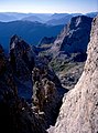
View from the Becco degli Armi (2,749 m) to the southeast

Mountaineering group on the Sentiero delle Bocchette Centrale, in the background the Guglia di Brenta (Campanile Basso)


literature
- Helmut Pietsch: Brenta Group, area guide for hikers and mountaineers. Bergverlag Rudolf Rother, Munich, 1st edition 1987. ISBN 3-7633-3302-9
- Luca Visentini; Brenta group. Hikes and normal routes to the most important peaks. Bozen, Athesia, 1989. ISBN 88-7014-518-2
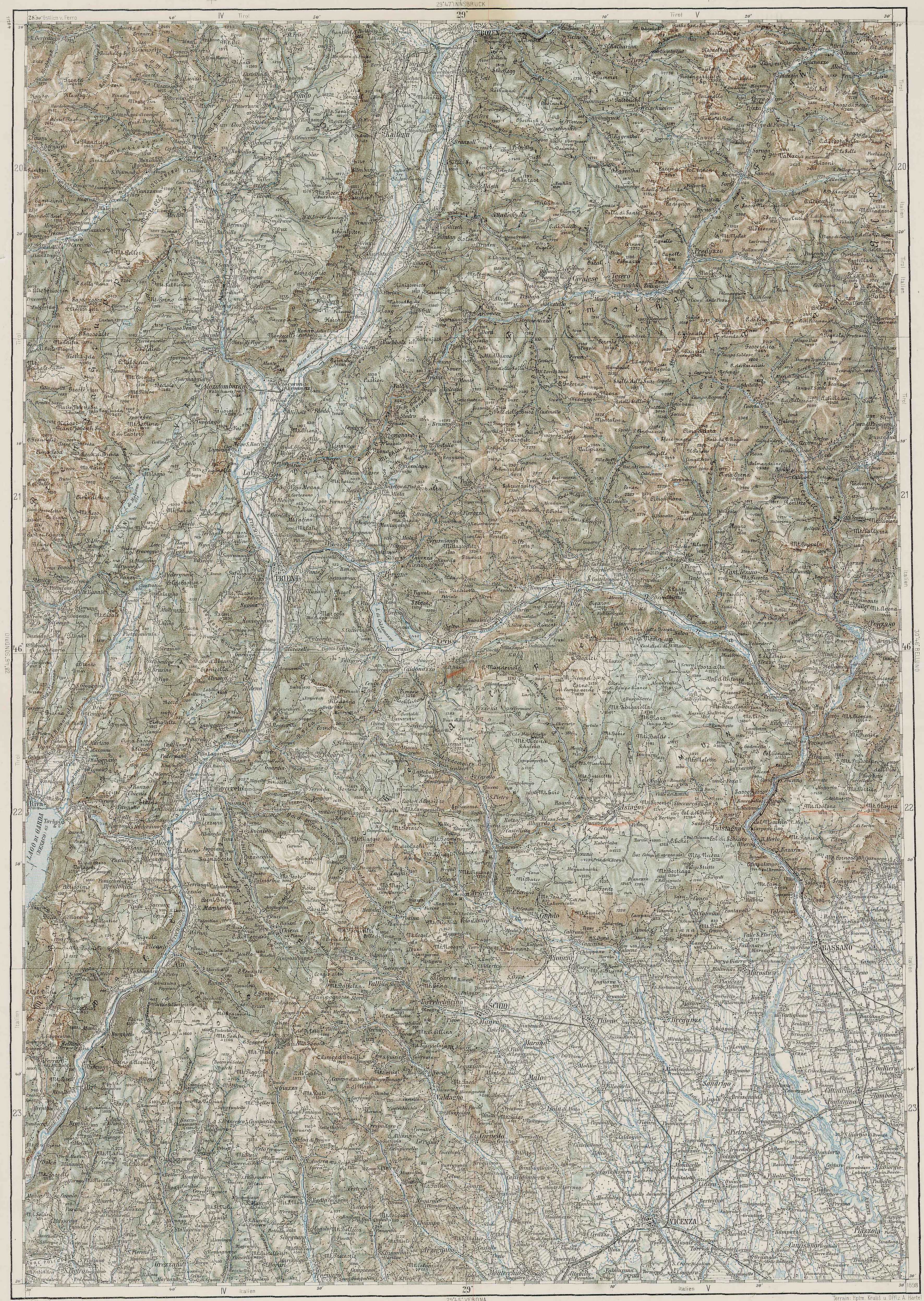
- Various maps on a scale of 1: 25,000, such as the Alpine Club map of the German Alpine Club , sheet 51, Brenta Group . Maps on a scale of 1: 50,000 are not recommended here due to the small size of the area.
Web links
- Website with information on huts, via ferrata, locations, ... (German, Italian)
- Website of the SAT (Soc. Alpina del Trentino) with information on huts, trails, ... (Italian)

