
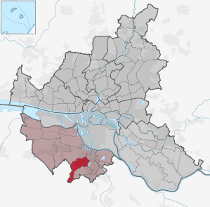
Hamburg-Eißendorf
|
district of Hamburg |
|
|---|---|
  |
|
| Coordinates | 53 ° 27 '21 " N , 9 ° 57' 16" E |
| surface | 8.4 km² |
| Residents | 24,999 (Dec. 31, 2019) |
| Population density | 2976 inhabitants / km² |
| Post Code | 21073, 21075, 21077 |
| prefix | 040 |
| district | Harburg |
| Transport links | |
| Federal road |
|
| Source: Statistical Office for Hamburg and Schleswig-Holstein | |
Eißendorf ( Low German : Eißendbody ) is a district of Hamburg in the Harburg district .
geography
Geographical location

Today, Eißendorf is primarily characterized by Eißendorfer Straße (further on Ehestorfer Weg), which runs from the center of Harburg to the outskirts on a ridge between two valleys. The original town center is located in the south-east of the Göhlbachtal. The northern flank of the Harburg Mountains makes Eißendorf one of the hilly districts of Hamburg.
While Eißendorfer Straße and adjacent streets are densely built - multi-storey apartments towards the center of Harburg, terraced and detached houses towards the outskirts - the Göhlbachtal is completely different: towards the center the valley opens up in the form of a park; there is an allotment garden area and a few free arable land. In the area of the old town center there are still historical buildings, some with half-timbering. Further south there is a dense development with single, row and multi-storey houses.
The southwest Eißendorf is characterized by the state forest Eißendorfer Forst and Eißendorfer Sunder .
Neighboring places
In the northeast, Eißendorf borders the Harburg district with the center of the district. In the east, the Marmstorfer Weg forms the border with Wilstorf along the Harburg city park . In the south and east, Eißendorf is connected to Marmstorf and its districts of Appelbüttel and Lürade by a long border along Heino-Marx-Weg, Bremer Straße and about the A 261 . The state forest borders the state border in the south and south-west. This is where the Lower Saxon community of Rosengarten in the Harburg district joins. In the north and northwest, Denickestrasse, Goldene Wiege and Ehestorfer Weg form roughly the border with the Heimfeld district .
history
Eißendorf was 1332 / 1333 first mentioned. In 1450 the settlement was still called Eytzen-dorpe . This name probably goes back to one of the first settlers of the cluster village and is translated as the village of Eizo . For centuries the place belonged to the parish Sinstorf . In 1811 all the inhabitants of the village were used by the French occupiers under Napoleon to build an army road (Harburg-Bremen-Wesel), the Bremer Chaussee (since 1856 Bremer Straße). In 1813/1814, Eißendorf suffered again from the occupiers and fell victim to multiple fires. In 1892 the New Cemetery was created to replace the overcrowded Old Harburg Cemetery. In 1900 the consequences of industrialization found their way into Eißendorf. Farms were given up, and development on Eißendorfer Strasse began. In 1904 an own parish was founded and in 1906 the Luther Church was consecrated. In 1910, Eißendorf was incorporated from the Harburg district into the city of Harburg / Elbe (urban district) and was now considered an urban expansion area, although the development of large housing estates did not really begin until the 1920s and 1930s, when Harburg became the city of Harburg-Wilhelmsburg .
The Adolf-von-Elm-Hof and the row buildings between Hoppenstedt- and Eißendorfer Straße are evidence of the new building of this time . In 1937 Harburg-Wilhelmsburg, which previously belonged to the Province of Hanover (until 1866 Kingdom of Hanover) in Prussia , is incorporated into the Hanseatic City of Hamburg and loses all independence a year later. Since then, Eißendorf has been part of the Harburg district that was founded after the Second World War.
Population development
- 1885: approx. 800
- 1905: approx. 3000
- 2003: approx. 22,580
statistics
- Minor quota: 16.9% [Hamburg average: 16.3% (2017)].
- Old age quota: 20.5% [Hamburg average: 18.2% (2017)].
- Proportion of foreigners: 17.6% [Hamburg average: 17.1% (2017)].
- Unemployment rate: 5.3% [Hamburg average: 5.2% (2017)].
The average income per taxpayer in Eißendorf is 32,988 euros annually (2013), the Hamburg average is 39,054 euros.
Religions and churches
There are two Evangelical Lutheran churches, the Apostle Church in Hainholzweg and the Luther Church in Straße Am Kirchenhang.
The Catholic Church of St. Vinzenz is located on Lichtenauer Weg , to which a residential complex for the elderly is attached.
politics
For the election to Hamburg citizenship , the eastern areas of Eißendorf belong to the constituency of Harburg . The west of Eißendorf belongs to the Süderelbe constituency . The border runs south across the streets: Weusthoffstraße, Friedhofstraße, Bremer Straße to the state border.
| Citizenship election | SPD | Green | CDU | AfD | left | FDP | Rest |
|---|---|---|---|---|---|---|---|
| 2020 | 42.6% | 18.3% | 13.3% | 8.0% | 7.4% | 4.7% | 5.7% |
| 2015 | 49.0% | 8.5% | 15.1% | 8.6% | 7.8% | 7.1% | 3.9% |
| 2011 | 51.7% | 7.2% | 22.2% | - | 6.3% | 6.0% | 6.6% |
education

In Eißendorf there is the Heisenberg-Gymnasium, the state commercial school with business school (H 10) Harburg, the district school Ehestorfer Weg and the school In der Alten Forst. In addition, the Technical University of Hamburg-Harburg (TUHH) is located on Eißendorfer Strasse and, with its premises in the Harburg district, is directly adjacent to Eißendorf.
Culture and sights
The Hamburger Staatsforst Eißendorfer Forst is a hilly local recreation area whose appeal is clouded by the nearby A 7 . The nearby Eißendorfer town center still has a few historical buildings, some buildings are under monument protection (see list of cultural monuments in Hamburg-Eißendorf ).
Regular events
Once a year there is a bird shooting, which is organized by the Eißendorfer Schützenverein from 1878. It begins on the first weekend in June, Friday evening with a walk through Eißendorf and a subsequent tattoo in the Göhlbachtal. In addition to bird shooting, the Eißendorfer Schützenverein v. 1878 at the bird shooting from Saturday to Monday another village festival with many free performances for the residents of Harburg.
New Harburg cemetery in Eißendorf

The Harburg New Cemetery, also known as Eißendorfer Friedhof, is the largest church-owned cemetery in Northern Germany with 32,000 graves on 32 hectares. Various stories of Harburg's past can be read from the monuments and gravestones of the Harburg main cemetery - located on the eastern slopes of the Göhlbach valley. There are also graves of soldiers of the First World War from the hospitals in Hamburg, of soldiers of the Second World War from the fighting with the advancing British troops, of bomb victims from the civilian population and the forced laborers in Harburg. There are also graves for the victims of National Socialism from Belgium, France, the Netherlands, Italy, Croatia, Latvia, Poland, Romania, Russia, Slovakia, Spain and the Czech Republic, as well as a war cemetery for Polish forced laborers.
See also
- List of streets and squares in Hamburg-Eißendorf
- List of cultural monuments in Hamburg-Eißendorf
- List of stumbling blocks in Hamburg-Eißendorf
Web links
Individual evidence
- ^ Horst Beckershaus: The names of the Hamburg districts. Where do they come from and what they mean , Hamburg 2002, ISBN 3-434-52545-9 , p. 37
- ↑ Quota of minors in the Hamburg districts in 2017
- ↑ Proportion of 65-year-olds and older in the Hamburg districts in 2017
- ↑ Proportion of foreigners in the Hamburg districts in 2017
- ↑ Unemployment rate in the Hamburg districts in 2017
- ↑ Statistical Office for Hamburg and Schleswig-Holstein (ed.): Hamburg District Profile 2016 (= NORD.regional . Volume 19 ). 2018, ISSN 1863-9518 ( Online PDF 6.6 MB [accessed February 12, 2018]).
- ^ Result of the eastern part at www.wahlen-hamburg.de .
- ^ Result of the western part at www.wahlen-hamburg.de .
- ↑ http://www.habenverband-harburg.de/friedhof/pdf/Herzig_Willkommen-ein_Ueberblick.pdf
- ^ War graves in the New Harburg Cemetery at volksbund.de> Germany> Harburg
Altenwerder | Cranz | Eißendorf | Francop | Well moor | Harburg | House break | Heimfeld | Langenbek | Marble peat | Moorburg | Neuenfelde | Neugraben-Fischbek | New territory | Rönneburg | Sinstorf | Wilstorf