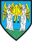
Gmina Barczewo
| Gmina Barczewo | ||
|---|---|---|

|
|
|
| Basic data | ||
| State : | Poland | |
| Voivodeship : | Warmia-Masuria | |
| Powiat : | Olsztyński | |
| Geographic location : | 53 ° 50 ' N , 20 ° 42' E | |
| Height : | 139 m npm | |
| Residents : | s. Gmina | |
| Postal code : | 11-010 | |
| Telephone code : | (+48) 89 | |
| License plate : | NOL | |
| Economy and Transport | ||
| Street : | DK16 Iława - Olsztyn - Ełk | |
| DW595 Barczewo– Jeziorany | ||
| Rail route : | Olsztyn – Korsze | |
| Next international airport : | Danzig | |
| Gmina | ||
| Gminatype: | Urban-and-rural parish | |
| Gmina structure: | 32 school offices | |
| Surface: | 319.85 km² | |
| Residents: | 17,994 (Jun. 30, 2019) |
|
| Population density : | 56 inhabitants / km² | |
| Community number ( GUS ): | 2814013 | |
| Administration (as of 2018) | ||
| Mayor : | Andrzej Maciejewski | |
| Address: | pl. Ratuszowy 1 11-010 Barczewo |
|
| Website : | www.barczewo.pl | |
The Gmina Barczewo [ barˈʧɛvɔ ] is a town-and-country municipality in the Olsztyński powiat in the Warmian-Masurian Voivodeship in Poland . Its seat is the city of the same name ( German Wartenburg in East Prussia ) with about 7500 inhabitants.
geography
The municipality is located in the middle of the voivodeship and borders in the southwest on the capital Olsztyn (Allenstein) . The other neighboring municipalities are Dywity in the west, Jeziorany in the north, Biskupiec in the east, Dźwierzuty in the southeast and Purda in the south.
The community has an area of almost 320 km², 52 percent of which is used for agriculture and 31 percent for forestry. Your area belongs to the Masurian Lake District . There are numerous lakes. The largest are Wadąg (494 hectares , Wadangsee ) and Pisz (220 hectares, Kleiner Wadangsee / Pissasee ). The Pisa Warmińska (Pissa) connects both lakes.
history
The rural community was newly formed in 1973 from various gromadas . Urban and rural communities were merged to form urban and rural communities in 1990/1991. From 1946 to 1998, its area belonged to the Olsztyn Voivodeship in various ways. The powiat was disbanded from 1975 to 1998. On January 1, 1999, the community came to the Warmia-Masurian Voivodeship and again to the Powiat Olsztyński.
The community has entered into a partnership with the Lower Saxony community of Hagen am Teutoburg Forest .
structure
The town and country municipality of Barczewo includes the town with three settlements and 32 villages (German names, official until 1945) with a Schulzenamt (sołectwo):
Barczewo , settlements:
- Nowe Miasto (New Town)
- Stare Miasto (old town)
- Domki Jednorodzinne (single-family houses)
Villages and school authorities:
- Barczewko (Alt Wartenburg)
- Bark (Barkeim)
- Bartołty Wielkie (Groß Bartelsdorf)
- Biedowo ( New Maraunen , 1928–1945 Maraunen)
- Bogdany (Bogdainen)
- Jedzbark (Hirschberg)
- Kaplityny (Kaplitainen)
- Kierzliny (Kirschlainen)
- Kromerowo (Kraemersdorf)
- Kronowo ( Groß Cronau , 1929–1945 Cronau)
- Lamkowo (Groß Lemkendorf)
- Łapka (Lapka compensation)
- Łęgajny (Lengainen)
- Leszno ( Groß Leschno , 1938–1945 Leschnau)
- Maruny (Great Maraunen)
- Mokiny (mocaine)
- Niedźwiedź (Bear Break)
- Nikielkowo (Nickelsdorf)
- Odryty (Odritten)
- Radosty (Ottendorf)
- Ramsówko ( Groß Ramsau , 1928–1945 Ramsau)
- Ramsowo (Klein Ramsau)
- Ruszajny (Reuschhagen)
- Skajboty (Skaibots)
- Stare Włóki (Alt Vierzighuben)
- Szynowo (Schönau)
- Tumiany (thumb)
- Wipsowo (Wieps)
- Wójtowo (Fittigsdorf)
- Wrócikowo (Robertshof)
- Zalesie ( Vorwerkswalde , 1938–1945 Waldhausen)
Smaller places are:
- Barczewski Dwór (Klein Wartenburg)
- Bartołty Małe (Klein Bartelsdorf)
- Czerwony Bór (Rothwalde)
- Dąbrówka Mała (Klein Damerau)
- Dadaj (Schönfließ)
- Dobrąg (Debrong)
- Gaj (Gayhof)
- Kierzbuń (cherry tree)
- Klimkowo ( Klimkowo , 1938–1945 Klimkau)
- Klucznik ( Klutznik , 1938–1945 Klausen)
- Kołaki (collapse)
- Koronowo
- Kronówko (Klein Cronau)
- Krupoliny (Kroplainen)
- Lamkówko (Klein Lemkendorf)
- Leszno Małe ( Klein Leschno , 1938–1945 Leschnau Forestry )
- Orzechówko
- Próle (Prohlen)
- Rejczuchy (Karolinenhof)
- Rycybałt (Rittebalde)
- Sapunki (small sapuhnen)
- Sapuny (Sapuhnen)
- Studzianek (Kutzborn)
- Tęguty (Tengutten)
- Żarek (Neurode)
traffic
The state road DK16 , which leads from Grudziądz (Graudenz) via Olsztyn (Allenstein) to the border with Lithuania , runs through the municipality and its main town . From it branches off the voivodship road DW595 to Jeziorany (Seeburg) in Barczewo .
Railway stations on the Olsztyn – Korsze are Łęgajny, Barczewo and Wipsowo.
The nearest major international airport is Gdansk .
Personalities
- Hermann Kickton (1847–1915), civil engineer; born in Lengainen
- Ulrich Fox (1937–2012), local history researcher - Federal Cross of Merit; born in Alt Wartenburg.
Web links
- City and municipality website (Polish)
Footnotes
- ↑ population. Size and Structure by Territorial Division. As of June 30, 2019. Główny Urząd Statystyczny (GUS) (PDF files; 0.99 MiB), accessed December 24, 2019 .
- ↑ Partner communities of the community of Hagen am Teutoburg Forest (accessed on May 2, 2019)
- ↑ The Historical Place Directory.
- ↑ barczewo.bip.net.pl: Wykaz Sołtysów i Przewodniczących Rad Osiedlowych. (Polish, accessed August 20, 2020)


