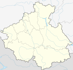
Gorno-Altaysk
| city
Gorno
-Altaysk Горно-Алтайск Туулу Алтай
|
||||||||||||||||||||||||||||||||||||||||||
|
||||||||||||||||||||||||||||||||||||||||||
|
||||||||||||||||||||||||||||||||||||||||||
| List of cities in Russia | ||||||||||||||||||||||||||||||||||||||||||
Gorno-Altaisk ( Russian Горно-Алтайск , Altaic Туулу Алтай) is the capital of the Autonomous Republic of Altai in the Asian part of Russia . The city has 56,933 inhabitants (as of October 14, 2010).
geography
The city is located in southern Western Siberia on the edge of the Altai Mountains, about 200 kilometers southeast of the city of Barnaul . This is about half the distance between the Siberian metropolis Novosibirsk and the border with Mongolia . It extends in the valley of the Maima , a right tributary of the Katun not far from the mouth. The region's climate is continental.
Gorno-Altaysk is the only city in the Altai Republic; about a quarter of the inhabitants of the sparsely populated republic live here. The city is surrounded by the territory of the Maima Rajon , but forms a separate, rajon-free urban district .
The city has no railway connection to connect to, 100 km away Bijsk however, is in the project stage (2007). A few kilometers to the northwest, near the Maima settlement , which has practically grown together with Gorno-Altaisk , is the Gorno-Altaisk airport , which is used for national connections . The R256 trunk road (the Chuja tract ), which connects Siberia with the high mountain range of the Altai and western Mongolia , also runs through Maima .
history
Around 1830 there was a small Altai settlement in the place of today's Gorno-Altaisk, at the confluence of the Ulala stream (today in the Russian form Ulaluschka ) with the Maima . With the influx of Russian resettlers in the course of the 19th century, the important village of the same name Ulala emerged .
In 1922 Ulala became the administrative center of the Oirot Autonomous Oblast (Oiroten - outdated designation of the Altai people) and in 1928 received city rights. In 1932 the city was renamed Oirot-Tura ( Altaic city of the Oiroten ). In 1948, as part of the “renaming” of the Oiroten to “Altaier”, the city was renamed to its current name (Russian for Berg-Altai (city) ; at the same time the autonomous region became the Autonomous Oblast Berg-Altai or Gorno-Altaisker Autonomous Oblast , Горно-Алтайская автономная область, renamed).
Population development
| year | Residents |
|---|---|
| 1926 | 5,691 |
| 1939 | 24,045 |
| 1959 | 27,534 |
| 1970 | 34,413 |
| 1979 | 40,296 |
| 1989 | 46,436 |
| 2002 | 53,538 |
| 2010 | 56,933 |
Note: census data
Culture, education and sights
In Gorno-Altaysk is the Gorno-Altaysk State University (Горно-Алтайский государственный университет), which was founded in 1993 from a pedagogical institute founded in 1949 and is currently attended by 5,500 students. Among other things, the university has a research institute for history, Altay language and literature (НИИ истории, алтайского языка и литературы).
Gorno-Altaisk has a theater and the Republican Museum of Local History, founded in 1918 and named today after the ethnographer , musicologist and composer Andrei Anochin (1867–1931).
economy
In addition to smaller mechanical and electrical appliance manufacturing companies, Gorno-Altaisk only has light and food industries. The city is primarily the commercial, administrative and cultural center of the republic.
It is one of the cities with the least ecological problems in Siberia and is, not least, the center of the Altai's tourist development.
sons and daughters of the town
- Evdokija Mekschilo (1931–2013), cross-country skier
- Sergei Voronin (1946–1997), Russian number theorist
- Alexander Berdnikow (* 1953), Russian politician and President of the Altai Republic from 2006 to 2019
- Sergej Mikajeljan (* 1992), Armenian cross-country skier
Individual evidence
- ↑ a b Itogi Vserossijskoj perepisi naselenija 2010 goda. Tom 1. Čislennostʹ i razmeščenie naselenija (Results of the All-Russian Census 2010. Volume 1. Number and distribution of the population). Tables 5 , pp. 12-209; 11 , pp. 312–979 (download from the website of the Federal Service for State Statistics of the Russian Federation)
Web links
- City administration website (Russian)
- Gorno-Altaisk on mojgorod.ru (Russian)
- Website of the Gorno Altaysk University (English, German, Russian)


