Hajdina
|
Hajdina Haidin |
|||
|
|||
| Basic data | |||
|---|---|---|---|
| Country |
|
||
| Historic region | Lower Styria / Štajerska | ||
| Statistical region | Podravska (Drau region) | ||
| Coordinates | 46 ° 25 ' N , 15 ° 51' E | ||
| surface | 21.6 km² | ||
| Residents | 3,747 (January 1, 2017) | ||
| Population density | 173 inhabitants per km² | ||
| Post Code | 2288 | ||
| License Plate | MB | ||
| Structure and administration | |||
| structure | local community | ||
| Mayor : | Stanislav Glažar | ||
| Mailing address | Zgornja Hajdina 44a 2288 Hajdina |
||
| Website | |||
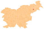
Hajdina ( German : Haidin ) is a municipality in northeastern Slovenia . It is located in the historical Spodnja Štajerska ( Lower Styria ) region and in the statistical region of Podravska .
geography
location
Hajdina borders Ptuj to the southwest and lies on the right side of the Drava . The community is located in the flat Dravsko polje ( Draufeld ) at 232 m. ü. A. Apart from the Drava and the canal of the Zlatoličje hydroelectric power station ( Slov .: Prekop HE Zlatoličje ) there are no significant bodies of water.
Community structure
The municipality comprises seven localities. The German exonyms in brackets were mainly used by the German-speaking population until the area was ceded to the Kingdom of Serbs, Croats and Slovenes in 1918 and are largely uncommon today. (Population figures as of January 1, 2017):
|
|
Neighboring communities
| Starše | Ptuj | Ptuj |
| Kidričevo |

|
Ptuj |
| Videm | Videm | Ptuj |
history
In Hajdina was one of the first Mithras - places of worship discovered (2nd century). Besides Roman archaeological sites (the old Poetovio was in Hajdina ), the parish church of St. Martin with one of the earliest star rib vaults in Slovenia is worth seeing .
traffic
Hajdina is on the railway line from Pragersko to Ormož . The "Hajdina" train stop is located in the municipality of Ptuj , but can be reached quickly from the main town. The nearest intercity train station is "Ptuj", about 4 km away.
In addition, the A4 motorway runs through the municipality. The villages in the northern area are accessed via the "Zlatoličje" junction, while "Hajdina" is more centrally located.

