
Administrative community loop
| coat of arms | Germany map | |
|---|---|---|

|
Coordinates: 51 ° 32 ' N , 14 ° 32' E |
|
| Basic data | ||
| Existing period: | 1999– | |
| State : | Saxony | |
| Administrative region : | Dresden | |
| County : | Goerlitz | |
| Area : | 89.11 km 2 | |
| Residents: | 4323 (Dec. 31, 2019) | |
| Population density : | 49 inhabitants per km 2 | |
| License plate : | GR, LÖB, NOL, NY, WSW, ZI | |
| Association key : | 14 6 26 5237 | |
| Association structure: | 3 municipalities | |
| Association administration address : |
Friedensstrasse 83 02959 loop |
|
| Website : | ||
| Administrative Chairman: | Reinhard Bork | |
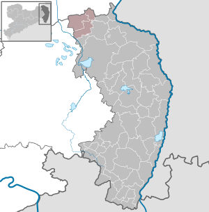
| Location of the administrative community in the Görlitz district | ||
  |
||

The administrative community loop , Upper Sorbian Zarjadniski zwjazk Slepo , is a Saxon administrative community in the northeast of the district of Görlitz on the border with the state of Brandenburg . Its seat is in the municipality of Runde . The administrative community is the political and geographical delimitation of the Schleifer region , which, depending on the interpretation, is also equated with the parish Runde .
Member municipalities
The seven villages of the administrative community are historically closely linked. In some of them the Schleifer dialect of the Sorbian language is spoken and the Schleifer costume is worn. Furthermore, they belonged to the " District Muskau III" formed in 1874 , which was reduced to these seven rural communities (and four manor districts) by 1908 and was renamed in 1933 to "District Loop". Through incorporations between 1995 and 1999, the number of municipalities was reduced from seven to three.
The administrative community was founded on July 7, 1995 by six municipalities. Trebendorf joined her on November 16, 1996. It has existed in its current form since January 1, 1999.
| German place name | Sorbian place name | local community | Residents | Area in km² |
|---|---|---|---|---|
| Big Düben | Dźěwin | Big Düben | 564 | 8.28 |
| Halbendorf | Brězowka | Big Düben | 508 | 6.28 |
| Mulkwitz | Mułkecy (Mułkoce) | loop | 202 | 7.36 |
| Mill rose | Miłoraz | Trebendorf | 188 | 19.74 |
| Raw | Rowno (rowne) | loop | 413 | 19.71 |
| loop | Slepo (Slěpe) | loop | 1806 | 14.80 |
| Trebendorf | Trjebin | Trebendorf | 661 | 12.21 |
Remarks:
- Place names in brackets are names in Schleifer dialect that differ from Upper Sorbian.
- The population figures of the individual villages come from the registry office loop (as of December 31, 2019) and, due to different calculation rules, show a total deviation from the population figures of the municipalities published by the state statistical office of the Free State of Saxony.
Parish loop
.jpg)
The parish (also parish ) is made up of the seven villages of the administrative community and the Brandenburg and Lower Lusatian village of Lieskau . Until 1914, the Mühlroser village part of Ruhlmühle and the part of Neustadt on the right side of the Spree belonged to the Schleifer parish. Afterwards these places were parish after Spreewitz .
geography
The administrative community is located in the city triangle Hoyerswerda - Spremberg - Weißwasser . Your area is characterized by an extensive lake and forest landscape. The Struga flows in a north-westerly direction through Trebendorf, Loop, Rohne and Mulkwitz towards the Spree . The Spree cuts the area on its way north in the Ruhlmühle part of the village of Mühlrose.
traffic
Of the railway lines that once ran through the administrative area, only the Berlin – Görlitz railway line with Schleifer Bahnhof is still relevant for traffic. The train station in Halbendorf on the former Weißwasser – Forst railway line has been abandoned, the rails have been dismantled. The small railway line of the Muskau forest railway from Weißwasser to the clay pit in the zoo (between Mühlrose and Trebendorf) is not approved for public transport and will be dismantled in the first half of this decade in favor of the Nochten opencast mine .
Bundesstrasse 156 touches the administrative area between Spremberg and Weißwasser . The municipal administrations rejected the draft route of the planned B 160 through the administrative area, as this - in addition to the approaching opencast mine - would cut too much into the settlement area. During the celebrations for the Trebendorf contract between the municipality of Trebendorf and Vattenfall Europe Mining AG, the Saxon Prime Minister Stanislaw Tillich announced that it would not pursue this northern route plan in September 2008.
Open pit
The communities are located in the Lusatian lignite district . As early as the middle of the nineteenth century, lignite was occasionally mined underground; on a larger scale, mining only began in the middle of the twentieth century, when brown coal was mined in several pits in the Trebendorfer Felder open-cast mine . The Halbendorfer See , where the borders of the three communities meet, emerged from its largest remaining hole .
The first relocation was the first partial relocation of Mühlrose in 1966/1967, when the Neustadt expansion had to give way to the Nochten open-cast mine . After a decade-long southward movement and a subsequent bend, the Nochten opencast mine will reach Trebendorf around 2020 and Rohne and Mühlrose in the following years. In Trebendorf, the Hinterberg part of the village had to be completely relocated, for Klein Trebendorf the mining use had already been approved, but the opencast mine will now be moved past the settlement. In Rohne, the Schäferstrasse, a little south of the village center, and the farms on Mühlroser Weg are affected; in Mühlrose, the extensions along the Strasse Am Damm (Mühlrose loop) have to give way to open-cast mining. In addition, a large part of the zoo, in which the Muskau Counts ' hunting lodge stood until 1973, is being excavated . The Mühlroser town center lies on a fault zone that prevents dismantling there with the existing F60 conveyor bridge . However, since the place would lie like an island in an open-cast mining landscape with only one access road for decades, the majority of the residents have requested resettlement as a village community. The new location is in a loop between Lieskuer Straße and Groß Dübener Weg.
The use of the priority areas of the opencast mine still applied for and approved by Vattenfall would be completely relocated to the loop west of the railway line as well as Mulkwitz and Rohne and the opencast mine would be directed towards the Brandenburg towns of Lieskau and Graustein . After the sale of Vattenfall's lignite division, Lausitz Energie Bergbau AG, as the new operator, canceled the use of the approved priority areas; only the Mühlrose sub-field is to be dismantled with adapted technology at the end of the open-cast mine after the resettlement of the population.
literature
- Matthias Mack: A new spiritual departure. The Sorbian Brethren in Upper Lusatia . Self-published, 2015.