Lüttringhausen West
|
Lüttringhausen West district of Remscheid |
|
|---|---|
| Coordinates | 51 ° 13 '19 " N , 7 ° 13' 45" E |
| height | 279 m |
| surface | 4.85 km² |
| Residents | 1379 (December 31, 2015) |
| Population density | 284 inhabitants / km² |
| Post Code | 42899 |
| prefix | 02191 |
| Borough | Luettringhausen |
| Transport links | |
| bus | 670 680 NE16 AST BB |
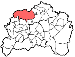
Lüttringhausen West is a statistical district of the Bergisch city of Remscheid in the district of Lüttringhausen . The sparsely populated district in the northwest of Remscheid and on the border with Wuppertal-Ronsdorf combines numerous farms and smaller villages. These include Westen , Oelingrath , Grund , Halbach , Spelsberg , Farrenbracken , Flügel , Birgden III , Spelsberger Hammer , Langenhaus , Heusiepen , Grüne , Desert , Clemenshammer and Stollen .

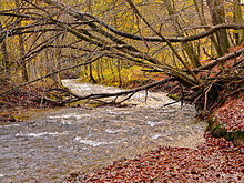
In Lüttringhausen West there are numerous nature and landscape protection areas, such as the Gelpe and Saalbach valleys , which border on Wuppertal , the Westener and Platzer Siefen, the Oelingrather Bach and Grunder and Farrenbracker Bachtal. The aspects of nature and environmental protection are discussed in the local nature school Grund.
The district is only moderately connected to local public transport. On weekdays the city bus 680 runs several times a day, which connects the court with the Remscheid district of Hasten . The towns of Birgden III , Stollen and Halbach to the east are served by the regular city bus line 670, the latter also by the NE16 night express. There are also two lines of the collective call taxi and a citizen bus that runs several times a day, which u. a. drives to the center of Lüttringhausen .

