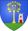
Le Rouret
| Le Rouret | ||
|---|---|---|

|
|
|
| region | Provence-Alpes-Cote d'Azur | |
| Department | Alpes-Maritimes | |
| Arrondissement | Grasse | |
| Canton | Valbonne | |
| Community association | Sophia Antipolis | |
| Coordinates | 43 ° 40 ′ N , 7 ° 0 ′ E | |
| height | 178-480 m | |
| surface | 7.10 km 2 | |
| Residents | 3,999 (January 1, 2017) | |
| Population density | 563 inhabitants / km 2 | |
| Post Code | 06650 | |
| INSEE code | 06112 | |
| Website | www.mairie-lerouret.fr | |
 Center of Le Rouret |
||
Le Rouret is a municipality between Nice and Cannes in southeast France in the Alpes-Maritimes (06) department of the Provence-Alpes-Côte d'Azur region with 3999 inhabitants (as of January 1, 2017). A well-preserved Roman road runs on the outskirts between forest and fields, where the ruins of a stone building can be found. It was extensively renovated by the city in 2006.
The Clamarquier dolmen is on the Chemin des Combes.
The community is a member of the Sophia Antipolis community association .
Population development
| year | 1962 | 1968 | 1975 | 1982 | 1990 | 1999 | 2006 | 2017 |
| Residents | 823 | 1208 | 1664 | 2315 | 2927 | 3428 | 3763 | 3999 |
| Sources: Cassini and INSEE | ||||||||
Attractions
See: List of Monuments historiques in Le Rouret
Personalities
- Richard Wright (1943–2008), the pianist for the British rock band Pink Floyd , lived in a mansion in the city.
literature
- Le Patrimoine des Communes des Alpes-Maritimes . Flohic Editions, Volume 1, Paris 2000, ISBN 2-84234-071-X , pp. 111-112.
Web links
Commons : Le Rouret - collection of images, videos and audio files
