Lenart
|
Lenart Sankt Leonhard in Windischbüheln |
|||
|
|||
| Basic data | |||
|---|---|---|---|
| Country |
|
||
| Historic region | Lower Styria / Štajerska | ||
| Statistical region | Podravska (Drau region) | ||
| Coordinates | 46 ° 35 ' N , 15 ° 50' E | ||
| surface | 62.1 km² | ||
| Residents | 8,251 (January 1, 2017) | ||
| Population density | 133 inhabitants per km² | ||
| Telephone code | (+386) 2 | ||
| Post Code | 2230 | ||
| License Plate | MB | ||
| Structure and administration | |||
| Mayor : | Janez Kramberger | ||
| Mailing address | Trg osvoboditve 7 2230 Lenart |
||
| Website | |||
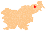
Lenart v Slovenskih goricah ( German : Sankt Leonhard in Windischbüheln ) is a small town and municipality in northeastern Slovenia . It is located in the historical Spodnja Štajerska ( Lower Styria ) region and in the statistical region of Podravska .
geography
location
The municipality of Lenart lies in the middle of the Slovenske gorice ( Windische Bühel ) and is traversed from west to east by the Pesnica ( Pößnitz ), a tributary of the Drava . The main town Lenart v Slovenskih goricah is located at about 260 m. ü. A. in the valley of said river.
The next larger city is Maribor approx. 14 km west of the main town, with which it is connected via the A5 motorway .
Community structure
The municipality comprises 22 localities. The German exonyms in brackets date from the middle of the 19th century and are no longer used today. (Population figures as of January 1, 2017):
|
|
Neighboring communities
| Sveti Jurij | Sveta Ana | Benedict |
| Pesnica , Maribor |

|
Sveta Trojica |
| Duplek | Ptuj , Destrnik | Trnovska vas |
sons and daughters of the town
- Franc Kramberger (born October 7, 1936), former Archbishop of Maribor
Web links
- Lenart municipality website
- Map of the municipality of Lenart
- Lenart on 24cities.eu, Competence Center Steirisches Thermenland -Oststeiermark
Individual evidence
- ^ General state law and government gazette for the Crown Land of Styria. 1850 (supplement Marburg district)
- ↑ Statistical Office of the Republic of Slovenia ( English )


