List of streets in Altenkirchen (Westerwald)
The list of streets in Altenkirchen (Westerwald) lists all street names in the Rhineland-Palatinate district town of Altenkirchen (Westerwald) and the districts of Bergenhausen, Dieperzen , Leuzbach and Honneroth. In the street directory there are 118 streets in Altenkirchen (Westerwald).
introduction
The street names used in the city of Altenkirchen (Westerwald) are relatively young. Up until the 18th century the terms “street”, “square” and “avenue” did not appear at all. An inner-city street was called "Gaß", later "Gasse". The basic word “-straße” appears for the first time (apart from the connecting roads to Frankfurt am Main , Koblenz , Cologne or Siegen ) with the centrally located Wilhelmstraße ; this was also the first street name honoring a person. Ultimately, however, it was not until the end of the 19th century that streets were named after people, such as “Blücherplatz”, named after Gebhard Leberecht von Blücher , at the northern end of Wilhelmstrasse and Schloßplatz .
After the town fire of 1893, the municipal council decided to name all streets; they had previously remained anonymous or the common parlance had found the collective term "dirt alley". Some had popular names such as "Vordergasse" (today Wilhelmstrasse ) or "Hintergasse" (today Marktstrasse ).
During the Weimar Republic, field marshals August von Mackensen ("Mackensenstrasse", since 1951 again Frankfurter Strasse ) or Paul von Hindenburg ("Hindenburgstrasse", today again Rathausstrasse ) were used as namesake . The National Socialists erased street names that they did not like; so the lower section of Kumpstrasse became Adolf-Hitler-Strasse and Im Hähnchen became Hermann-Göring-Strasse .
In the post-war period , social reformers such as Theodor Fliedner or Friedrich Wilhelm Raiffeisen were upgraded with street names. Names of the post-war period had cultural ( Von-Kleist-Straße ) or political ( Konrad-Adenauer-Platz ) backgrounds, but were in many cases mostly harmless and were reminiscent of plants, rivers , field names or districts . Since 1947, following a recommendation by the City Council , “street name fields” have been used in new development areas, as was used in Leuzbach or Honneroth. There are fields of street names with trees (since the 1970s in the new development area of the Leuzbach district) and writers since the 1970 / 80s in the Honneroth district.
Some of the local street names are related to local or regional people or issues; mostly with the use of historical district names. The local personality Friedrich Emmerich was honored, as well as the Count of Sayn and the other historical surroundings in connection with Altenkirchen.
Overview of the streets and squares of the city of Altenkirchen (Westerwald)
The following table gives an overview of the existing or historical streets and squares of Altenkirchen as well as some related information. In detail these are:
- Name / geoposition : current name of the street or square. Via the link 'Location' (geoposition determined with MyGeoPosition.com ) the street or the place can be displayed on various map services. The geoposition indicates approximately the middle.
- Former or no longer valid street names are in italics in this column . Temporary names from the Nazi era are usually mentioned.
- Length / dimensions in meters: The length data contained in the overview are overview values rounded up or down according to mathematical rules, which were determined in the BayernAtlas using the local scale. They are more for comparison purposes and, if official values are known, are exchanged and marked separately.
- For squares, the dimensions are shown in the form a × b for rectangular systems, a × b × c for triangular systems with a as the longest edge and the diameter for circular systems.
- Name origin : origin or reference of the name.
- Location : Indication of the start and end point for streets or important roads leading to it from squares.
- Notes : Further information on nearby institutions, the history of the street, historical names, monuments, etc.
- Image : Photo of the street / square or an adjacent object.
| Name / geoposition | Length / dimensions (in meters) |
Origin of name | location | Remarks | image |
|---|---|---|---|---|---|
|
Ahornweg ( Location ) |
100 | From Leuzbacher Weg to Kiefernweg . | The street is in the Leuzbach district . | ||
| Almersbacher Strasse ( Location ) |
100 | The name refers to the connection to the neighboring town of Almersbach (footpath) | From Wiedstrasse to Raiffeisenstrasse . | The street is on the southern edge of the Leuzbach district. It crosses the Altenkirchen-Neuwied railway line. | |
| At the thorn ( Location ) |
347 | Reference to the “Dorn” ridge in the south of the city. | From Heuweg to Frankfurter Straße (footpath). | The street named in 1930 is located on the southern edge of the city to Wiesental along the Limburg – Altenkirchen railway line and is a dead end on both sides. |

|
| At the Kumphof ( Location ) |
approx. 50 | Reference to historical development | From Kumpstrasse . | The street, named in 2002, is located on the northern edge of the city. | |
| On the Altdriesch ( Location ) |
about 100 | Field name | Turning off the elevated road. | The street, named in 1968, is located on the northeastern edge of the city near the cemetery. It leads to the equestrian facility, | |
| On the acorn ( Location ) |
500 | Field name | Branching off from the Leuzbacher Weg . | The street is in the Leuzbach district. | |
| On the frame ( Location ) |
150 | Field name | Branch off from Auf dem Steinchen . | The street, named in 1957, is located on the northern edge of the city. It's a dead end. | |
| On the stone ( Location ) |
300 | Field name | From Kumpstraße to Lohmühlenweg . | The street, named in 1957, is located on the northern edge of the city near the bypass. | |
| August-Horch-Strasse ( Location ) |
180 | August Horch , German mechanical engineer and founder of the automotive companies Horch and Audi. | From Kölner Strasse . | The street is in the industrial area on the western edge of the city. It's a dead end. | |
| Bachstrasse ( Location ) |
about 100 | Reference to the Quengelbach, which the Bachstraße crosses. | From Kumpstraße to Schützenstraße | The narrow street, named in 1931, crosses the Altenkirchen-Au / (Sieg) railway line and crosses the Dammweg . |

|
| Bahnhofstrasse ( Location ) |
207 | Street to Altenkirchen train station. | From Koblenzer Straße to Konrad-Adenauer-Platz . | The street is on the southern edge of the city and connects the city center with the train station. It is one of the central shopping streets in the city. The eponymous station building (Bahnhofstrasse 1), built in 1883/84, is a cultural monument of the city, as is the post office building opposite ( Bahnhofstrasse 28, Friedrich-Emmerich-Strasse 6 ) from 1920. |

|
| Mountain road ( Location ) |
477 | The road leads over the Dorn mountain range in the south of the city. | From Koblenzer Straße to Straße Zum Johannistal . | The area was built on in the 1920s. The street, named in 1931, is located on the southern edge of the city by the city forest. | |
| Birch path ( Location ) |
150 | Branching off from Leuzbacher Weg . | The street named in 1970 is in the Leuzbach district. It's a dead end. | ||
| Bleaching path ( Location ) |
53 | Reference to the former bleaching meadow in the Wiedtal. | Branch off from Wilhelmstrasse . | The small street, named in 1931, lies on the edge of the city center and crosses the Altenkirchen-Limburg railway line. It serves largely as a parking lot |

|
|
Blücherplatz ( Location ) |
Gebhard Leberecht von Blücher , Prussian Field Marshal General, who moved into his headquarters in Herr von Avemann's house on November 11, 1813. | From Wilhelmstrasse to Rathausstrasse . | The Blücherplatz, named in 1927, is located at the upper end of the inner city pedestrian zone and has not been recognizable as a square since the redesign and development of the Schlossplatz in the 1990s and 2000s ; it only remained as a postal address; In 1996 the name was changed to Schloßplatz . | ||
| Buchenweg ( Location ) |
approx. 200 | Branching off from Leuzbacher Weg . | The street named in 1970 is in the Leuzbach district. It's a dead end. | ||
| Büchnerstrasse ( Location ) |
about 1000 | Georg Büchner , German playwright | From Mörickestrasse . | The street named in 1982 is located in the Honneroth district . It was built as a circular road in the 1980s. | |
| Causeway ( Location ) |
566 | Relation to the embankment of the Altenkirchen-Au am Quengelbach railway line. | From Quengelstraße to Schützenstraße . | The street, named in 1951, is located near the city center on Parc de Tarbes. |

|
| Dieperzbergweg ( Location ) |
about 500 | The name refers to the Dieperzberg in the north of the city. | From Siegenerstraße to Parc de Tarbes . | The street, named in 1931, is located on the northern edge of the city, crosses the Dammweg and continues at its end in a field and hiking trail. |

|
| Village street ( Location ) |
706 | The only street in the district of Dieperzen . | From Heinestraße (Honneroth) and to Kreisstraße 39 | The county road, named Dieperzen Dorfstraße in 1970 , leads through the hamlet on the northern edge of the city and continues at its northern end into the Kobersteiner Weg to Koberstein and Obererbach. | |
| Driesscheider way ( Location ) |
887 | ? | From Kumpstraße to Helmenzen . | The street, named in 1927, is located on the western edge of the city. It passes under the bypass road Bundesstrasse 414 . |

|
| Eichendorffstrasse ( Location ) |
approx. 200 | Joseph von Eichendorff , German poet | From Lessingstrasse . | The street named in 1977 is in the Honneroth district . It was created in the 1970s. | |
| Erlenweg ( Location ) |
about 100 | Branching off from Leuzbacher Weg . | The street named in 1974 is in the Leuzbach district near the hospital. It's a dead end. | ||
| Feldstrasse ( Location ) |
approx. 75 | Relation to early agricultural use | From Siegener Strasse . | The street, named in 1951, is located on the northern edge of the city near the school center. It's a dead end. | |
| Finkenweg ( Location ) |
approx. 200 | From Auf dem Steinchen to Kumpstrasse . | The street, named in 1957, is located in the northwest of the city. | ||
| Fontanestrasse ( Location ) |
about 400 | Theodor Fontane , German writer | From Büchnerstrasse to Gerhart-Hauptmann-Strasse . | The street named in 1982 is located in the Honneroth district . It was created in the 1980s. | |
| Frankfurter Strasse ( Location ) |
a. 1500 | Reference to the historical route connection to Frankfurt am Main ( Cölnische Hohe Heerstrasse and Geleitstrasse ). | From Quengelstraße to Gieleroth . | The street called Mackensenstrasse from 1927 , Frankfurter Strasse again since 1951, forms one of the central roads in the south-east of the city as Bundesstrasse 8 . It crosses the Altenkirchen-Limburg railway line. |

|
| Friedrich-Emmerich-Strasse ( Location ) |
157 | Friedrich Emmerich was a lawyer on Daaden who left the city of Altenkirchen a piece of land on which the hospital was built on the former site of Wiedstrasse / Kölner Strasse. | From Bahnhofstrasse to the intersection of Kölner Strasse and Wiedstrasse . | The street, named in 1926, is near Altenkirchen train station. |

|
| Friesenstrasse since around 1920 ( Location ) |
about 100 | So named since 1951, previously Friedrich-Friesen-Straße . Friedrich Friesen was a co-founder of German gymnastics, an educator and freedom fighter. | From Parkstrasse to Zum Löh . | The street, named in 1937, is located in the Parkstrasse district in the northeast of the city. |

|
| gardenstreet ( Location ) |
54 | Possibly. Reference to the former gardens in front of the former city wall. | From Wallstrasse to Zum Hähnchen . | The street is on the southern edge of the market square. |

|
| Gerhart-Hauptmann-Strasse ( Location ) |
276 | Gerhart Hauptmann , German playwright | From Fontanestrasse to Schillerstrasse . | The street named in 1982 is located in the Honneroth district . It was created in the 1980s. | |
| Bell top ( Location ) |
about 150 | Field name | From the Hochstraße (K151). | The street named in 1951 opens up the school center, including the Westerwald-Gymnasium and the Realschule plus. | |
| Goethestrasse ( Location ) |
653 | Johann Wolfgang von Goethe , German writer | From Kumpstrasse to Schillerstrasse . | The street is located in the Honneroth district and serves as one of the central access roads in the Wochngebiet. It was created in the 1980s. | |
| Graf-Zeppelin-Strasse ( Location ) |
about 600 | Ferdinand von Zeppelin , developer and founder of rigid airship construction | From the elevated road . | The nte 1987 benanStraße is located on the northeastern edge of the city north of Michelbach (Westerwald) . It opens up the industrial area of the same name near Bundesstraße 414 . | |
| Heimstrasse ( Location ) |
about 1000 | Reference to the former children's home (today Felsenkeller house) | From Koblenzer Strasse to Bergstrasse . | The street, named in 1927, is located on the southern edge of the city. She crosses the city forest. | |
| Heinestrasse ( Location ) |
1129 | Heinrich Heine , German poet | From Goethestrasse to Dieperzen . | The street named in 1982 is located in the Honneroth district . It was created in the 1980s. | |
| Helmenzer Strasse ( Location ) |
approx. 200 | Old connection route to Helmenzen | Branching off from Wiedstrasse . | The street named in 1968 is located in the Leuzbach district. It's a dead end. | |
| Hermann-Löns-Strasse ( Location ) |
230 | Hermann Löns , German writer | From the mountain road . | The road, named in 1973, is located on the southern edge of the city near the city forest. | |
| Hay path ( Location ) |
approx. 200 | Reference to the Wiesental at the southern end of the path | From Frankfurter Straße to Wiesental. | The street, named in 1927, is located on the southern edge of the city center. It crosses the Limburg – Altenkirchen railway line . |

|
| Elevated road ( Location ) |
about 1000 | The road climbs to the Glockenspitze. | From Siegener Straße to the B414 . | The street is located on the northern edge of the city center and is one of the city's central routes. The building at Hochstraße 3 (today the location of the music school) is a cultural monument of the city. |

|
| Hope valley ( Location ) |
123 | Field name | From Koblenzer Strasse . | The small street, named in 1908, is located on the southern edge of the city in the direction of Almersbach and serves as an access road. | |
| Hofstrasse ( Location ) |
178 | From Saynstrasse to Marktstrasse . | The street named in 1930 is located in the central city center. She crosses the market square . |

|
|
| In the chicken ( Location ) |
433 | Field name | From Heuweg to Mühlengasse . | The street, named in 1945, is located on the southern edge of the city center. It was called Hermann-Göring-Strasse from 1940–45 . |

|
| In Kortenthal ( Location ) |
approx. 200 | Field name | From the pine path to the alder path . | The street named in 1970 is in the Leuzbach district. | |
| In the Mühlberg ( Location ) |
approx. 200 | Field name | From Siegener Strasse . | Named in 1978. |

|
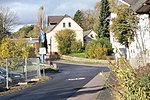
| In Schleedörn ( Location ) |
approx. 50 | Field name | From Frankfurter Strasse to Mittelstrasse in Michelbach (Westerwald) | The street, named in 1976, is mostly in the area of the local community of Michelbach. |
|
| In the sports center ( Location ) |
about 100 | literally | From the elevated road . | The street named in 1999 is located on the northern edge of the city. It opens up the school and sports center, a day-care center and a hotel on the Glockenspitze and also serves as a parking lot and bus turning point. | |
| In Vogelsang ( Location ) |
about 150 | Field name | From Friesenstrasse to Sehrtenbachstrasse . | The street, named in 1955, is located in the Parkstrasse district on the eastern edge of the city. |

|
| In the Wolfsacker ( Location ) |
about 100 | Field name | From Hochstraße to Zum Löh . | The street, named in 1940, lies on the northern edge of the city and the edge of the Parkstrasse district. |

|
| In the gardens ( Location ) |
120 | Field name | From Karlstrasse to Sehrtenbachstrasse . | The street, named in 1957, is located in the Parkstrasse district and serves as an access road. |

|
| In the Bellersbach ( Location ) |
166 | Field name | From Kölner Strasse . | The street, named in 1930, is located in the industrial area on the western edge of the city. It serves as an entrance to an industrial plant. | |
| In the malt drought ( Location ) |
approx. 50 | Field name | From Parkstrasse . | The street named in 1973 is located in the Parkstrasse district according to the district administration. | |
| Karlstrasse ( Location ) |
approx. 350 | From Frankfurter Strasse to Hochstrasse . | The street, named in 1908, is located on the northeastern edge of the city center. It crosses the Parkstrasse district, which was built in the 1920s. |

|
|
| Kastanienweg ( Location ) |
about 250 | From Wiedstrasse . | The street named in 1970 is on the western edge of the Leuzbach district. | ||
| Kaestnerstrasse ( Location ) |
approx. 200 | Erich Kästner , German writer | From Büchnerstrasse | The street named in 1982 is located in the Honneroth district . It was created in the 1980 / 90s. | |
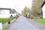
| Pine path ( Location ) |
258 | From the Leuzbacher Weg . | The street named in 1974 is located in the Leuzbach district. |
|
|
| Kirchstrasse ( Location ) |
91 | The street borders on the grounds of the Evangelical Church | From Wilhelmstrasse to Quengelstrasse . | The street, named in 1930, is located in the center of the city center. As a pedestrian zone, it connects Marktplatz and Quengelstraße. |

|
| Klingelstrasse ( Location ) |
about 100 | From the An der Ziegelhütte . | The street is on the northernmost edge of the city to the local community Mammelzen . | ||
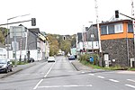
| Koblenzer Strasse ( Location ) |
about 1000 | From Kölner Straße to Almersbach . | The street is located on the southern edge of the city and, as the L267, is a central arterial road towards Puderbach . |
|
|
| Koelner Strasse ( Location ) |
approx. 2000 | Reference to the historical route connection to Cologne ( Cölnische Hohe Heerstrasse and Geleitstrasse and Cologne-Leipziger Strasse ) | From Quengelstraße to Helmenzen . | The street is located as part of the historic Köln-Leipziger-Straße on the western edge of the city center, opens up the industrial area in the west of the city and, as Bundesstraße 8, is one of the central arterial roads towards Siegburg , Bonn and Cologne . | |
| Konrad-Adenauer-Platz ( Location ) |
530 | Konrad Adenauer , German politician | From Bahnhofstrasse to Wiedstrasse . | The square, named in 1976, is located on the southwestern edge of the city center near the train station and also forms the forecourt. |

|
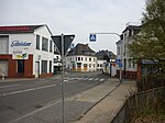
| Kumpstrasse ( Location ) |
approx. 2000 | "Kump", a bowl-shaped depression on a field and meadow. | From Kölner Straße to Hamm (Sieg) . | The street , which was renamed Adolf-Hitler-Straße in 1933 in the lower and built-up section, and again completely Kumpstraße in 1945, is located on the northern edge of the city center and, as the L267, is one of the central arterial roads to the north and to the bypass. |
|
| Lärchenweg ( Location ) |
about 150 | From Wiedstrasse . | The street named in 1978 is located in the Leuzbach district. She crosses the Tannenweg . | ||
| Lessingstrasse ( Location ) |
193 | Gotthold Ephraim Lessing , German poet | From Eichendorffstrasse . | The street named in 1986 is in the Honneroth district . It was created in the 1980s. | |
| Leuzbacher way ( Location ) |
about 1000 | Connection road to Leuzbach | From Wiedstrasse . | The street named in 1930 opens up the residential area around the hospital from Altenkirchen and flows again into Wiedstrasse in Leuzbach. |

|
| Lindenweg ( Location ) |
about 100 | From the pine path to the alder path . | The street named in 1970 is in the Leuzbach district. | ||
| Lise-Meitner-Strasse ( Location ) |
112 | Lise Meitner , Austrian nuclear physicist | From Kölner Strasse / Rehhardt . | The street, named in 2002, is located on the northern edge of the city. It opens up the industrial area on Bundesstraße 8 . | |
| Lohmühlenweg ( Location ) |
about 450 | Reference to the former mill location | From Kumpstrasse to Auf dem Steinchen . | The street, named in 1951, is located on the southwestern edge of the city center. It crosses Am Steinchen . |

|
| Ludwig-Jahn-Strasse ( Location ) |
131 | Friedrich Ludwig Jahn , German educator | From Frankfurter Strasse to Im Hahnchen . | The street, initially named Jahnstraße in 1930 , is located on the eastern edge of the city center. She crosses Saynstrasse . | |
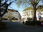
| Marketplace ( Location ) |
128x approx. 100 | literally | From Wilhelmstrasse to Marktstrasse . | The square is located in the center of the city center and is crossed by Hofstrasse . |
|
| Market street ( Location ) |
289 | Regarding the marketplace | From Saynstrasse to Wilhelmstrasse . | The street is in the center of downtown. She crosses the market square. |

|
| Mörikestrasse ( Location ) |
approx. 200 | Eduard Mörike , German poet | From Büchnerstrasse . | The street named in 1982 is located in the Honneroth district . It was built as a circular road in the 1980s. | |
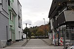
| Mühlengasse ( Location ) |
93 | Reference to the former mill location on Mühlengraben | From Wilhelmstrasse to Im Hähnchen . | The street is on the southern edge of the city center at the parking lot of the same name. The continuation of the alley turns into a hiking trail that leads to the Wiesental, |
|
| Open way ( Location ) |
405 | Relation to Nieder- and Oberölfen | From the B256 . | The street, named in 1968, is located in the Bergenhaus district of the Leuzbach district. | |
| Parkstrasse ( Location ) |
about 300 | Reference to the park-like development from the 1900s | From Hochstraße to Sehrtenbachstraße . | The street, named in 1908, is located in the northeast of the city center. According to plan, the street was built by the Altenkirchen master builder C. Sachse until the 1930s. It crosses Karlstrasse and crosses Friesenstrasse . The house Park Road 12 , a small mansard roof villa is a cultural monument of the city. |

|
| Pestalozzistrasse ( Location ) |
107 | Johann Heinrich Pestalozzi , Swiss educator | From Schulstrasse to Ziegelweg . | The residential street, named in 1955, is located on the western edge of the city center near the primary school of the same name. |

|
| Petersbachweg ( Location ) |
48 | Relation to waters | From Kölner Straße / B8 . | The street, named in 1955, is located on the northern edge of the city. It opens up the industrial area on Bundesstraße 8. | |
| Philipp-Reis-Strasse ( Location ) |
cs. 100 | Philipp Reis , German physicist and inventor | From Kölner Straße / B8. | The street, named in 1974, is located on the northern edge of the city. It opens up the industrial area on Bundesstraße 8. It crosses Lise-Meitner-Straße . | |
| Quengelstrasse ( Location ) |
588 | Reference to the Quengelbach | From Kölner Strasse to Frankfurter Strasse . | The street is located on the north-western edge of the city center and, as a section of the B8, connects the two central arterial roads. This connection was created during the urban redevelopment in the 1960s and 70s and the rededication of Wilhelmstrasse as a pedestrian zone . |

|
| Raiffeisenstrasse ( Location ) |
about 250 | Friedrich Wilhelm Raiffeisen , German economist and founder of a cooperative | From Wiedstrasse . | The street named in 1968 is located on the southern edge of the Leuzbach district. It opens up an industrial area and crosses the Altenkirchen-Puderbach railway line. | |
| Rathausstrasse ( Location ) |
about 100 | Reference to the historic town hall and the current town hall of the Altenkirchen community (Westerwald) | From Wilhelmstrasse to Siegener Strasse . | The street, named Hindenburgstraße from 1927 and again Rathausstraße in 1948, is located on the northern edge of the city center. It connects the B8 and the pedestrian zone with Siegener Straße . The building at Rathausstrasse 12 , a late historical business and administration building from 1906, is a cultural monument of the city. |

|
| Rehhardt ( Location ) |
about 100 | Field name | From Lise-Meitner-Straße to Helmenzen. | The street, named in 2000, is located on the northernmost edge of the urban area. It connects the residential area in Helmenzen to the B8. | |
| Rudolf-Diesel-Strasse ( Location ) |
445 | Rudolf Diesel , German engineer and the inventor of the diesel engine | From Kölner Strasse . | The street, named in 1974, is located on the western edge of the city and opens up an industrial area. | |
| Saynstrasse ( Location ) |
about 100 | Reference to the historical connection to the County of Sayn and the County of Sayn-Altenkirchen | From Ludwig-Jahn-Strasse to Wilhelmstrasse . | The street named in 1999 is located in the inner city area and was built in the course of urban redevelopment in the 1990s. She crosses Marktstrasse . |

|
| Schiller Street ( Location ) |
945 | Friedrich Schiller , German playwright | From Fontanestrasse to Goethestrasse . | The street named in 1977 is in the Honneroth district . It was created in the 1970s. | |
| Schlossplatz ( Location ) |
183 × approx. 100 | Reference to the former Altenkirchen Castle | From Wilhelmstrasse to Rathausstrasse . | The square, named in 1990, is located in the center of the city center at the northern end of the pedestrian zone. It was created when the city center was redesigned in the 1990s. The new buildings of the Westerwald Bank and Kreissparkasse Altenkirchen were opened in 1995; the square itself was inaugurated in 1997. |

|
| Schlossweg ( Location ) |
approx. 75 | Reference to the former Altenkirchen Castle | From Quengelstrasse to Kirchstrasse . | The street, named in 1930, is located on the edge of the city center and connects the parking lot to Quengelstraße . | |
| Schulstrasse (new) ( Location ) |
143 | The road leads to the Pestalozzi School (elementary school) | From Kölner Straße to Driescheider Weg . | The street named in 1955 (previously Hohlweg ) lies on the western edge of the city center. |

|
|
Schulstrasse (old) ( Location ) |
about 100 | Reference to former inner-city school location | From Zum Weyerdamm to Kirchstrasse | The street named in 1893 was on the western edge of the city center. The buildings on Schulstrasse were demolished during urban redevelopment in the 1970s and gave way to the underpass of the inner-city bypass ( Quengelstrasse ); today there is a parking lot and a small park in this area. |

|
| Schützenstrasse ( Location ) |
approx. 200 | Relation to the Schützenplatz | From Dammweg to Bachstraße . | The street, named in 1930, is located on the southern edge of the city center. | |
| Schützenweg ( Location ) |
100 | Reference to the local shooting club and the nearby shooting range | Branching off from the Tannenweg . | The street named in 1968 is located in the Leuzbach district. It's a dead end. | |
| Schwalbenweg ( Location ) |
100 | From the Auf dem Steinchen . | The street, named in 1957, is located on the northern edge of the city. | ||
| Sehrtenbachstrasse ( Location ) |
100 | Reference to the Sehrtenbach, which runs parallel | From Frankfurter Strasse to Im Vogelsang . | The street, named in 1940, is located on the southern edge of the Parkstrasse district. She crosses Parkstrasse . |

|
| Siegener Strasse ( Location ) |
about 500 | Link road over knowledge to Siegen | From Rathausstrasse to Mammelzen . | The street, named in 1948, begins on the northern edge of the city center. At its northern end it crosses under the bypass road B414 and, as the B256, forms one of the central arterial roads. | |
| Stadionstrasse ( Location ) |
100 | From the Ringstrasse to An der Ziegelhütte . | The street is on the northernmost edge of the urban area on the border with Mammelzen . | ||
| Stadthallenweg ( Location ) |
100 | Relation to the town hall | From Dammweg . | Named in 1955, the street is on the edge of the city center. It connects to the town hall and is a dead end. | |
| Tannenweg ( Location ) |
250 | From Helmenzerstraße to Wiedstraße . | The street, named in 1978, is located on the western edge of the Leuzbach district. It crosses the Schützenweg . | ||
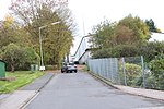
| Theodor-Fliedner-Strasse ( Location ) |
122 | Theodor Fliedner , German Protestant pastor, social reformer and founder of the Kaiserswerther Diakonie . | From the Leuzbacher Weg . | The short street, named in 1975, is located on the eastern edge of the Leuzbach district. It connects to the retirement home of the same name. |
|
| Uhlandstrasse ( Location ) |
133 | Ludwig Uhland , German poet and politician | From Goethestrasse . | The street named in 1980 is located in the Honneroth district . It was created in the 1980s. | |
| Ulmenweg ( Location ) |
approx. 50 | From the Leuzbacher Weg . | The street named in 1970 is in the Leuzbach district. | ||
| Connection path ( Location ) |
151 | literally | From Wiedstrasse to Leuzbacher Weg . | The street, named in 1930, is located on the western edge of the city in the direction of the Leuzbach district. |

|
| Von-Kleist-Strasse ( Location ) |
337 | Heinrich von Kleist , German writer | From Büchnerstrasse . | The street named in 1982 is located in the Honneroth district . It was built as a circular road in the 1980s. | |
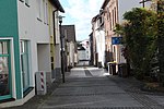
| Wallstrasse ( Location ) |
100 | Reference to the former city fortifications (city wall) | From Marktstrasse to Saynstrasse . | The street is in the central area of the city center. She crosses the market street. |
|
| Wiedstrasse ( Location ) |
approx. 2000 | The street runs parallel to the Wied . | From Kölner Straße to K151. | The street connects the city center with the district Leuzbach as Kreisstraße 151, this with the federal highway 256 (bypass road). |

|
| Meadow road ( Location ) |
50 | Relation to early agricultural use | From Feldstrasse . | The street named in 1974 is parallel to Siegener Straße . | |
|
Wilhelmstrasse ( Location ) |
418 | Wilhelm I , German Emperor | From Kölner Strasse to Schlossplatz . | The street is in the center of downtown. It has been the pedestrian zone since the 1980s and crosses the market square . |

|
| Ziegelweg ( Location ) |
270 | Relation to the former brickyard location | From Driescheider Weg to Kölner Straße . | Named in 1951. |
 . .
|
| To the Johannistal ( Location ) |
300 | Field name | From the mountain road . | The street, named in 1940, lies on the southern edge of the urban area towards Almersbach. |

|
| To the Löh ( Location ) |
approx. 50 | Field name | From Karlstrasse to Friesenstrasse . | The street, named in 1951, is located in the Parkstrasse district in the northeast of the city. |

|
| To Pfarracker since the 1950s? ( Location ) |
approx. 50 | Field name | From Kiefernweg to Wiedstrasse . | The street, named in 1955, is located in the western part of the city in the direction of the Leuzbach district. |

|
| To Weyerdamm ( Location ) |
186 | Reference to dam fortifications on the Quengelbach | From Quengelstraße to Schloßweg . | The street, named in 1930, is located on the western edge of the city center and connects Quengelstraße with an underpass to Wilhelmstraße and Dammweg . This connection changed when the inner-city bypass was built in the 1960s and 1970s and Wilhelmstrasse was rededicated as a pedestrian zone . |
|
spelling
Altenkirchen generally adheres to the guidelines for the spelling of street names published by Duden-Verlag . The most important rules are:
- The first word of a street name is capitalized, e.g. B. On the Altdriesch .
- Street names are written together, consisting of a noun (or a name) and a basic word typical of street names such as B. Street , Gasse , Weg , Platz exist: Mühlengasse, Wilhelmstrasse .
- If the first component is an adjective that is inflected, it is written separately.
- The hyphenation also applies to adjectival derivatives of place and country names: Kölner Straße .
- The hyphen is used when the definition of the basic word consists of several words. So Von-Kleist-Strasse .
Web links
Individual evidence
- ^ Altenkirchen at Straßenweb.de
- ↑ These were Bahnhofstrasse, Dieperzbergweg, Frankfurter Strasse, Gartenstrasse, Hochstrasse, Hohlweg, Johannisberg, Kirchstrasse ( renamed Schulstrasse on October 9, 1930 ), Koblenzer Strasse, Kölner Strasse, Kumpstrasse, Marktplatz, Marktstrasse, Mühlengasse, Quengelstrasse, Rathausstrasse, Schloßplatz , Wallstrasse, Wiedstrasse and Wilhelmstrasse . Source: Address book for the city and the district of Altenkirchen. Lorsbachs (ed.). Siegen 1898
- ↑ a b c d e Nationalblatt, 10th vol., No. 271 of 18./19. February 1939.
- ↑ a b c d e f g h i j k l m n o p q r s t u v w x y z aa ab ac ad ae af ag ah ai aj ak al am an ao ap aq ar as at au av aw ax ay az ba bb bc bd be bf bg bh bi bj bk bl bm bn Eva Siebenherz: Renamed streets in Rhineland-Palatinate: What was the street called earlier? . 2016
- ^ Eberhard Blohm: Jewish families from the communities of the Verbandsgemeinde Altenkirchen . Weyerbusch 2008, p. 30 ff.
- ↑ Heinz Krämer: A contribution to the history of the homes on the Dorn in Altenkirchen . In: Heimat-Jahrbuch des Kreis Altenkirchen and the neighboring communities 1987 Publisher: Neunkirchen, 1987, p. 83 ff.
- ↑ a b c d e f g h i j k l m n o p q r s t u v w x residents' register for the Westerwald - C. Ebner-Verlag (ed.). Edition 1931.- Hachenburg 1931
- ↑ a b c Heimat-Adressbuch Kreis Altenkirchen 1966.-Verlag HE Kasper and Co .. Cologne 1966
- ↑ a b Heinz Krämer: The Parkstrasse in Altenkirchen . In: Heimat-Jahrbuch des Kreis Altenkirchen and the neighboring communities 1993 Publisher: Neunkirchen, 1993, p. 82
- ^ Hans Helzer : Der Blücherplatz in Altenkirchen In: Heimat-Jahrbuch des Kreis Altenkirchen and the neighboring communities 1979 Publisher: Neunkirchen, 1979
- ↑ During the Nazi era, the first house on the square was assigned to Mackensenstrasse (today again Frankfurter Strasse ) ( instead of Blücherplatz 2, put: Mackensenstrasse 21. ). see. Official Journal of the Reich Finance Administration: Edition A., Volume 23, 1941
- ↑ a b c d e f g Home address book of the Altenkirchen district 1957.-Verlag HE Kasper and Co .. Cologne 1957
- ↑ a b c d e f g Altenkirchen district - residents address book - Bequna publishing house (ed.). Remscheid 1951
- ↑ Festschrift of the Altenkirchener Schützenverein . Altenkirchen 1966, p. 51
- ↑ a b c Address book of the Altenkirchen district 1908. Otto Ebner Verlag (ed.). Betzdorf 1908
- ^ Heinz Dittmeyer: Rhenish field names . Bonn: Hartmann, approx. 1963, p. 171
- ↑ a b c Heimat-Adressbuch Kreis Altenkirchen 1966.-Verlag HE Kasper and Co. Cologne 1966
- ↑ Jürgen Kolb, Horst Ascheid: The Altenkirchener Schloßplatz. Before, its change, today. In: Heimat-Jahrbuch des Kreis Altenkirchen and the neighboring communities 1998 Publisher: Neunkirchen, 1998, p. 52 f
