
Maud belt
The Maud Belt is a highly polydeformed, metamorphic orogenic belt in East Antarctica . It occupies a key position with regard to the formation and disintegration of the supercontinent Rodina and Gondwana as well as the continent of East Antarctica.
It runs about 4,500 kilometers in an arc along the continental margin from Coatsland in the southwest to the eastern Queen Maud Land . Geologically, it can be divided into three major geological provinces. The western forms the geosuture between the Grunehogna craton and the Crohn craton with the southern Shackleton Range , while the central and eastern consists of a collection of oceanic igneous super-terranos . The geodynamic development covers a period from the Mesoproterozoic to the Neoproterozoic and Cambrian .

Map of Antarctica with East Antarctica and the surrounding waters

Location of the East Antarctic Queen Maud Land


Structural structure and crust components

Location from Coatsland

Simplified geological map of Neuschwabenland
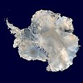
Satellite image of the Antarctic ice sheet without ice shelf


Geomorphologically and geologically, the Maud Belt can be structured into several units. Only the highest peaks of the Maud Belt protrude from the Antarctic ice sheet .
The Bertrab , Littlewood and Moltke Nunatakers are located in Coatsland in the extreme southwest of the belt . They can be assigned to a western province.
They are followed in Neuschwabenland the mountain outcrops of the central province Heimefrontfjella (homes Front Range), Kirwanveggen (Kirwan Escarpment) Sverdrupfjella (Sverdrup Mountains), gjelsvik mountains (Gjelsvik Mountains), Mühlig-Hofmann Mountains (Mühlig-Hofmann Mountains or MuhligHofmannfjella) Wohlthat Mountains ( Wohlthat Mountains) and Schirmacher Oasis (Schirmacher Oasis).
The northeastern province includes Sør Rondane (Sør Rondane Mountains) and the Yamato-Belgica complex in the far east. There the belt connects to the Lützow-Holm complex .
Geodynamic development
Western Province

Location of the Kaapvaal craton in southern Africa

Paleographic reconstruction of the Crohn's craton and Mawson's craton

Shackleton Range map sheet


The western province forms a collision- related geosutur between the Grunehogna craton and the Crohn craton with the southern Shackleton Range . The Jutul Penck Trench forms the western limit to the Grunehogna Kraton. This trench took in huge loads of sediment from the interior of East Antarctica. Today the Jutul-Penck-Graben is filled with glaciers . The Forster Magnetic Anomaly delimits the western province from the east. This magnetic anomaly forms an important tectonic block boundary and / or a seam zone between rocks with African affinities and Archaic Mesoproterozoic ages in the west and the younger rocks of the early Neoproterozoic in the east. These are shows in the central and eastern provinces.
The only outcrops in the western province come in Coats Land with the adjacent minute Bertrab - Littlewood - and Moltke - Nunataker ago. The first two consist of approx. 1100 mya old, flatly deposited, unmetamorphosed granophyres or rhyolites . However, the Moltkenunataker is made up of metasediments, the age of which is assumed to be more than 1100 mya, since its confession did not cause any deformations in the other two nunatakers. Its rock spectrum consists of slate , limestone and various types of sandstone with activated metavolcanites.
Presumably these Nunatakers belong to a microcontinent known as the Coatsland Block. From polar migration curves it is concluded that Coatsland was not yet connected to the Kaapvaal Kraton and the Maud Belt during this period , but rather lay as part of an orogenic belt similar to an island arch between this and the nearby continent Laurentia . According to one hypothesis, this block first docked with the Kaapvaal craton of Western Gondwana. It was then wedged between West and East Gondwana. The Maud Natal Belt was formed as a geosuture between the Kaapvaal Kraton or the Grunehogna Kraton, which was still connected at that time, and the Crohn Kraton. After the collapse of Gondwana, the Coatsland Block and the Grunehogna Craton remained in East Antarctica.
The Nunantaker similar rocks were in South Africa Namaqualand , KwaZulu-Natal and Mozambique as well as in Sri Lanka detected. From this it was concluded that the western Maud Province was originally associated with the East African Orogen and formed the northeastern continuation of the African Namaqua-Natal belt.
Central Province
The central Maud province, like the eastern province, developed under a subduction regime in which various juvenile (newly formed) magmatic-volcanic island arch terranes were formed. They were severely deformed several times and metamorphically overprinted. The name TOAST was coined for them, an English abbreviation from Tonian Oceanic Arc Super Terrane ( Tonium Oceanic Island Arch Superterrane).
As a result of the subduction, the ocean closed between the Crohn craton and the Kaapvaal craton.
The rocks from the Backarc and Forearc basins contained therein show the age of the protoliths (parent rocks) around 1170 mya. The rock spectrum of the basement consists predominantly of mafic to felsic meta magmatites , gabbro - tonalite-trondhjemite-granodiorite complexes , meta volcanites and supracrustal rocks. Granites , gabbros, anorthosites and charnockites intruded into these rock packages . Frequent and different fault zones run through these basement complexes.

Between 1090 and 1060 mya they received transformations ranging from green schist to granulite facies . This period falls within the formation phase of Rodinia. During the Gondwana formation, especially the collisions between the East and the African part of West Gondwana, another organic event took place around 550 mya. It is assigned to the Kuunga orogeny, in which between approx. 600 and 500 mya East Antarctica and the African Kaapvaal craton collided. During this process, areas of the basement were reactivated.
Meta sedimentary overburden is only slightly preserved. Remnants of the sub-Permian overburden are known as the Amelang Plateau Formation and have only survived in Vestfjella, Heimefrontfjella and Kirwanveggen. It contains diamictites , sand and siltstones with gneissic dropstones and individual carbonate-bearing horizons . Otherwise it is missing. The Amelang Plateau Formation represents a typical periglacial fluvial to lacustrine sequence that followed the ice retreat. The age of the Amelang Plateau Formation could be narrowed down to the lower Permian using pollen analysis methods.
After the formation of Gondwana in the Cambrian , Queen Maud Land was a clearing area for a long time . Remains of a Neoproterozoic Lower Cambrian molasse of the East African East Antarctic orogen are only recorded in the southern Kirwanveggen. After that there is no geological evidence from the Upper Cambrian to the Carboniferous .

Geological overview map of Heimefrontfjella
Petrified leaf imprint of Gangamopteris cyclopteroides, locality Kottasberge


Various well-preserved fossils were found in sedimentary deposits of the Kottas Mountains in the northern Heimefrontfjella , such as trace fossils of the species Beaconichnus darwinum and the order Cochlichnus as well as leaf prints of the species Gangamopteris cyclopteroides from the order Glossopteridales .
Eastern Province

The eastern province is made up of the Sør Rondane Mountains and the Yamato-Belgica complex. This extends between the Lützow-Holm complex and the Sør Rondane Mountains to the south-west. It mainly consists of various igneous rocks. Amphibolite facies metamorphosis and magmatism occurred around 535 mya. This period corresponds to the Kuunga orogeny. The metamorphic processes correlate with those in the Vijayan Complex and Wanni Complex of Sri Lanka and Rayner Province .
Between the Yamato-Belgica-Complex and the Lützow-Holm-Complex a clear alternation of magnetic anomalies occurs, which indicates a border to Cratonic basement areas.
Web links
- Simon L. Harley, Ian CW Fitzsimons and Yue Zhao: Antarctica and supercontinent evolution: historical perspectives, recent advances and unresolved issues. In: Geological Society, London, Special Publications, 383, 1-34, 9 October 2013. doi: 10.1144 / SP383.9 , alternative
- Georg Kleinschmidt: Geological development and tectonic structure of the Antarctic. In: Warning signal climate: The polar regions. Scientific evaluations, Hamburg. 376 pages. PDF
- Michael Studinger: Interpretation and analysis of potential field data in the Weddell Sea, Antarctica: the disintegration of the supercontinent Gondwana. In: Dissertation from 1998, Department of Geosciences at the University of Bremen. PDF
- J. Jacobs, W. Bauer & CM Fanning: New age constraints for Grenville-age metamorphism in western central Dronning Maud Land (East Antarctica), and implications for the palaeogeography of Kalahari in Rodinia. In: International Journal of Earth Sciences volume 92, pages 301-315 (2003). doi: 10.1007 / s00531-003-0335-x .
- SK Roy, NC Pant, A. Kundu, A. Dharwadkar and others: Geological studies in the Baalsrudfjellet nunatak between the Schirmacher Oasis and the Wohlthat Mountains to establish the continuation of the East African Orogen (EAO) in central Dronning Maud Land, East Antarctica . In: Geological Society, London, Special Publications, 457, 37–59, 13 April 2017. doi: 10.1144 / SP457.3 , alternative
- M. Asami, Y. Osanai, K. Shiaishi and H. Makimot: Metamorphic Evolution of the Sør Rondane Mountains. In: Antarktic Earth Science, pp 7-15. PDF
Individual evidence
- ↑ a b Wilfried Bauer: The geological development on the border between West and East Gondwana in the Atlantic sector of Antarctica. In: Habilitation thesis 2003, RWTH Aachen University. PDF
- ↑ Wilfried Bauer, Heinrich Siemes, Gerhard Spaeth and Joachim Jacobs: Transpression and tectonic exhumation in the Heimefrontfjella, western orogenic front of the East African / Antarctic Orogen, revealed by quartz textures of high strain domains. In: Polar Research, 35: 1. doi: 10.3402 / polar.v35.25420 , alternatively
- ^ A b G. H. Grantham, C. Jackson, AB Moyes, PB Groenewald and others: Kirwanveggen — HU Sverdrupfjella areas, Dronning Maud Land, Antarctica. In: Precambrian Research, Volume 75, Issues 3-4, December 1995, Pages 209-229. doi: 10.1016 / 0301-9268 (95) 80007-5 .
- ↑ Avinash Bisnath and E. Frimmel: Metamorphic evolution of the Maud Belt: P-T-t path for high-grade gneiss in gjelsvik mountains, Dronning Maud Land, East Antarctica. In: Journal of African Earth Sciences, Volume 43, Issue 5, December 2005, Pages 505-524. doi: 10.1016 / j.jafrearsci.2005.09.007 , PDF
- ↑ Y. Ohta, BO Tørudbakken and K. Shiraishi: Geology of gjelsvik mountains and western MühligHofmannfjella, Dronning Maud Land, East Antarctica. In: Polar Research, 8: 2, 99-126. doi: 10.3402 / polar.v8i2.6808 , alternatively
- ^ W. Bauer and J. Jacobs: German Expedition 1999/2000 to Gjelsvikfjella and Western Muhlig-Hofmann-Gebirge, Central Dronning Maud Land, Antarctica. In: Gondwana Research (Gondwana Newsletter Section) V. 3, No. 4, pp. 557-559. doi: 10.1016 / S1342-937X (05) 70764-4 , PDF
- ↑ V. Ravikant, JH and MM Laux Pimentel: Sm-Nd and U-Pb isotopic constraints for crustal evolution during LateNeoproterozic from rocks of the Schirmacher Oasis, East Antarctica: Geodynamic development coeval with the East African Orogeny. In: US Geological Survey and the National Academies; USGS OF-2007-1047, Short Research Paper 007. doi: 10.3133 / of2007-1047.srp007 , alternatively
- ↑ Yasuhito Osanai, YoshifumiNogi, SotaroBaba, Nobuhiko Nakano, Tatsuro Adachi and others: Geologic evolution of the Sør Rondane Mountains, East Antarctica: Collision tectonics proposed based on metamorphic processes and magnetic anomalies. In: Precambrian Research, Volume 234, September 2013, Pages 8-29. doi: 10.1016 / j.precamres.2013.05.017 .
- ↑ Peters, Matthias; Lippolt, Hans Jürgen; Rittmann, Ursula; Weber, Klaus: Age determinations of rocks from Vestfjella and Ahlmannryggen in Antarctica. PANGEA, doi: 10.1594 / PANGEA.763219 .
- ↑ Antonia Ruppel, Graeme Eagles, Joachim Jacobs, Wilfried Jokat and Andreas Läufer: The Forster Magnetic Anomaly: reading between the lines to better understand a major suture crossing central Dronning Maud Land. In: 19th EGU General Assembly, EGU2017, proceedings from the conference held April 23-28, 2017 in Vienna, Austria, p.11750. link
- ↑ SL Loewy, IWD Dalziel, S. Pisarevsky, JN Connelly, J. Tait, RE Hanson and D. Bullen: Coats Land crustal block, East Antarctica: A tectonic tracer for Laurentia? In: Geological Society of America, Geology (2011) 39 (9): 859-862. doi: 10.1130 / G32029.1 , alternatively
- ^ Georg Kleinschmidt and Steven D. Boger: The Bertrab, Littlewood and Moltke Nunataks of Prinz-Regent-Luitpold-Land (Coats Land) -Enigma of East Antarctic Geology. In: Polarforschung 78 (3), 95-104, 2008. PDF
- ↑ Tomokazu Hokada, Geoffrey H. Grantham, MakotoArima, Satoshi Saito, Kazuyuki Shiraishi and others: Stenian A-type granitoids in the Namaqua-Natal Belt, southern Africa, Maud Belt, Antarctica and Nampula Terrane, Mozambique: Rodinia and Gondwana amalgamation implications. In: Geoscience Frontiers , Volume 10, Issue 6, November 2019, Pages 2265-2280, doi: 10.1016 / j.gsf.2019.04.003 .
- ↑ Antonia Ruppel, Joachim Jacobs, Graeme Eagles, Andreas Läufer and Wilfried Jokat: New geophysical data from a key region in East Antarctica: Estimates for the spatial extent of the Tonian Oceanic Arc Super Terrane (TOAST). In: Gondwana Research , Volume 59, July 2018, Pages 97-107, doi: 10.1016 / j.gr.2018.02.019 , PDF
- ↑ Hallgeir Sirevaag, Anna K. Ksienzyk, Joachim Jacobs, István Dunkl and Andreas runners: tectono-thermal evolution and Morphodynamics of the Central Dronning Maud Land Mountains, East Antarctica, Based on New Thermo Chronological Data. In: Geosciences 2018, 8 (11), 390. doi: 10.3390 / geosciences8110390 .
- ^ A b Joseph G. Meert: A synopsis of events related to the assembly of Eastern Gondwana. In: Tectonophysics 362 (1): 1-40 • February 2003, doi: 10.1016 / S0040-1951 (02) 00629-7 .