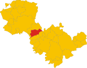
Montecchio
| Montecchio | ||
|---|---|---|

|
|
|
| Country | Italy | |
| region | Umbria | |
| province | Terni (TR) | |
| Coordinates | 42 ° 40 ′ N , 12 ° 17 ′ E | |
| height | 377 m slm | |
| surface | 48.99 km² | |
| Residents | 1,597 (Dec. 31, 2019) | |
| Population density | 33 inhabitants / km² | |
| Post Code | 05020 | |
| prefix | 0744 | |
| ISTAT number | 055018 | |
| Popular name | Montecchiesi | |
| Patron saint | San Bernardino (May 20th) | |
| Website | Montecchio | |
 Panorama of Montecchio |
||
Montecchio is an Italian commune with 1597 inhabitants (as of December 31, 2019) in the province of Terni in the Umbria region .
geography
The community extends over around 49 km². It is located about 50 km south of Perugia and about 35 km northwest of Terni in the climatic classification of Italian communities in zone D, 2 051 GG.
The districts (frazioni) include Melezzole, Prato Giardino, San Rocco and Tenaglie.
The neighboring municipalities are Avigliano Umbro , Baschi , Civitella d'Agliano ( VT ), Guardea , Orvieto and Todi ( PG ).
history
Montecchio was first mentioned in 1275, when the place already had a city wall. The name comes from the Latin Mons Herculis ( Hercules Mountain ), which later became Munticulus and then Montecchio. In the 10th and 11th centuries still under the rule of Todi, from the 12th under that of Baschi. In 1165 the Castro Monticoli castle was built by the Chiaravalle family . In the 13th century the place got into the fighting of the Ghibellines and Guelphs , then the second wall ring of the city fortifications was built.
Attractions
- Chiesa di San Biagio , a church in the Melezzole district that was built around 1112 and restored in 1624.
- Chiesa di San Giovanni Battista , church built in 1370 in the Tenaglie district.
- Chiesa di San Vitale , church from the 12th century in the Melezzole district.
- Chiesa di Santa Maria Assunta . The church was built in 1400 or 1437 and adapted several times; so the existing tower was built in 1633. The church represents the highest point in the parish.
Web links
- Official website of the municipality of Montecchio (Italian)
- History of the place near Medioevo in Umbra (Italian)
Individual evidence
- ↑ Statistiche demografiche ISTAT. Monthly population statistics of the Istituto Nazionale di Statistica , as of December 31 of 2019.
- ↑ Website of the Agenzia nazionale per le nuove tecnologie, l'energia e lo sviluppo economico sostenibile (ENEA) (PDF; 330 kB), accessed on December 1, 2012 (Italian)


