Allerona
| Allerona | ||
|---|---|---|

|
|
|
| Country | Italy | |
| region | Umbria | |
| province | Terni (TR) | |
| Coordinates | 42 ° 49 ' N , 11 ° 58' E | |
| height | 472 m slm | |
| surface | 82 km² | |
| Residents | 1,722 (Dec. 31, 2019) | |
| Population density | 21 inhabitants / km² | |
| Post Code | 05011 | |
| prefix | 0763 | |
| ISTAT number | 055002 | |
| Popular name | Alleronesi | |
| Patron saint | Sant'Ansano (December 1st) | |
| Website | Allerona parish | |
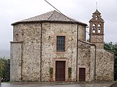
 Panorama of Allerona |
||
Allerona is an Italian commune with 1722 inhabitants (as of December 31, 2019) in the province of Terni in the Umbria region and is a member of the association I borghi più belli d'Italia (The Most Beautiful Places in Italy).
geography
The community extends over around 82 km² . It is located about 50 km southwest of Perugia and about 60 km northwest of Terni on a hill about 20 km northwest of Orvieto , at the point of contact between the regions of Umbria, Lazio and Tuscany . The place belongs to the administrative community Comunità montana Monte Peglia e Selva di Meana. The old Roman roads Via Cassia and Via Traiana Nova led through the village, and the village itself was entered through the main gate, Porta del Sole . The district of Allerona Scalo (approx. 7 km southeast, 171 meters altitude) is located on the Paglia . In addition to the official districts of Allerona Scalo (created in 1863 by the railway line) and Palombara, there are also various Borghi such as San Nicolò della Meana (built around 1273 by the Archbishop of Orvieto, approx. 4 km from Allerona Scalo) and San Pietro Acquaeortus (approx km north of Allerona, originated in the 11th century).
The only district is Allerona Scala.
The neighboring municipalities are Acquapendente ( VT ), Castel Viscardo , Città della Pieve ( PG ), Fabro , Ficulle , Orvieto and San Casciano dei Bagni ( SI ).
history
The place was settled in Etruscan and Roman times. In the Middle Ages it belonged to the Monaldeschi and Filippeschi families and was an important fortification of the Orvieto commune against Chiusi . The castle was destroyed between 1494 and 1495 by the troops of King Charles VIII . Remains of the city wall and the two city gates Porta del Sole (Sun Gate) and Porta della Luna (Moon Gate) have been preserved. Its own parish status dates back to 1585.
Attractions
- Antico Ospedale dei Poveri (German old hospital for the poor ), building erected in 1373 on the Piazzetta del Fiore in the town center.
- Chiesa Parrocchiale di Santa Maria Assunta - The single-nave parish church dates from the 12th century and was heavily renovated between 1892 and 1897.
- Chiesa della Madonna dell'Acqua - Church on an octagonal floor plan, which lies just outside the city walls and was built between 1715 and 1723 in place of an older chapel.
- Chiesa di San Michele Arcangelo - 12th century church just outside the city walls.
- Chiesa di San Nicola da Bari - Church ruins in Allerona Scalo with works and frescoes by Sinibaldo Ibi.
- Chiesa di Sant'Abbondio - 7th century church in the Allerona Scalo district
- Archaeological excavations at Sant'Ansano - remains of two grave monuments from Roman times.
- Villa Cahen - Art Nouveau villa with a large park, which was built in 1880 by Edouard Cahen in the Selva di Meana (Meana forest).
traffic
The district of Allerona Scalo (Allerona train station) is on two railway lines: the Direttissima Firenze – Roma and the Allerona – Castel Viscardo line . The A1 is in the immediate vicinity of Allerona Scalo, but without a junction. The closest connection to the motorway is Fabro / Ficulle or Orvieto , both around 15 km away.
Regular events
- Pugnaloni - Third Sunday in May, festival in honor of St. Isidore with allegorical floats and procession in historical costumes from the 19th century.
literature
- Touring Club Italiano : Umbria. Touring Editore, Milan 1999, ISBN 8836513379 .
Web links
Individual evidence
- ↑ Statistiche demografiche ISTAT. Monthly population statistics of the Istituto Nazionale di Statistica , as of December 31 of 2019.
- ^ I borghi più belli d'Italia. Borghipiubelliditalia.it, accessed August 13, 2017 (Italian).
- ↑ Official website of ISTAT (Istituto Nazionale di Statistica) on 2001 population figures in the province of Terni, accessed on November 7, 2012 (Italian)


