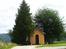
Oberweißau
|
Oberweißau ( hamlet ) locality |
||
|---|---|---|
|
|
||
| Basic data | ||
| Pole. District , state | Braunau am Inn (BR), Upper Austria | |
| Judicial district | Mattighofen | |
| Pole. local community | Munderfing ( KG Achenlohe ) | |
| Coordinates | 48 ° 1 '56 " N , 13 ° 10' 41" E | |
| height | 496 m above sea level A. | |
| Residents of the village | 39 (January 1, 2020) | |
| Building status | 19 ( n / a help ) | |
| Post Code | 5222 Munderfing | |
| Statistical identification | ||
| Locality code | 07643 | |
| Counting district / district | Munderfing area (40426 001) | |
| Source: STAT : index of places ; BEV : GEONAM ; DORIS | ||
Oberweißau is a village in the Innviertel in Upper Austria as well as a place of the communities Munderfing and Lochen am See in the district of Braunau am Inn , and the cadastral municipality Oberweissau of the latter.
geography
|
Oberweißau ( village ) locality cadastral municipality Oberweissau |
|
|---|---|
| Basic data | |
| Pole. District , state | Braunau am Inn (BR), Upper Austria |
| Judicial district | Mattighofen |
| Pole. local community | Punch at the lake |
| Coordinates | 48 ° 1 ′ 40 " N , 13 ° 9 ′ 46" E |
| height | 496 m above sea level A. |
| Residents of the village | 43 (January 1, 2020) |
| Building status | 16 ( n / a help ) |
| Area d. KG | 8.53 km² |
| Post Code | 5221 Punch |
| Statistical identification | |
| Locality code | 07545 |
| Cadastral parish number | 40122 |
| Counting district / district | Lochen (40419 000) |
| Source: STAT : index of places ; BEV : GEONAM ; DORIS | |
Oberweißau is located 8½ kilometers south of Mattighofen , 8 kilometers northwest of Straßwalchen in Mattigtal , between the places Munderfing north and Lochen south, 4 kilometers from the first, 2½ from the second, not far from the Kobernaußerwald . It is around 500 m above sea level. A. Höhe right at the Mühlberger Bach , which flows from the Tannberg to the Mattig , and here with the parallel Schwemmbach to the east forms the southern widening of the Mattig valley.
The place has about 30 buildings with 42 inhabitants. It is located exactly on the municipal boundary. The northern part forms - classified as a hamlet - a village of Munderfing, the southern - a village - one of Lochen am See; both parts are about the same size.
The place is on the L1043 Lochener Straße Munderfing - Lochen.
The much more comprehensive cadastral Oberweissau of punching on the lake with just under 853 hectares includes over six kilometers stretch the entire northern municipal area, from the corridors at Schwemmbach near the village of Upper prison east of the village on the villages Roßwinkel , Babenham , lower punch and Bergham west to Kerschham to the Mattig, an area that is already counted as part of the Südinnviertel Lake District .
|
Jeging (KG, Gem.)
|
Unterweißau (O, Gem. Munderfing) |
Achenlohe (O and KG, Gem.Munderfing )
|
|
Siegertshaft (KG, Gem. Kirchberg bM )
Roßwinkel (O, according to Punch aS)
|

|
Valentine (O, Gem. Munderfing)
Heiligenstadt (KG, Gem. Lengau )
Oberhaft (O, Gem. Punch aS)
|
|
Punch (O, according to Punch aS)
Palting (KG)
|
Scherschham (O, Gem. Punch aS) Wichenham (KG, Gem. Punch aS) |
Punch (KG, Gem. Punch aS)
|
history
The place is documented as wizauwa ('white floodplain ') in 1120 , and was previously simply called Weißau or on the Weißau . Here was a noble residence , the Schloss Weißau . It is documented in 1503 (Meißrembl zu Weißau). The castle burned down in 1810 and was no longer rebuilt, but removed. It stood behind today's Wirtshaus z'Weissau (tapping justice 1560, construction from 1742, a gate dated 1557). As far as the neighboring village of Roßwinkl, there were Hofmarkshäuschen that had largely disappeared by 1830.
proof
- 40419 - Punch at the lake. Community data, Statistics Austria .
- 40426 - Munderfing. Community data, Statistics Austria .
-
↑ The concept of the village in the topographical settlement designation of Statistics Austria represents a “closed place with 10 or more buildings”, the group “buildings in a loose arrangement regardless of the number”; cf. index of places 2001, common text part of all volumes, 5th abbreviation key for the topographical identification and "other abbreviations" , p. 20;
but the place name is officially located in Munderfing. - ↑ The boundary of the Upper Austrian spatial unit as a natural spatial zone is seen at Babenham.
- ↑ a b c Benedikt Pillwein (ed.): History, geography and statistics of the Archduchy of Austria above the Enns and the Duchy of Salzburg . With a register, which is also the topographical and genealogical lexicon and the district map. Geographical-historical-statistical detail according to district commissariats. 1st edition. Fourth part: the inner circle . Joh. Christ. Quandt, Linz 1832, Oberweissau, p. 235 f ( Google eBook ). 2nd edition 1843 ( Google Book )
- ↑ a b c Bogner: The noble seat Oberweißau. In: Br. Heimatkunde Heft 8, p. 70; also mentioned in Grüll: Innviertel , p. 181; Grabherr: Burgen , p. 51. Information from Weissau ( memento of the original from October 14, 2014 in the Internet Archive ) Info: The archive link was inserted automatically and has not yet been checked. Please check the original and archive link according to the instructions and then remove this notice. , Digital Upper Austrian Culture Atlas (DOKA).


