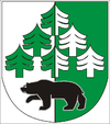
Oravská Polhora
| Oravská Polhora | ||
|---|---|---|
| coat of arms | map | |

|
|
|
| Basic data | ||
| State : | Slovakia | |
| Kraj : | Žilinský kraj | |
| Okres : | Námestovo | |
| Region : | Orava | |
| Area : | 84.519 km² | |
| Residents : | 3,997 (Dec. 31, 2019) | |
| Population density : | 47 inhabitants per km² | |
| Height : | 688 m nm | |
| Postal code : | 029 47 | |
| Telephone code : | 0 43 | |
| Geographic location : | 49 ° 31 ′ N , 19 ° 27 ′ E | |
| License plate : | NO | |
| Kód obce : | 509914 | |
| structure | ||
| Community type : | local community | |
| Administration (as of November 2018) | ||
| Mayor : | Michal Strnál | |
| Address: | Obecný úrad Oravská Polhora 454 02947 Oravská Polhora |
|
| Website: | www.oravskapolhora.sk | |
| Statistics information on statistics.sk | ||
Oravská Polhora (until 1948 in Slovak "Polhora"; in Hungarian Polhora - 1882–1888 Árvapolhora , in Polish and Goral Orawska Półgóra / Półhora ) is a municipality in northern Slovakia . It is the northernmost municipality in the country, is located in the Oravské Beskydy area about 22 km from Námestovo and 5 km from the border crossing to Poland .
The place was first mentioned in writing as Polgora in 1550 . The name Polhora is said to be derived from the location of the municipality, which is half defined by the Babia hora massif .
Most of the residents speak a Goral dialect.
Web links
Commons : Oravská Polhora - collection of pictures, videos and audio files

