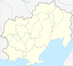
Palatka (Russia)
| Urban-type settlement
Palatka
Палатка
|
||||||||||||||||||||||||||||||
|
||||||||||||||||||||||||||||||
|
||||||||||||||||||||||||||||||
Palatka ( Russian Пала́тка ) is an urban-type settlement in the Magadan Oblast ( Russia ) with 4244 inhabitants (as of October 14, 2010).
geography
The settlement is located in the western foothills of the Kolyma Mountains , about 60 kilometers as the crow flies north of the Magadan Oblast Administrative Center on the left bank of the Khassyn River .
Palatka is the administrative center of the Rajons Chassyn . The township of Palatka (Gorodskoje posselenije) also includes the settlement of Chassyn, four kilometers southwest on the other bank of the river, with around 500 inhabitants.
history
The place was created in 1932 in connection with the construction of the Kolymatrasse , a road from Magadan to Ust-Nera and to the gold mining centers of the area. It was named after a tributary of the Chassyn which flows there. The word palatka stands for tent in Russian , but in this case it is probably a transformation of the combination of the words Palja ( Yukagir ) and Atkan ( Evenian ) - both meaning “stony river”.
In 1953, Palatka was given urban-type settlement status. On December 30, 1966, it became the administrative center of the newly spun off Chassyn district.
In the 1970s to 1980s, Palatka was primarily a residential area for employees of the mining center in the Karamken settlement 15 km to the northeast .
Population development
| year | Residents |
|---|---|
| 1959 | 5,108 |
| 1970 | 5,223 |
| 1979 | 8,400 |
| 1989 | 10,496 |
| 2002 | 4,888 |
| 2010 | 4,244 |
Note: census data
Economy and Infrastructure
In Palatka there is a repair shop for mining equipment and a factory for civil explosives , in the district of Chassyn there is a gold and silver refinery . In the area, potatoes and vegetables are grown as well as cattle and poultry for the regional supply.
Palatka is on the M56 trunk road , as the Kolymatrasse is officially called today. A secondary route branches off from the main route there, which leads through the Ust-Omtschug district administration center 180 kilometers away , bypasses the Kolyma reservoir to the west and reaches the M56 again after about 500 kilometers west of Sussuman .
On September 1, 1941, the first section of a narrow-gauge railway ( gauge 750 mm) from Magadan to Palatka was opened. The end point was reached in 1950, but the line was closed again in 1956. Among other things, steam locomotives of the ГР series produced in the GDR were used .
Individual evidence
- ↑ a b Itogi Vserossijskoj perepisi naselenija 2010 goda. Tom 1. Čislennostʹ i razmeščenie naselenija (Results of the All-Russian Census 2010. Volume 1. Number and distribution of the population). Tables 5 , pp. 12-209; 11 , pp. 312–979 (download from the website of the Federal Service for State Statistics of the Russian Federation)
- ↑ a b c Palatka on the regional information portal kolyma.ru (Russian)
- ↑ a b Palatka on the website of the Geographical Institute of the RAN (Russian)
- ↑ Narrow-gauge railway Magadan - Palatka at parovoz.com (Russian)

