Döbraberg
| Döbraberg | |
|---|---|
|
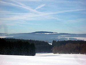
View of the snow-covered Döbraberg from the east |
|
| height | 794.6 m above sea level NHN |
| location | Bavaria , Germany |
| Mountains | Franconian Forest |
| Dominance | 21.8 km → Bergkopf ( 857 m , Fichtel Mountains ) |
| Notch height | 188 m ↓ Steinbach am Wald -N |
| Coordinates | 50 ° 16 '45 " N , 11 ° 38' 36" E |
| rock | Silica slate |
| particularities | - highest point in the Franconian Forest - Prinz-Luitpold-Turm - Döbraberg radar station |
The Döbraberg is 794.6 m above sea level. NHN the highest point in the Franconian Forest . It is located in the Upper Franconian district of Hof in Bavaria . The Prinz Luitpold Tower and the Döbraberg radar station are located on the mountain .
Name origin
In earlier centuries the Döbraberg was called Culm . The mountain was later named after the village on the eastern slope. The name Döbra probably comes from the Slavic word Dobratsch (do prac = wash), which was used to describe the mining of ore-bearing rock. In some publications the mountain is only called Döbra.
Geography and geology
Döbraberg is located in the Franconian Forest Nature Park on the outskirts of the town of Schwarzenbach am Wald , whose core town is west-northwest of the mountain. The eponymous district of Döbra is located on its east-northeast slope .
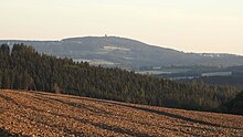
On the east side, the Döbraberg flattens out in rather gentle, often free slopes that extend far into the Selbitz valley . To the south and west there are fairly steep, mostly wooded slopes that drop into the valley of the Wild Rodach . From Döbra, the mountain top can be easily reached in around ten minutes.
Geologically, the Döbrabergipfel consists of hard silica slate .
tourism
Prince Luitpold Tower
The Prinz Luitpold Tower, an 18 m high observation tower, built by the Franconian Forest Association in 1902, stands on the summit of the mountain . At its own height, the 800 m contour line is exceeded. Next door is a small shelter for hikers.
The panoramic view from Döbraberg, especially from the tower, extends in the east from the Erzgebirge to the heights of the Fichtelgebirge . The Radspitze can be seen in the south . On a clear day you can see as far as the Gleichbergen . In the west and north you can see the heights of the Thuringian Forest , for example the whetstone at the transition to the Franconian Forest.
Winter sports, mountain biking, hiking
In winter, the Döbraberg and its surroundings are a popular area for cross-country skiers . On the western slope of the mountain there is a steep ski slope into the Rodachtal, which was previously used for ski races. Due to the lack of snow, it is seldom passable. There is a mountain rescue hut at the top of the slope . The slope is now also used by mountain bikers . In summer there are also extensive mountain bike routes that can be accessed from outside using the Franconian Forest mobile used especially for this purpose.
At the Döbraberg some hiking trails of the Franconian Forest Association cross :
- the Frankenweg
- the Ecksche Eastern Höhenweg
- the watershed path
- the European long-distance hiking trails E3 and E6
- the Radspitz-Döbraweg
- the Dr. Köhl way
- the top arrow path
The following route offers a circular route around the Döbraberg: From the Rodach valley via the Jägersteig to Schwarzenbach am Wald and on the southern outskirts to the Döbraberg. From there you use the high path with a blue H and walk to the Rauhenberg and the Rodach spring. Along the Rodach you come back to the starting point past the Bischofsmühle .
Döbraberg radar station
From 1961 the US Air Force operated a radar station on Döbraberg . Soldiers of the German Air Force had also been stationed there since the 1960s, and in 1974 the facility was officially taken over by the Bundeswehr . The spherical radome currently on the ridge (there used to be two or three domes at times) gives the mountain an unmistakable appearance and is a feature that can be seen from afar. Because of its proximity to the GDR border , this radar station was important as part of NATO's air defense system during the Cold War . A large part of the Döbrabergkuppe was designated as a military restricted area. In the meantime, the station has lost its importance, but is still used, also for civilian air surveillance. The last active military unit of the German Armed Forces was the detached Technical Train 132 as part of operational command area 1 , which was dissolved in 2013. As part of the restructuring of the Bundeswehr, the RRP 117 radar station is now operated by the detached Technical Train 357, which belongs to Operations Control Area 3 .
Individual evidence
- ↑ The Bergkopf is east of Reinersreuth and northeast of the Großer Waldstein .
- ↑ dominance and prominence according to TK 25; Scharte in the north of Steinbach (607 m) after Elevation Contours in Google Maps . Due to their inaccuracy, the actual notch height can deviate by a few meters.
- ↑ Map services of the Federal Agency for Nature Conservation ( information )
- ↑ Aerial view of the NATO radar site atop the Döbraberg near Hof , photo with two radar domes (today only the left dome is left), probably at the end of the 1960s, on usarmygermany.com (English)
- ↑ Radar flight reporting Döbraberg , chronicle and photo (see bottom right) with three radome domes (today there is only one dome), on doebra.de
literature
- Kurt Mohr, Heinrich Geiling: Between Waldstein and Döbraberg . H. 2. Geology, District Education Office (1963)
Web links
- All around the Döbraberg , illustrated hiking tour, on hinterinsel.de
- Mountain Rescue Service Schwarzenbach a. Forest with Döbraberg impressions , on bergwacht-schwarzenbach-wald.de
- Prinz-Luitpold-Turm on frankenwaldverein.de
- Prince Luitpold Tower. In: Structurae


