Ragged Island, Massachusetts
| Ragged Island | ||
|---|---|---|
| Waters | Boston Harbor , Atlantic Ocean | |
| Geographical location | 42 ° 15 '26.5 " N , 70 ° 53' 25.9" W | |
|
|
||
| length | 235 m | |
| width | 65 m | |
| surface | 1.66 ha | |
| Highest elevation | 9.14 m | |
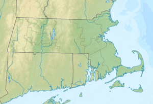
Ragged Island is an island in Hingham Bay in Boston Harbor . It is located 12 mi (19.3 km ) from downtown Boston in the state of Massachusetts in the United States . Ragged Iceland has an area of approximately 4.1 acres (1.6 hectares ), is from the town of Hingham managed and is part of the Boston Harbor Islands National Recreation Area . It is open daily from 9 a.m. to sunset.
geography
geology
The island consists largely of the locally occurring rock conglomerate Roxbury Puddingstone and rises up to 30 feet (9.1 m ) from the water. In the center of the island, a layer of mother earth provides a livelihood for some plants.
Flora and fauna
Today's flora on the island consists of a mixture of former cultivated plants and self-established wild plants. In the shade of large trees such as silver maple , red maple , norway maple , cedar and a single spruce , lilies of the valley and daylilies thrive . There is also a linden grove in the center of the island . The hike on the island is hindered by dense vegetation with stinging winds and climbing poison sumac . The island's wildlife is still the subject of scientific research.
history
The island was already used seasonally by the Indians . The European colonists cut down the trees on the island for firewood. In the late 17th century, the merchant John Langlee lived on the island with his family. Later a restaurant and rustic observation huts were built there, some of the remains of which can still be seen today.
Individual evidence
- ↑ a b c d Island Facts: Ragged Island. National Park Service , accessed July 26, 2013 .
Web links
- Boston Harbor Islands. Massachusetts Department of Conservation and Recreation , accessed July 26, 2013 (DCR basic information about the sanctuary, travel preparations and behavior).
