Rijeka Crnojevića
|
Rijeka Crnojevića Ријека Црнојевића |
||||
|
||||
| Basic data | ||||
|---|---|---|---|---|
| State : |
|
|||
| Municipality : | Cetinje | |||
| Coordinates : | 42 ° 21 ' N , 19 ° 2' E | |||
| Height : | 10 m. i. J. | |||
| Residents : | 175 (2011) | |||
| Telephone code : | (+382) 041 | |||
| Postal code : | 81253 | |||
| License plate : | CT | |||
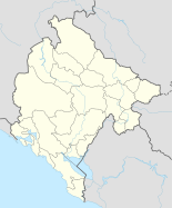
Rijeka Crnojevića is an urban settlement with 175 inhabitants in the municipality of Cetinje in Montenegro . It is located on the bank of the Crnojević River, near Lake Skadar .
The city, which was founded around 1481, is of historical importance. Like the river, it was named after the noble family of Crnojević , who ruled here in the area around Cetinje in the 15th century (see also Žabljak Crnojevića ).
Rijeka Crnojevića is generally known for its beautiful architecture and stone houses, some of which date from the 17th and 18th centuries. Most of the buildings date from the 19th century. The city's landmark, however, is the Old Bridge (Stari most), which was built by Prince Danilo Petrović-Njegoš in 1853 .
economy
The main industry is fishing . The settlement has suffered from a strong population drain for decades. Many residents move to the nearby Cetinje (8 km) or to Podgorica (20 km), where more and better paid job opportunities exist.
| year | 1948 | 1953 | 1961 | 1971 | 1981 | 1991 | 2003 | 2011 |
|---|---|---|---|---|---|---|---|---|
| Residents | 596 | 632 | 804 | 587 | 484 | 327 | 216 | 175 |
tourism
The place is not yet very well developed for tourism. Although it is not far from the important connecting road Podgorica - Cetinje, the feeder road into the village is narrow and often only passable in one lane. The main tourist activities are canoe paddling , swimming , fishing , the town also serves as a starting point for hikes along the Skadar Lake. B. Direction Virpazar .


