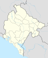
Bijelo Polje
|
Bijelo Polje Бијело Поље |
||||
|
||||
| Basic data | ||||
|---|---|---|---|---|
| State : |
|
|||
| Municipality : | Bijelo Polje | |||
| Coordinates : | 43 ° 2 ' N , 19 ° 45' E | |||
| Height : | 570 m. i. J. | |||
| Residents : | 16,000 (2007) | |||
| Telephone code : | (+382) 050 | |||
| Postal code : | 84000 | |||
| License plate : | BP | |||
Bijelo Polje ( Cyrillic Бијело Поље ) is a city in northern Montenegro with about 16,200 inhabitants. It is the administrative center of the municipality of Bijelo Polje with about 57,000 inhabitants on an area of 924 km². The place is best known as a transit city . The main road from Belgrade to the Adriatic Sea and the Belgrade – Bar railway line pass through Bijelo Polje.
Bijelo Polje means “white field” and is named after the white flowers that can be found everywhere there.
geography
Bijelo Polje is located on the left bank of the Lim , about 10 km south of the Serbian border. To the north-west of the city stretches the approximately 1500 m high Lisa Mountains , to the south lies Bjelasica with peaks over 2100 m high and the Biogradska Gora National Park .
population
At the 2011 census, the municipality of Bijelo Polje had 46,051 inhabitants, of whom 16,562 (35.96%) were Serbs , 12,592 (27.34%) were Bosniaks , 8,808 (19.13%) were Montenegrins , 5,985 (13%) identified them as Muslims and 334 (0.73%) as Roma . There are also other smaller population groups living in the city.
Attractions
The city and the surrounding area have several Serbian Orthodox churches and monasteries as well as some mosques.
sons and daughters of the town
- Avdo Međedović (1875–1953), Guslar
- Ćamil Sijarić (1913–1989), novelist, short story writer and reporter.
- Dragan Bogavac (born 1980), football player
- Radomir Đalović (* 1982), football player
- Branko Hajduković , President of the Cycling Federation of Montenegro
- Maida Markgraf (* 1991), soccer player
- Ilda Mujović (* 1993), soccer player
- Nikola Peković (* 1986), basketball player
- Dado Polumenta (* 1982), folk and pop singer and songwriter
- Šako Polumenta (* 1968), turbo folk singer


