Rodt (Marienheide)
|
Rodt
Municipality Marienheide
Coordinates: 51 ° 4 ′ 6 ″ N , 7 ° 33 ′ 33 ″ E
|
||
|---|---|---|
| Height : | 380-410 m above sea level NN | |
| Postal code : | 51709 | |
| Area code : | 02264 | |
|
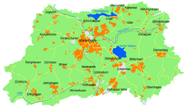
Location of Rodt in Marienheide |
||
Rodt is a village in Marienheide in the Oberbergischer Kreis in the administrative district of Cologne in North Rhine-Westphalia ( Germany ).
Location and description
The place is about three kilometers southeast of the community center at the highest point of the B 256 between Gummersbach and Marienheide. The place has an industrial area and a retail park.
history
The current B 256 running through Rodt was already a busy road in the 18th century that connected the Ruhr area and the Siegerland. In 1766 the bakery and restaurant "Albert Wirth" was built here, which served the truckers as a rest and transformer station. The restaurant is still operated today as a restaurant and hotel under the name "Hotel Landhaus Wirth".
In 1888, the municipality's first telephone connection was installed in the Wirth restaurant.
In 1903 a converted stable building became a Protestant school for the children from Rodt, Stülinghausen , Eberg and Kalsbach . At the end of 1933 the school was closed. The building now serves as a residential building.
Today's oldest sports field in the community was completed in Rodt in 1925 after a five-year construction period.
The place experienced strong growth at the turn of the last century. The shopping center has been built, a new residential area has been set up and the industrial area has been expanded. The traffic situation was also eased by the construction of roundabouts.
Economy and industry
Rodt has a shopping center and a large industrial area, which among other things houses the second largest plant of the ABUS Kransysteme company .
Leisure and attractions
About half a kilometer north of the town is the Brucher Dam , which is a popular destination.
Hiking trails
The following hiking trails lead through Rodt:
| Circular / hiking trail | Waymarks | Distance | Path length |
| trail | A7 | Rodt - Bruchertalsperre - Eberg | 2 km |
| Circular hiking trail | A8 | Rodt - Around the Bruchertalsperre - Rodt | 4.7 km |
| Circular hiking trail | A2 | Obernhagen - Müllenbach - north of Rodt - Bruchertalsperre - Gervershagen - west of Dannenberg - Müllenbach - Obernhagen | 8 kilometers |
Association
- TV Rodt-Müllenbach
bus connections
Stop: Rodt
- Line 336: Remscheid-Lennep - Hückeswagen - Wipperfürth - Marienheide - Gummersbach
- Line 320: Marienheide - Müllenbach - Meinerzhagen


