Roschnyativ
| Roschnyativ | ||
| Рожнятів | ||

|
|
|
| Basic data | ||
|---|---|---|
| Oblast : | Ivano-Frankivsk Oblast | |
| Rajon : | Roschnyativ district | |
| Height : | 362 m | |
| Area : | 19.23 km² | |
| Residents : | 3,883 (January 1, 2011) | |
| Population density : | 202 inhabitants per km² | |
| Postcodes : | 77600 | |
| Area code : | +380 3474 | |
| Geographic location : | 48 ° 56 ' N , 24 ° 9' E | |
| KOATUU : | 2624855100 | |
| Administrative structure : | 1 urban-type settlement | |
| Mayor : | Vasyl Mazewko | |
| Address: | площа Єдності 15 77600 смт. Рожнятів |
|
| Statistical information | ||
|
|
||
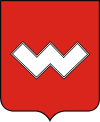
Roschnjatiw (Ukrainian Рожнятів ; Russian Рожнятов / Roschnjatow , Polish Rożniatów ) is an urban-type settlement in western Ukraine west of the Oblast capital Ivano-Frankivsk on the Duba River , a tributary of the Limnyzja . The coat of arms goes back to the former owners of the place, the Skarbek family.
history
The place originated in the 12th century and was in the Polish-Lithuanian aristocratic republic in the Ruthenian Voivodeship until 1772 . Under the Polish name Rożniatów it then belonged to the Austrian Galicia until 1918 and was the seat of a district administration from 1854 to 1867 . In 1875 a station on today's Stryj – Ivano – Frankivsk railway was opened near the town .
After the end of the First World War it came to Poland and was first occupied by the Soviet Union and from 1941 to 1944 by Germany during the Second World War and joined the district of Galicia .
In 1945 the city came back to the Soviet Union , there it became part of the Ukrainian SSR and has been part of today's Ukraine since 1991.
Web links
- Rożniatów . In: Filip Sulimierski, Władysław Walewski (eds.): Słownik geograficzny Królestwa Polskiego i innych krajów słowiańskich . tape 9 : Poźajście – Ruksze . Walewskiego, Warsaw 1888, p. 864 (Polish, edu.pl ).

