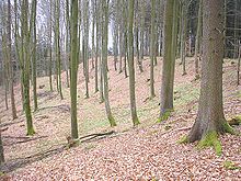
Wagesenberg ski jump
The early medieval ski jump Wagesenberg ( Wagesenberg , Pöttmes ) is located next to a high medieval castle stable in the Ebenrieder Forest in the Aichach-Friedberg district in Swabia . The large ramparts show some typical features of a Hungarian fortress from the 10th century.
description
The Burgplatz (approx. 515 m above sea level) is about 100 meters above the hamlet of Wagesenberg. The north-east facing mountain spur is only connected to the ridge in the southwest. The other sides are secured by the moderately steep to heavily sloping slopes. In the south, an unusually deep trench begins , which continues on the plateau in a northeastern direction. The kidney-shaped, almost flat castle plateau is around 300 × 190 meters in size.
In the south-east, the trench section is partially exposed to a wide, up to four-meter-high rim wall. Behind the pointed ditch, which is 8 meters deep in places, the main wall rises up to 15 meters. The wall then descends again by about three meters and then rises up to four meters after a wide depression. The interior is about 2 meters below the wall crown.
The unusual dimensions of this fortification section, which is around 70 meters wide, can be explained by the use of a natural erosion channel. The remaining sections only appear to be artificially divided and were certainly secured by palisades or wattle fences. An additional embankment cannot be seen here.
About 100 meters west of the main wall, a four-meter-high, about 50-meter-long rampart with a ditch runs to the south. To the west of these earthworks, an angled rampart, only up to two meters high, has been preserved, which is interpreted as the remainder of the ramparts of the neighboring high medieval tower castle.
The short Vorburgwall is a further indication of the Hungarian classification of the Wallburg. It is possible that the outer fortification line was not completed after the Hungarian threat had been removed. A more recent site plan of the State Office for the Preservation of Monuments documents a westward, but flattened or unfinished continuation of this approach obstacle. Similar earthworks can be found in the run-up to numerous early medieval protective castles from the first half of the 10th century.
The elaborate, four-fold staggered wall system on the main attack side is a typical feature of Hungarian castles. The Magyar cavalrymen were to be kept at a distance and forced to dismount.
Time and purpose
The castle area was already used as a settlement site in the Bronze , Urnfield and Hallstatt Period (archaeological finds). The small burial mound field in the nearby “Ackerschlag” is dated to the Hallstatt period. To the west of the large castle, the earthworks of a La Tène period square hill can be seen in the area.
The last stage of the fortifications is likely to go back to the time of the Hungarian invasions (first half of the 10th century). The mighty front wall, referred to as the "Hungarian Wall", which is a typical feature of such large castles, particularly refers to this period. In the wider vicinity of the episcopal city of Augsburg there are comparable protective castles and troop assembly points at Schwabegg ( Haldenburg ) and Fischach (Buschelberg). In addition to these large state castles , which can be traced back to King Henry I's castle building regulations , numerous smaller fortifications were built and older systems were modernized. At that time, the diocese probably employed a fortress builder who coordinated the work on this fortress system.
In 1977, the researcher Rudolf Wagner (see lit.) located the long-sought castle of Count Berthold von Burgeck (Civitas Purgeka) within the walls. This dynast lived at the beginning of the 12th century. Some remains of medieval settlements have also been found inside the large hill. Immediately to the south, however, the remains of a very large high medieval tower hill castle ( Burgstall Wagesenberg ) have been preserved, which would fit very well into Berthold's time. However, Wagner only sees the location of the Grafenburg farmyard, which seems rather unlikely in view of the conception typical of the time and the enormous size of the castle stable (length about 350 meters).
The Bavarian State Office for Monument Preservation lists the ground monument as an early medieval section fortification under monument number D 7-7432-0013.
literature
- Erwin Keller: An early medieval castle on the Wagesenberg near Pöttmes . In: Aichacher Heimatblatt, 21. Aichach 1973.
- Rudolf Wagner : Count Berthold and the Civitas Burgeck . In: Journal of the Historical Association for Swabia, 71 volume. Augsburg 1977, pp. 89-108.
- Michael Schmidberger: Prehistory and early history in the Pöttmes area . In: Wilhelm Liebhart (ed.): Pöttmes - rule, market and community . Pöttmes 2007, pp. 59-73.
Topographical surveys
- Older plan of the Bavarian State Office for the Preservation of Monuments: Medieval fortifications and castle stables in the Aichach-Friedberg district . In: Altbayern in Schwaben - Aichach-Friedberg district 1984–1987 . Aichach 1987, ISSN 0178-2878 .
- Newer plan of the Bavarian State Office for the Preservation of Monuments: In: Wilhelm Liebhart (Hrsg.): Pöttmes - Herrschaft, Markt und Gemeinde . Pöttmes 2007, p. 65.
Individual evidence
- ^ Bavarian State Office for Monument Preservation: Entry ( memento from January 19, 2016 in the Internet Archive )
Coordinates: 48 ° 34 '13.2 " N , 11 ° 3' 30.7" E


