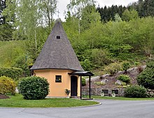
Schrems near Frohnleiten
| Schrems (former municipality) | ||
|---|---|---|
|
|
||
| Basic data | ||
| Pole. District , state | Graz-Umgebung (GU), Styria | |
| Judicial district | Graz-West | |
| Coordinates | 47 ° 16 '46 " N , 15 ° 21' 50" E | |
| height | 493 m above sea level A. | |
| Residents of the stat. An H. | 586 (January 1, 2017) | |
| Building status | 203 (2011 ) | |
| surface | 19.25 km² | |
| Post Code | 8130 Frohnleiten | |
| prefix | + 43/3126 (Frohnleiten) | |
| Statistical identification | ||
| Community code | 60663 | |
| Counting district / district | Schrems near Frohnleiten (60663 011) | |
 Location of the former municipality in the then borders of the Graz-Umgebung district |
||
| Independent municipality until the end of 2014; Towns / Katastralgemeinden: 15032/63008 Gschwendt, 15033/63026 Schrems Source: STAT : Gazetteer ; BEV : GEONAM ; GIS-Stmk |
||
Schrems bei Frohnleiten was a municipality with a last 586 inhabitants (as of December 31, 2014) in the north of the Graz-Umgebung district in Styria . On January 1, 2015 it was merged with the communities Frohnleiten and Röthelstein to form the new community Frohnleiten as part of the Styrian community structural reform .
geography
Geographical location
Schrems bei Frohnleiten is located about three kilometers east of Frohnleiten in the Grazer Bergland in Eastern Styria. The Schremsgraben is dominated by the Hochtrötsch on the south side . The highest elevation in the former municipality is the Gschieskogel ( 1142 m ). The area lies at the foot of the Rechberg Pass .
structure
The former municipal area comprised two localities or cadastral communities of the same name (population as of January 1, 2020; area 2016):
- Gschwendt (280 Ew., 889.08 ha)
- Schrems (305 inhabitants, 1,035.99 ha)
Former neighboring communities
| Röthelstein | Pernegg on the Mur | Tyrnau |
| Frohnleiten |

|
Tulwitz |
| Frohnleiten | Semriach | Semriach |
history
Schrems was first mentioned around 1300 with the name "Schrentz". Around 1381 there was the first written mention with the place name "Schremcz". From 1393 Schrems was written for a short time.
The local community as an autonomous body was established in 1850. After the annexation of Austria in 1938, the community came to the Reichsgau Steiermark, 1945 to 1955 it was part of the British zone of occupation in Austria. On January 1st, 2015, Schrems near Frohnleiten was merged with the communities Frohnleiten and Röthelstein to form the community Frohnleiten.
Population development

Economy and Infrastructure
traffic
Schrems is located directly on Rechberg Straße B 64 from Frohnleiten to Weiz . In Frohnleiten the road ends directly at the Bruck expressway S 35 from Graz to Bruck an der Mur .
There is no train station in Schrems. The nearest train station is about four kilometers away in Frohnleiten. It offers access to the Südbahn with hourly regional train connections to Graz and Bruck an der Mur.
The Graz Airport is around 45 km away.
politics
The last mayor of the community was Peter Schlegl (SPÖ). After the 2010 elections, the municipal council was composed as follows:
coat of arms
The municipal coat of arms was awarded with effect from November 1, 1997.
The blazon (description of the coat of arms) reads:
- "Divided by cuts of fir twigs and red beech branches of blue, silver and red, in the middle crossed diagonally an old form in black."
Web links
- 60643 - Schrems near Frohnleiten. Community data, Statistics Austria .
Individual evidence
- ↑ Announcement of the Styrian regional government of November 21, 2013 on the unification of the municipality of Frohnleiten and the municipalities of Röthelstein and Schrems near Frohnleiten, all of the political district of Graz-Umgebung. Styrian Provincial Law Gazette of December 6, 2013. No. 152, 35th issue. ZDB ID 705127-x . P. 682.
- ↑ Statistics Austria: Population on January 1st, 2020 by locality (area status on January 1st, 2020) , ( CSV )
- ↑ Federal Office for Metrology and Surveying, Regional Information, reference date December 31, 2016, accessed on February 19, 2017
- ^ Announcements from the Styrian Provincial Archives 48, 1998, p. 59


