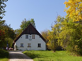
Schweigelberg
|
Schweigelberg
Gößweinstein market
Coordinates: 49 ° 47 ′ 26 ″ N , 11 ° 19 ′ 31 ″ E
|
|
|---|---|
| Height : | 429 (428-432) m above sea level NHN |
| Residents : | 1 (1970) |
| Postal code : | 91327 |
|
The Schweigelberg district of Gößweinstein
|
|
Schweigelberg is a Franconian wasteland that belongs to Gößweinstein .
geography
In the Wiesentalb location remote area is one of 31 officially designated community parts of the upper Frankish market Gössweinstein. Schweigelberg is located about two and a half kilometers north-northwest of the center of Gößweinstein at an altitude of 429 m above sea level. NHN .
history
Until the beginning of the 19th century, Hungenberg was under the sovereignty of the Bamberg Monastery. The bailiwick , which is decisive in the Franconian area for the successful claim of sovereignty , was exercised by the Bamberg office of Waischenfeld . When the bishopric of Bamberg was secularized as a result of the Reichsdeputationshauptschluss 1802/03 and annexed by the Electorate of Palatinate-Baiern in breach of the Reich constitution , Schweigelberg became part of the New Bavarian territories that were forcibly taken over during the Napoleonic land consolidation .
Due to the administrative reforms carried out in the Kingdom of Bavaria at the beginning of the 19th century , Schweigelberg became part of the independent rural community of Unterailsfeld with the second municipal edict in 1818 , to which the village of Hungenberg and the hamlet of Moschendorf also belonged. In the course of the municipal territorial reform carried out in Bavaria in the 1970s , Schweigelberg was incorporated into the Gößweinstein market together with the Unterailsfeld community at the beginning of 1972. In 1970 Schweigelberg had a resident. Of the former two properties in the village, only the former forester's house still exists today. This is now a restaurant for excursions.
traffic
Schweigelberg is not connected to the public road network, but can only be reached via non-asphalt forest roads. The wasteland is therefore not served by public transport . The closest train station is in Ebermannstadt , it is the commercial terminus of the Wiesenttalbahn .
literature
- Johann Kaspar Bundschuh : Schweigelberg . In: Geographical Statistical-Topographical Lexicon of Franconia . tape 5 : S-U . Verlag der Stettinische Buchhandlung, Ulm 1802, DNB 790364328 , OCLC 833753112 , Sp. 257 ( digitized version ).
- Gertrud Diepolder : Bavarian History Atlas . Ed .: Max Spindler . Bayerischer Schulbuch Verlag, Munich 1969, ISBN 3-7627-0723-5 .
- Federal Statistical Office (Hrsg.): Historical municipality register for the Federal Republic of Germany. Name, border and key number changes in municipalities, counties and administrative districts from May 27, 1970 to December 31, 1982 . W. Kohlhammer, Stuttgart / Mainz 1983, ISBN 3-17-003263-1 .
Web links
- Bavarian authorities guide for Schweigelberg , accessed on November 3, 2019
- Schweigelberg in the BayernAtlas , accessed on November 3, 2019
- Schweigelberg on a historical map , accessed on November 3, 2019
- Schweigelberg in the Topographia Franconiae of the University of Würzburg , accessed on November 3, 2019.
Individual evidence
- ↑ a b Bavarian State Statistical Office (Hrsg.): Official local directory for Bavaria . Issue 335 of the articles on Bavaria's statistics. Munich 1973, DNB 740801384 , p. 153 ( digitized version ). Retrieved November 3, 2019
- ^ Schweigelberg in the local database of the Bayerische Landesbibliothek Online . Bayerische Staatsbibliothek, accessed on November 3, 2019.
- ↑ Geographical location of Schweigelberg in the BayernAtlas , accessed on November 3, 2019
- ↑ Gertrud Diepolder : Bavarian History Atlas . Ed .: Max Spindler . Bayerischer Schulbuch Verlag, Munich 1969, ISBN 3-7627-0723-5 , p. 31 .
- ↑ Gertrud Diepolder : Bavarian History Atlas . Ed .: Max Spindler . Bayerischer Schulbuch Verlag, Munich 1969, ISBN 3-7627-0723-5 , p. 97-103 .
- ^ Johann Kaspar Bundschuh : Schweigelberg . In: Geographical Statistical-Topographical Lexicon of Franconia . tape 5 : S-U . Verlag der Stettinische Buchhandlung, Ulm 1802, DNB 790364328 , OCLC 833753112 , Sp. 257 ( digitized version ).
- ↑ Gertrud Diepolder : Bavarian History Atlas . Ed .: Max Spindler . Bayerischer Schulbuch Verlag, Munich 1969, ISBN 3-7627-0723-5 , p. 35 .
- ↑ Gertrud Diepolder : Bavarian History Atlas . Ed .: Max Spindler . Bayerischer Schulbuch Verlag, Munich 1969, ISBN 3-7627-0723-5 , p. 106-107 .
- ^ Federal Statistical Office (ed.): Historical municipality directory for the Federal Republic of Germany. Name, border and key number changes in municipalities, counties and administrative districts from May 27, 1970 to December 31, 1982 . W. Kohlhammer, Stuttgart / Mainz 1983, ISBN 3-17-003263-1 , p. 697 .
- ↑ Homepage of the “Forsthaus Schweigelberg” restaurant , accessed on November 4, 2019

