
Seggebruch
| coat of arms | Germany map | |
|---|---|---|

|
Coordinates: 52 ° 18 ' N , 9 ° 6' E |
|
| Basic data | ||
| State : | Lower Saxony | |
| County : | Schaumburg | |
| Joint municipality : | Nienstädt | |
| Height : | 59 m above sea level NHN | |
| Area : | 7.49 km 2 | |
| Residents: | 1552 (Dec. 31, 2019) | |
| Population density : | 207 inhabitants per km 2 | |
| Postal code : | 31691 | |
| Primaries : | 05724 05722 | |
| License plate : | SHG, RI | |
| Community key : | 03 2 57 034 | |
| Community structure: | 7 districts | |
| Association administration address: | Bahnhofstrasse 7 31691 Helpsen |
|
| Website : | ||
| Mayor : | Jörn Wittkugel ( SPD ) | |
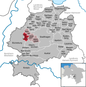
| Location of the community Seggebruch in the district of Schaumburg | ||
  |
||


Seggebruch is a municipality in the Schaumburg district and part of the Nienstädt municipality .
geography
The community lies between Minden and Stadthagen on the Hanover – Minden railway line . The Weser Uplands Schaumburg-Hameln nature park joins to the south .
In a clockwise direction , neighboring towns are Hespe , Helpsen , Obernkirchen and Bückeburg .
The districts of the municipality are Alt- and Neu-Seggebruch, Tallensen, Echtorf, Schierneichen, Deinsen and the settlement of Baum. In addition, the residential area Brummershop belongs to the community.
history
- Around 1300 the Minden church in Secbroke owned a house that it gave to a Reinbert Steen as a fief . It was not until 1766 that the current spelling was approached with Seggebroock . In the Middle Ages the land and interest rule existed by the Counts of Holstein-Schaumburg. In 1871 Seggebruch belonged to the rural community of Deinsen. When the districts were founded in 1899, the Bückeburg district was responsible. From April 1948 to July 1977 the community belonged to the Schaumburg-Lippe district. The formation of the joint municipality of Nienstädt took place on March 1, 1974.
- Echtorf first appeared as Ectorpe in 1188, according to the Westphalian document book .
- The Schierneichen farm owners were listed under Deinsen in 1565. They were first mentioned in 1597 as residents of Schiren Eichen .
- Tallensen was first mentioned in a document in 1286. The noble Bernhard von Lo transferred a court to the Obernkirchen Abbey.
- Deinsen was mentioned as Deyghenhusen around 1300 . The place belonged to the Bishop of Minden and was given to Reinbert Steen as a fief.
- The settlement of Baum was named in 1304 as des Hoves thon Walbomen, dhe leget an dem dorphe tho Hydessen . The nobleman Gerhard von dem Berge left his property to Count Gerhard von Hoya. In 1964 the settlement was still a residential area in the non-parish area of Baum.
- Brummershop was founded in 1566 as Hof zum Sael by Claus von Münchhausen.
On March 1, 1974, the communities Schierneichen-Deinsen and Tallensen-Echtorf were incorporated.
religion
- The Evangelical Lutheran Christians have formed their own parish in Seggebruch since 1912/1913. The church was consecrated on August 27, 1913.
- The Catholic faithful belong to the parish of St. Marien in Bückeburg.
politics
Mayor / Administration
Jörn Wittkugel (SPD) is the honorary community mayor. Ditmar Köritz, the mayor of the municipality, is the appointed municipal director. The community office is located at 20 Cronsbruchstrasse.
Municipal council
The council of the municipality consists of 11 councilors and councilors.
(Status: local election on September 11, 2016)
Economy and Infrastructure
Public facilities
- The police station in Bückeburg is responsible for security and order.
- The fire protection and general help are by the volunteer fire departments ensured Seggebruch, Schier Oak Deinsen tree and Tallensen-Echtorf.
education
- In the pre-school area there is an integrative day-care center, a day nursery and a day nursery.
- The primary school in Nienstädt has a branch in Seggebruch.
- Secondary schools are located in Helpsen , Stadthagen and Bückeburg .
traffic
The next motorway junction is Bad Eilsen on the federal motorway 2 Hanover - Dortmund , about 11 km away. The federal highway 65 , which runs from Minden to Hanover, runs south of the municipality . The next train station is in Kirchhorsten (municipality of Helpsen). There is an hourly connection to Minden and Hanover by S-Bahn. The public transport is served by the company Rottmann und Spannuth.
Web links
Individual evidence
- ↑ State Office for Statistics Lower Saxony, LSN-Online regional database, Table 12411: Update of the population, as of December 31, 2019 ( help ).
- ^ Federal Statistical Office (ed.): Historical municipality directory for the Federal Republic of Germany. Name, border and key number changes in municipalities, counties and administrative districts from May 27, 1970 to December 31, 1982 . W. Kohlhammer GmbH, Stuttgart / Mainz 1983, ISBN 3-17-003263-1 , p. 201 .
- ^ Ratsinfomanagement Samtgemeinde Nienstädt: Seggebruch: Personen
Ahnsen | Apelern | Auetal | Auhagen | Bad Eilsen | Bad Nenndorf | Beckedorf | Buchholz | Buckeburg | Hagenburg | Haste | Heeßen | Help | Hespe | Heuerßen | Hohnhorst | Hülsede | Lauenau | Lauenhagen | Lindhorst | Lüdersfeld | Luhden | Meerbeck | Messenkamp | Niedernwöhren | Nienstädt | Nordsehl | Obernkirchen | Pohle | Pollhagen | Rinteln | Rodenberg | Sachsenhagen | Seggebruch | Stadthagen | Suthfeld | Wiedensahl | Wölpinghausen