Sieg (nature reserve)
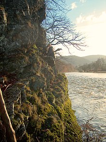
The Sieg nature reserve is a 617 hectare area in the course of the Sieg , which is under the protection of Natura 2000 and is registered with the number DE-5210-303. The area includes the Mitteliegtal as a winding valley between Fürthen and Troisdorf .
The river Sieg, which often flows through the grassland valley and is relatively close to nature, has in parts rock fillings as bank reinforcement, on the other hand there are sometimes natural gravel banks in front of it. Often, dense riparian woodland predominantly made up of tree willows, willow bushes and ash trees, as well as riparian vegetation, mark the course of the river in the grassland floodplain. In the floodplains are oxbow lakes, which are often overgrown with alder floodplain forests.
Habitats
- Natural eutrophic lakes and oxbow lakes
- Rivers with underwater vegetation
- Rivers with mud banks and annual vegetation
- Moist tall herbaceous vegetation
- Grove beech forest
- Mixed ravine and hillside forests
- Alder-ash and softwood floodplain forests
- Oat and Wiesenknopf Silgenwiesen
- Silicate rocks with crevice vegetation
Animal welfare
Protect values occurring species are salmon , brook lamprey , river lamprey , bullhead , loach , bitterling , sea lamprey , dusky large blue , scarce large blue and yellow-bellied toad .
Web links
- Information from the State Office for Nature, Environment and Consumer Protection in North Rhine-Westphalia
- Middle course map (PDF file; 736 kB)
- Underflow map (PDF file; 791 kB)
Coordinates: 50 ° 46 ′ 25.1 ″ N , 7 ° 23 ′ 55.5 ″ E


