Limersbach
| Limersbach | ||
|
|
||
| Data | ||
| Water code | DE : 2725992 | |
| location | North Rhine-Westphalia , Germany | |
| River system | Rhine | |
| Drain over | Victory → Rhine → North Sea | |
| source | Near Lichtenberg (City of Hennef ) 50 ° 44 ′ 39 ″ N , 7 ° 20 ′ 57 ″ E |
|
| muzzle | At Haus Attenbach (Hennef) in Sieg Coordinates: 50 ° 46 ′ 16 ″ N , 7 ° 20 ′ 52 ″ E 50 ° 46 ′ 16 ″ N , 7 ° 20 ′ 52 ″ E
|
|
| length | 3.9 km | |
| Catchment area | 1.99 km² | |
The Limersbach is a 3.9 km long tributary of the Sieg in the urban area of Hennef (Sieg) in North Rhine-Westphalia . From the village of Stein it is called Steiner Bach .
course
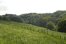
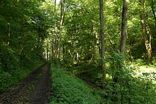
The Limersbach rises near Lichtenberg (Hennef) , north and directly below the B8 federal road. Its valley runs in the first half to the north-northwest between the villages of Striefen and Adscheid . There are some wet and wet meadows near the source area. The Limersbachtal is quite flat on the upper reaches, but then quickly cuts into the landscape and becomes narrower in the process. The Limersbachtal is mainly forested from the upper to the lower reaches in the valley floodplain and on the lower parts of the valley slopes, upwards there are pastures and fields on both sides of the valley that surround the villages of Adscheid and Striefen. Between the two villages there are individual fish ponds, below which the meadows connect and form the only unwooded section of the valley. In the lower half the valley bends to the northeast. The lower course narrows further and is characterized by the steep, wooded valley slopes on both sides. At the end of the valley is the village of Stein , which the now called Steiner Bach stream flows through. It approaches the Ahrenbach to almost 100 meters, but then bends to the northwest, while the Ahrenbach flows northeast into the Sieg. The Steiner Bach finally crosses under the Sieg route and flows into the Sieg at Haus Attenbach , across from Oberauel .
natural reserve
The Limersbachtal has been a nature reserve since 2008. The nature reserve has an area of 18.90 hectares.
recreation
A hiking trail runs through the Limersbachtal and is directly connected to the Sieg nature trail at Stein . The 2.7 km long path extends from Lichtenberg to Stein, there are branches to Adscheid and Striefen.
Origin of name
The name Limersbach is derived from the high clay content of the water, which is noticeable through rapid brown coloration at higher water levels and clay deposits in quieter flow areas. From the village of Stein it was named after this and bears the name Steiner Bach up to the mouth .
Individual evidence
- ↑ a b Topographical Information Management, Cologne District Government, Department GEObasis NRW ( Notes )
- ↑ Nature reserve "Limersbach and tributaries" in the specialist information system of the State Office for Nature, Environment and Consumer Protection in North Rhine-Westphalia , accessed on February 27, 2017.


