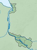
Lower Wümme (Bremen)
|
Lower Wümme
|
||
|
Wümme near Blockland |
||
| location | Bremen , Free Hanseatic City of Bremen | |
| surface | 148.5 ha | |
| Identifier | 13 | |
| WDPA ID | 166001 | |
| FFH area | 148.5 ha | |
| Bird sanctuary | 148.5 ha | |
| Geographical location | 53 ° 9 ' N , 8 ° 50' E | |
|
|
||
| Sea level | from 0 m to 2.5 | |
| Setup date | October 8, 1991 | |
Untere Wümme is a nature reserve in the districts of Blockland and Borgfeld and the Horn-Lehe district of the municipality of Bremen .
General
The nature reserve is 148.5 hectares . It is registered in the nature conservation book of the city of Bremen under number 13. The nature reserve is part of the approximately 445 hectare FFH area “Untere Wümme” and the 3,180.3 hectare EU bird protection area “Blockland”. The area has been a nature reserve since October 8, 1991. It has been looked after by the NordWest Natur Foundation, founded in 1999, since 2006 . The responsible nature conservation authority is the Senator for Environment, Building and Transport.
description
The area includes the lower reaches of the Wümme from Borgfeld to the Lesum between the state border with Lower Saxony in the middle of the river and the Wümmedeich. It connects directly to the nature reserve of the same name in Lower Saxony and forms a contiguous protected area with it. South of the dike is the block land, a wetland landscape and original floodplain of the Wümme that as a conservation area has been designated a "block-country Burgdammer meadows". In the southeast it borders on the nature reserve " Westliches Hollerland (Leherfeld) ", in the east the nature reserve " Borgfelder Wümmewiesen " adjoins.
The meandering , tide affected underflow of Wümme is characterized by extensive reed fields, pastures Auwald damp Hochstaudenfluren and freshwater waddings . It is of great importance as a connecting link between the Fischerhuder and Borgfelder Wümmeniederung upstream and the Hamme Niederung to the north-west .
The Wümme is the habitat of various migratory fish . Eel , salmon and sea trout are native. The river is also the habitat of sea , river and brook lamprey, as well as the mud whip . The otter is also at home here again. The extensive reed areas are the habitat of various reed breeders, including various reed warbler species. The Marsh Harrier also occurs. In the nature reserve settle u. a. Marsh marigold and marsh ragwort .
In the early 1990s, a colony of gray herons settled near the Oberneulander lock, which connects the Neue Semkenfahrt with the Wümme .
The nature reserve borders in the east on Borgfelder Allee, which connects Borgfeld with Lilienthal , and is crossed a little below Borgfelder Allee by Lilienthaler Allee as the Lilienthaler bypass road. At the same time, the route of the former Bremen – Tarmstedt small railway crosses the protected area (a cycling and hiking trail runs along it). Another road crosses the protected area southeast of Ritterhude.
See also
Web links
- No. 13 Untere Wümme , overview of nature reserves in the Bremen environmental information system, Senator for the Environment, Building and Transport
- Untere Wümme , Protected Areas in the State of Bremen, Brochure of the Free Hanseatic City of Bremen (PDF file, 1.0 MB)
Individual evidence
- ↑ Untere Wümme , profiles of the Natura 2000 areas, Federal Agency for Nature Conservation . Retrieved March 22, 2018
- ↑ Blockland , profiles of the Natura 2000 areas, Federal Agency for Nature Conservation. Retrieved March 22, 2018
- ↑ Untere Wümme nature reserve , NordWest Natur, Northwest German Foundation for Animal and Nature Conservation. Retrieved May 12, 2011.
- ↑ Untere Wümme , BUND, State Association Bremen. Retrieved March 22, 2018
- ↑ Untere Wümme , Adventure Space Nature, Free Hanseatic City of Bremen. Retrieved March 22, 2018


