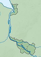
Ochtum lowlands near Brokhuchting
|
Ochtum lowlands near Brokhuchting
|
||
|
Ochtum lowlands near Brokhuchting |
||
| location | Bremen , Free Hanseatic City of Bremen | |
| surface | 375 ha | |
| Identifier | 16 | |
| WDPA ID | 318904 | |
| Geographical location | 53 ° 4 ' N , 8 ° 43' E | |
|
|
||
| Sea level | from 1.5 to 3.5 | |
| Setup date | December 15, 1998 | |
The Ochtumniederung near Brokhuchting is a nature reserve in the district of Huchting and in the district of Strom of the municipality of Bremen .
General
The nature reserve is 375 hectares . It is registered under number 16 in the nature protection book of the city of Bremen. The nature reserve is largely part of the EU bird sanctuary "Niedervieland". The course of the river Ochtum through the nature reserve and its banks are part of the FFH area "Bremische Ochtum". The nature reserve borders on landscape protection areas in several places , including in the north on the landscape protection area "Niedervieland-Wiedbrok-Stromer Feldmark" and in the west on the landscape protection areas "Ochtumniederung" and "Bywisch-Hullen-Schohasberge" in Lower Saxony. The area, which was designated as a landscape protection area since 1968, has been a nature reserve since December 15, 1998. The responsible nature conservation authority is the Senator for Environment, Building and Transport.
description
The protected area is located in the south-west of Bremen in the Niedervieland . It is managed by Ochtum and the Old Ochtum and numerous canals criss-crossed and ditches. In the northwest, the Varreler Bäke flows through the protected area before it flows into the Ochtum. In the nature reserve there are several, partly created, still waters as well as oxbow lakes in the area of the Old Ochtum.
Today's nature reserve was still a relatively dry and predominantly intensively cultivated area in the 1980s. In the course of compensatory measures for the development of commercial areas in the vicinity of the Neustädter Hafen, in which wet meadows were lost, the use of the area was extended and arable land was converted to grassland. Since the mid-1980s, emerged as flood plains, ditches and pond, wetlands and wetland broke . From then on, the land was used extensively for agricultural purposes. The area experienced a further appreciation at the end of the 1980s, when the Ochtum was relocated as part of the expansion of Bremen Airport and designed in a natural way.
The nature reserve is of wet meadows and wet waste land with marshes , Hochstaudenfluren , reeds , flood turf and floodplain coined. The meadows are partly as grassland used extensively for agriculture. In the north-west of the protected area, a polder has been created as a floodplain . In the winter months, the meadows in the protected area are also frequently flooded. The nature reserve is therefore of great importance for resting water birds and waders . The area is also of particular importance as a breeding area for meadow birds .
In the nature reserve are u. a. Lapwing , redshank , godwit , common snipe , shoveler , teal duck , potted moorhen , bag tit , bluethroat and kingfisher are indigenous. The waters are the habitat of various fish , amphibians and dragonflies , e.g. B. Wedge-spotted dragonfly , early reed hunter and green maidenhead, as well as numerous other insects , including the marsh insect .
In the trenches and on their banks, u. a. Crab claw , frog bite and water feather , pointed , blunt-leaved and flat-stemmed spawnweed . The yellow pond rose has spread in the oxbows of the Ochtum . The grasslands accommodate, among other Lathyrus palustris , marsh marigold , water groundsel , small and large rattle , ragged robin , knapweed , yellow meadow rue , brome fescue spring and traubige brome .
A road runs through the protected area between the Bremen district of Huchting and the district of Strom and the freight railway with a marshalling yard between the Bremen – Oldenburg railway line and Neustädter Hafen.
In the nature reserve there are several places for nature observation, such as a viewing platform on the southern edge of the floodpold and two viewing hills near the Ochtum in the southeast.
See also
Web links
- No. 16 Ochtumniederung near Brokhuchting , overview of nature reserves in the Bremen environmental information system, Senator for the Environment, Building and Transport
- Ochtum lowlands near Brockhuchting , protected areas in the state of Bremen, Free Hanseatic City of Bremen (PDF file, 2.5 MB)
- "Ochtumniederung bei Brokhuchting" nature reserve, nature reserves in the state of Bremen, The Senator for Building and Environment (PDF file, 254 kB)
Individual evidence
- ↑ a b Brokhuchting , BUND, Landesverband Bremen. Retrieved March 22, 2018.


