Verdal
| coat of arms | map | |
|---|---|---|

|
|
|
| Basic data | ||
| Commune number : | 5038 | |
| Province (county) : | Trøndelag | |
| Administrative headquarters: | Verdalsøra | |
| Coordinates : | 63 ° 47 ' N , 11 ° 29' E | |
| Surface: | 1,547.77 km² | |
| Residents: | 14,948 (Feb 27, 2020) | |
| Population density : | 10 inhabitants per km² | |
| Language form : | neutral | |
| Structure: | Verdalsøra, Nord- og Sørskaget, Haug, Lysthaugen, Brannan, Stormoen, Stiklestad, Vuku, Ness, Garnes, Helgådalen, Vera, Bjartan, Nord- og Sør-Leksdal | |
| Website: | ||
| politics | ||
| Mayor : | Pål Sverre Fikse ( Sp ) (2019) | |
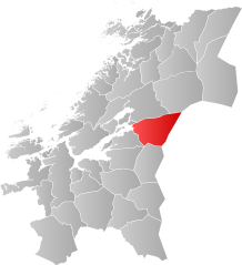
| Location in the province of Trøndelag | ||

|
||
Verdal is a Norwegian municipality in Trøndelag .
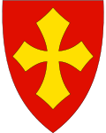
A district of Verdal is Stiklestad. At the Battle of Stiklestad in 1030, which marks a turning point in Norwegian history , according to tradition , the fighters of Olav the Saint had a cross on their shields. An altarpiece in the church of Haltdalen shows Olav's entry into Verdal and his fall. In this picture the shields are red with a yellow cross. The current coat of arms of the municipality reminds of this.
There is a museum in Verdal with buildings from the 17th - 19th centuries. There is also a typical house of an average cottage maker. The oldest building dates from around 1650.
In the vicinity of Stiklestad there are two larger tombs, probably from pre-Christian times. There are eight large burial mounds about 1.5 km east of Heggstad Church. The largest has a diameter of 46 m and is about 8 m high. So far, no excavations have been carried out in Heggstad, so it is difficult to classify the site in terms of time. The burial mounds probably date from the first millennium.
On May 19, 1893, the largest natural disaster in Norway in modern times took place in Verdal. After an unusually rainy winter, 55 million cubic meters of mud raced down to the valley and buried the entire Verdal under them. 1/3 of the village disappeared, 105 farms, thousands of cattle and 116 people. The mudslide was 8-10 m high and hurtled down to the valley at 60 km / h. A 40–50 m high bank wall was floated up at Stiklestad. In between there was no trace of the many earlier buildings and courtyards to be found. The destroyed houses could still be seen further down at Verdalsøra.
In 1930 a long-planned Catholic chapel was built there and endowed with pious foundations. There is also a stone church in Stiklestad, the oldest components of which date from the 12th century and which have Anglo-Norman style elements. It was then further built in Romanesque and Gothic styles. The church was last extensively restored in 1930 for the 900th anniversary.
At the presumed place of the battle there is a stele made of Bornholm sandstone with a plaque made of marble.
At the time of National Socialism, the Nazjonal Samling party planned and built a monumental memorial and inaugurated it on St. Olav's Day in 1944. The leader Vidkun Quisling gave a speech for important party officials. In 1945 the facility was destroyed by the residents and the stele previously erected there was erected again.
Verdal used to be part of the Frostathing Thing Association .
The Iron Age burial ground of Verdal is spread over three farms in Verdal.

