Heim (Norway)
| coat of arms | map | |
|---|---|---|

|
|
|
| Basic data | ||
| Commune number : | 5055 | |
| Province (county) : | Trøndelag | |
| Administrative headquarters: | Kyrksæterøra | |
| Coordinates : | 63 ° 17 ' N , 9 ° 5' E | |
| Surface: | 1,024.58 km² | |
| Residents: | 5,963 (Feb 27, 2020) | |
| Population density : | 6 inhabitants per km² | |
| Language form : | neutral | |
| Website: | ||
| politics | ||
| Mayor : | Odd Jarle Svanem ( Sp ) (2019) | |
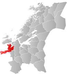
| Location in the province of Trøndelag | ||

|
||
Heim is a Norwegian municipality in Trøndelag that has existed since January 1, 2020. It consists of the former municipalities of Hemne , Halsa and part of the municipality of Snillfjord ( Vennastranda ) and has 5963 inhabitants (as of February 27, 2020). The administrative seat is in Kyrksæterøra . Hasla previously belonged to the Fylke Møre og Romsdal .
geography
The municipality is located on the south and east sides of the fjords Halsfjord , Arasvik Fjord and Vinjefjord and on all sides of the Hemnfjord . Aure is northwest of the municipality . The highest elevation is rods with a height of 1040 moh.
coat of arms
The coat of arms has an ornament on a blue background. The ornament can represent boats, seeds, fish or fjord arms.
Web links
- Heim im Store norske leksikon (Norwegian)
- official website (Norwegian)
Individual evidence
- ↑ Statistisk sentralbyrå - Befolkning
- ↑ Høyeste fjelltopp i hver commune. Kartverket, September 1, 2015, accessed on July 7, 2020 (Norwegian Bokmål).

