Rindal
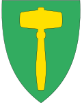
| coat of arms | map | |
|---|---|---|

|
|
|
| Basic data | ||
| Commune number : | 5061 | |
| Province (county) : | Trøndelag | |
| Administrative headquarters: | Rindal | |
| Coordinates : | 63 ° 2 ′ N , 9 ° 17 ′ E | |
| Surface: | 631.95 km² | |
| Residents: | 2.003 (Feb. 27, 2020) | |
| Population density : | 3 inhabitants per km² | |
| Language form : | neutral | |
| Website: | ||
| politics | ||
| Mayor : | Vibeke Langli ( Sp ) (2019) | |
| Location in the province of Trøndelag | ||

|
||
Rindal is a municipality in the Norwegian Fylke Trøndelag .
The municipality, founded in 1858, is largely located in the Trollheimen Mountains . With effect from January 1, 2019, the municipality moved from Fylke Møre og Romsdal to Trøndelag . Rindal was the only municipality in Møre og Romsdal without access to the sea.
Geography and traffic
Neighboring municipalities to Rindal are (clockwise) Hemne , Orkdal , Meldal , Rennebu , Oppdal and Umgebung .
The most important traffic connection is the Reichsstraße 65, which connects Rindal with Umgebung and Trondheim . There is also a road to Meldal.
The largest town is Rindal, which is also the administrative center. Other localities are Øvre Rindal, Romundstad, Bolme and Bjørnstad.
Attractions
- The Rindal Bygdemuseum consists of 14 old buildings and, as of 2014, a ski museum.
- There are churches in Rindal and Øvre Rindal.
Personalities
- John Neergaard (1795-1885), politician
- Eli Landsem (* 1962), soccer coach
Web links
Commons : Rindal - collection of images, videos and audio files
- Entry on snl.no in the store norske leksikon (Norwegian)
Individual evidence
- ↑ Statistisk sentralbyrå - Befolkning
- ↑ Trøndelag County Council: Rindal. Retrieved November 15, 2018 (Norwegian).
