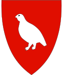
Holtålen
| coat of arms | map | |
|---|---|---|

|
|
|
| Basic data | ||
| Commune number : | 5026 | |
| Province (county) : | Trøndelag | |
| Administrative headquarters: | Ålen | |
| Coordinates : | 62 ° 50 ′ N , 11 ° 18 ′ E | |
| Surface: | 1,209.49 km² | |
| Residents: | 1,981 (Feb 27, 2020) | |
| Population density : | 2 inhabitants per km² | |
| Language form : | neutral | |
| Website: | ||
| politics | ||
| Mayor : | Arve Hitterdal (Framtida Holtålen) (2019) | |
| Location in the province of Trøndelag | ||

|
||
Holtålen is a municipality in the central Norwegian Fylke Trøndelag .
It is located in a sparsely populated mountain landscape, a well-known high valley in the region is Hessdalen . The largest town and administrative center is Ålen ; other settlements are z. B. Haltdalen and Aunegrenda . Iron and copper ore were mined in the area until 1986 . Today tourism is one of the main industries. Hunters , fishermen and skiers in particular come here.
Haltdalen stave church , built around 1170, is one of the oldest in Norway; However, it was dismantled in 1884, brought to Trondheim and reinstalled in the Trøndelag Folkemuseum in 1937 , where it can still be viewed today. In 2004 a copy of the stave church was built in Haltdalen, the original location.
See also
Web links
- Homepage of the municipality (Norwegian)
- Cultural information about Holtålen (also Norwegian)
Individual evidence
