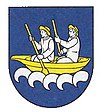
Vozokany (Topoľčany)
| Vozokany | ||
|---|---|---|
| coat of arms | map | |

|
|
|
| Basic data | ||
| State : | Slovakia | |
| Kraj : | Nitriansky kraj | |
| Okres : | Topoľčany | |
| Region : | Nitra | |
| Area : | 9.12 km² | |
| Residents : | 358 (Dec. 31, 2019) | |
| Population density : | 39 inhabitants per km² | |
| Height : | 237 m nm | |
| Postal code : | 956 05 ( Radošina post office ) | |
| Telephone code : | 0 38 | |
| Geographic location : | 48 ° 34 ' N , 18 ° 0' E | |
| License plate : | TO | |
| Kód obce : | 505757 | |
| structure | ||
| Community type : | local community | |
| Administration (as of November 2018) | ||
| Mayor : | Jaroslav Bazala | |
| Address: | Obecný úrad Vozokany 100 95605 Vozokany |
|
| Website: | www.miestnykanal.com/Vozokany | |
| Statistics information on statistics.sk | ||
Vozokany (Hungarian Végvezekény - until 1907 Vezekény ) is a municipality in central Slovakia .
location
The place is located in the north-western parts of the "Nitra hill country" at the foot of the Inowetz Mountains (Považský Inovec) in a side valley of the upper reaches of the Hlavinka brook and is touched by the state road from Topoľčany to Piešťany .
history
The place was first mentioned in 1318 as Wezeken . In 1353 it belonged to a Jánovi, Imrich's son , to the Raab chapter in the 16th century , and then to the Esterházy family until the 19th century . During the Turkish wars, the place was badly affected.
The population lived mainly from agriculture and viticulture . Since the Second World War, residents have increasingly been commuting to work in the surrounding cities.
