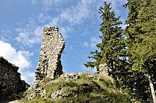
Vršatské Podhradie
| Vršatské Podhradie | ||
|---|---|---|
| coat of arms | map | |

|
|
|
| Basic data | ||
| State : | Slovakia | |
| Kraj : | Trenčiansky kraj | |
| Okres : | Ilava | |
| Region : | Stredné Považie | |
| Area : | 13.431 km² | |
| Residents : | 220 (Dec. 31, 2019) | |
| Population density : | 16 inhabitants per km² | |
| Height : | 650 m nm | |
| Postal code : | 018 52 ( Pruské post office ) | |
| Telephone code : | 0 42 | |
| Geographic location : | 49 ° 4 ' N , 18 ° 9' E | |
| License plate : | IL | |
| Kód obce : | 557625 | |
| structure | ||
| Community type : | local community | |
| Administration (as of November 2018) | ||
| Mayor : | Peter Remiš | |
| Address: | Obecný úrad Vršatské Podhradie č. 54 018 52 Pruské |
|
| Website: | www.vrsatskepodhradie.sk | |
| Statistics information on statistics.sk | ||
Vršatské Podhradie (until the 19th century Slovak Oršovské Podhradie or Podhradie ; German Lowenstein , Hungarian Oroszlánkő - until 1907 Oroszlánykőpodhragy - older Podhrágy ) is a municipality in the northwest of Slovakia with 220 inhabitants (December 31, 2019), which in Okres Ilava , part of the Trenčiansky kraj .
geography
The municipality is located within the White Carpathians below the Vršatské bradlá cliff , near the border with the Czech Republic . The 13.43 km² large municipal area is largely forested and covered by brown forest floors; the height varies from 380 m nm to 926 m nm (Chmeľová mountain). As such, the municipality lies within the Biele Karpaty Protected Landscape Area . The center of the village is at an altitude of 650 m nm and is 12 kilometers from Ilava .
Neighboring municipalities are Červený Kameň in the north, Mikušovce in the east, Tuchyňa and Pruské in the southeast, Krivoklát in the south, Horné Srnie in the southwest, Brumov-Bylnice (CZ) in the west and Nedašov (CZ) in the northwest.
history
The oldest settlement in the municipality goes back to the younger Bronze Age, with a settlement and burial site of the Lusatian culture . Later there were settlements of the Puchau culture as well as a Slavic one from the 9th century.
The current place developed from a settlement below the castle Löwenstein (Slovak Vršatecký hrad ); a watchtower stood on the castle hill as early as 1244 and monitored a route to Moravia . The village itself was mentioned in writing for the first time in 1439 as Podhraghye and belonged to the estate of the Löwenstein Castle, which in addition to this place also included Pruské, Bohunice and Mikušovce. The owners changed accordingly with those of the castle, some of the later ones were Jakušič (1577), Breuner (1699) and Königsegg . An explosion in 1707 almost destroyed the entire castle. In 1828 there were 51 houses and 578 inhabitants who were employed in agriculture.
The place in Trenčín County belonged to the Kingdom of Hungary until 1918 and then came to Czechoslovakia or Slovakia.
1979–1990 Vršatské Podhradie was part of the Pruské municipality.
population
According to the 2011 census, Vršatské Podhradie had 241 residents, 240 of whom were Slovaks. One resident made no statement. 230 residents professed to the Roman Catholic Church, three residents to the Greek Catholic Church and one resident to the Evangelical Church AB. Two residents were non-denominational and the denomination of five residents has not been determined.
Results after the 2001 census (258 inhabitants):
|
By ethnicity:
|
By denomination:
|
Attractions
- Ruins of Löwenstein Castle
- Vršatské bradlá cliff
Individual evidence
Web links
- Entry on e-obce.sk (Slovak)


